In brief: In today’s post we discuss a warmup in our weather through Saturday, followed by a short but sharp cold front on Sunday. We also spend some time talking about how the week before Christmas is likely to bring warmer-than-normal weather.
A very early look at the weather preceding Christmas
I’m not ready to break out into “Mele Kalikimaka” yet—the Hawaiian-themed Christmas song popularized by Bing Crosby, and appearing in Christmas Vacation, among other movies—but the middle of December is starting to look somewhat warm. To be clear, we’re not there yet. We have some chilly mornings today and Thursday, and a cold front arriving on Sunday could pack a fairly sharp punch. Parts of Houston are likely to flirt with a freeze early next week.
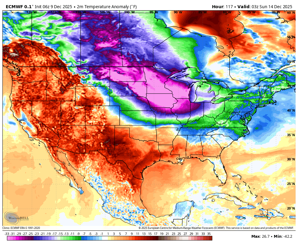
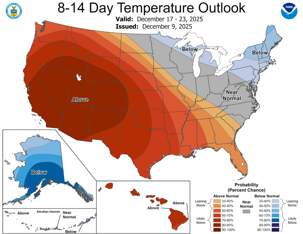
But this morning I want to talk about what comes after this, during the week preceding Christmas beginning around December 18. That is within the edge of what is possible to forecast, and the data were seeing point to above average temperatures across Texas. It appears that high pressure will build over the western United States in a fairly stable pattern. I don’t think we’re looking at anything too crazy, but for the most part we can probably expect highs in the 70s, with lows in the 50s and 60s. A front or two could still sneak in, but overall we should be warmer than average. As for what happens by Christmas Day, it remains a little far out to say anything with confidence. Which means, of course, I’ll make a stupidly early Christmas forecast in the next day or two.
Wednesday
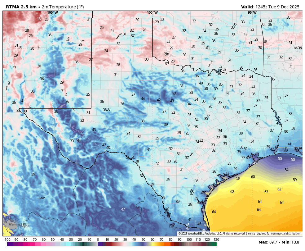
Temperatures this morning are generally in the mid- to upper-40s across Houston, with clear skies (it’s a beautiful sunrise, I must say). We are going to warm nicely this afternoon, into the low 70s for the most part. We would be well on our way to a significant warming trend, but for the fact that a reinforcing front will arrive today, with light winds shifting to come from the north this afternoon. This cooler air will allow temperatures to drop into the 40s tonight, with a few outlying areas possibly returning to the upper 30s. I don’t expect any rain, or possibly even any clouds, to accompany the front.
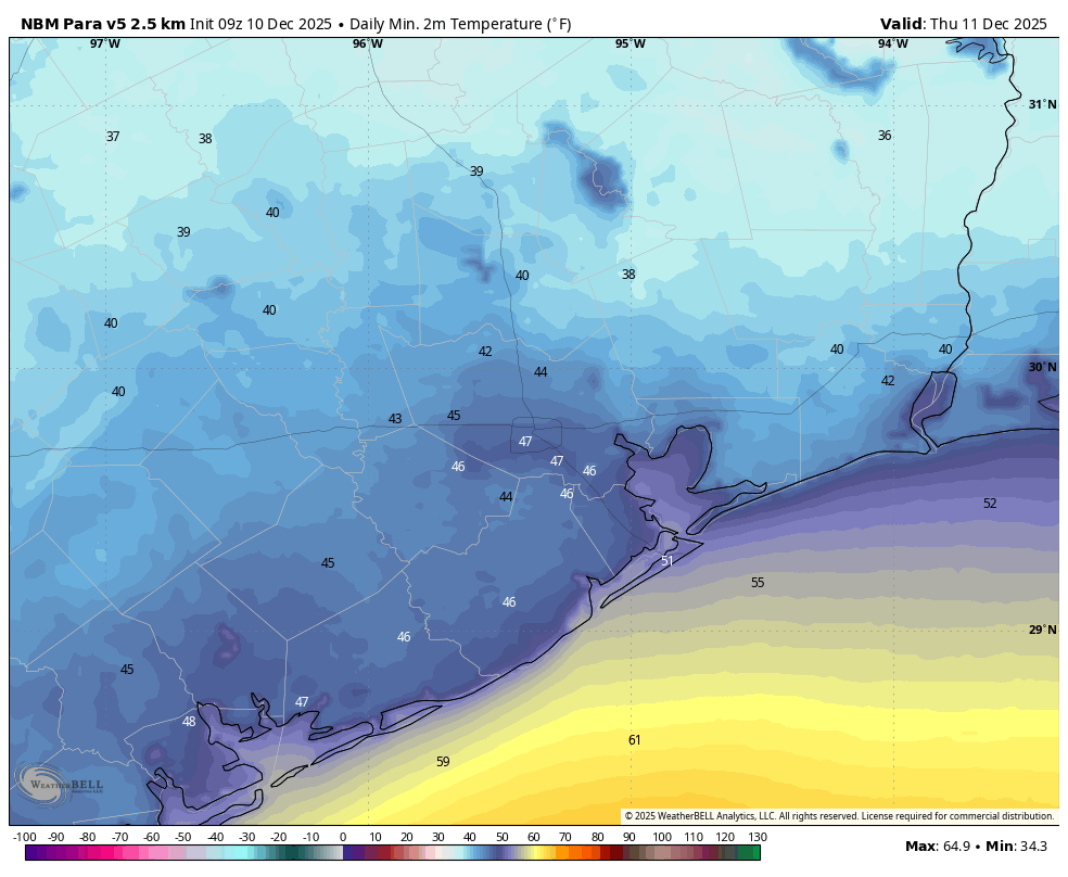
Thursday
This will be a sunny day, with highs in the 60s. As winds shift to come from the south we are going to see a warmer night, in the 50s.
Friday and Saturday
This period will be warmer, with a southerly flow off the Gulf. Look for daytime highs in the mid- to upper-70s, and nights with lows around 60 degrees. Skies will be partly sunny, with only very slight rain chances.
Sunday
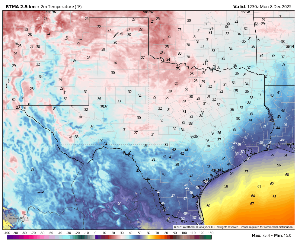
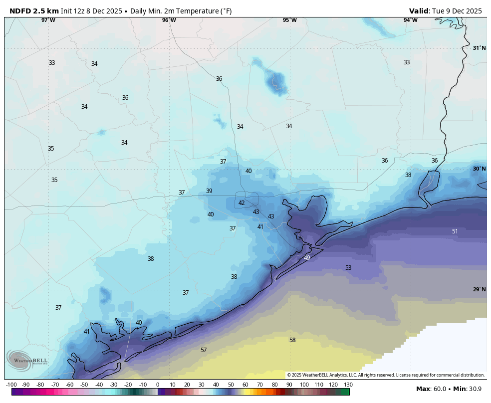
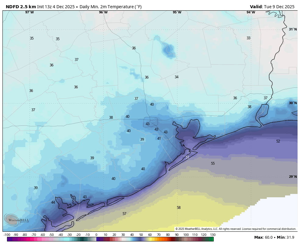
Sunday is likely to start out moderately warm as well, but our confidence is now fairly high in a cold front dropping down from the north during the daytime. This will bring with it a decent shot of rain, but overall accumulations for most should be on the lower side, almost certainly less than half an inch (and probably less than this). In the wake of the front I expect a cold night. Temperatures probably will drop into the 40s in Houston, but there is a chance of falling all the way into the 30s. I’m not entirely ruling out a freeze for some inland locations, as we’ll just have to see how much cold Arctic air makes it into Texas, rather than being shunted off to the east before dropping this far south.
Next week
Monday and Tuesday of next week looks rather chilly before—as I wrote at the outset of this post—we see a warming trend that could stick around awhile.