In brief: Houston’s forecast remains largely the same: highs in the low 90s with a few, sporadic showers and thunderstorms during the afternoon through the weekend. Next week should see somewhat better rain chances. I also share a tip that helps me survive summer in Houston.
A beginner’s guide to surviving summer in Houston (psychologically)
There are some people who love summer in Houston. They love the heat. They love the long days with 14 hours of sunshine. They love the ability to get a tan in about 15 minutes in the middle of the day. They abhor the onset of fall because it means the end of summer. If you’re one of those people I have two things to say to you. One, bless your heart. And two, the following section is not for you. Please skip ahead.
OK, those who are still reading “survive” summer in Houston rather than “thrive,” right? I grew up in Michigan, but moved to Texas in 1991, and arrived in H-town in 1997. This will, therefore, be my 28th summer in our (fair?) city. Growing up in Michigan I had never experienced a hurricane nor the humidity that comes along with dewpoints in the upper 70s. But in the decades since then I have learned a couple of tricks that, psychologically at least, help me weather summer weather here. I want to share one of them today.
I’m writing this post now because, in some sense, our turn toward fall begins tomorrow, on the summer solstice. It is the longest day of the year in the northern hemisphere (in Houston it will be 14 hours, 2 minutes, and 18 seconds, to be precise). You probably think I’m crazy. By some definitions, this is the beginning of summer! However, it also means that, starting with Saturday, every day will be that little bit shorter for the next six months. The Sun will be that little bit lower in the sky. Accordingly we are sliding toward fall, however slowly.
Of course the hottest time of the year still remains about six to eight weeks from now, due to a variety of factors including the fact that it takes longer for water to heat up than land. And fall, in reality, is at least three months away. So this trick is just psychological. But for me, just the fact that the days are getting a wee bit shorter helps me realize that fall will come even though it is hot as blazes outside. After tomorrow, it’s inevitable.
Thursday
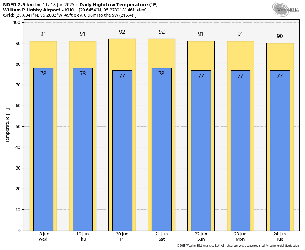
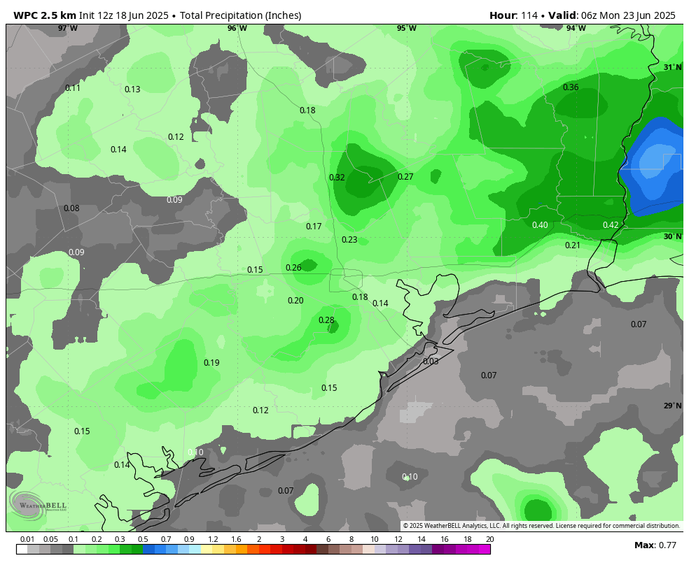
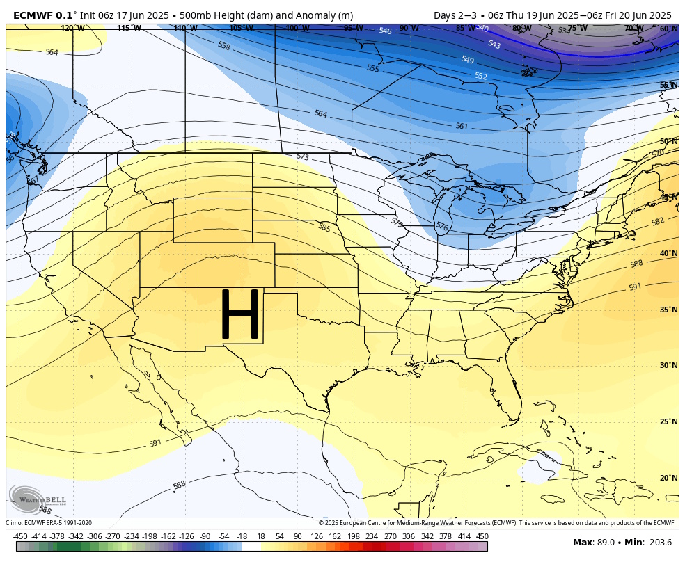
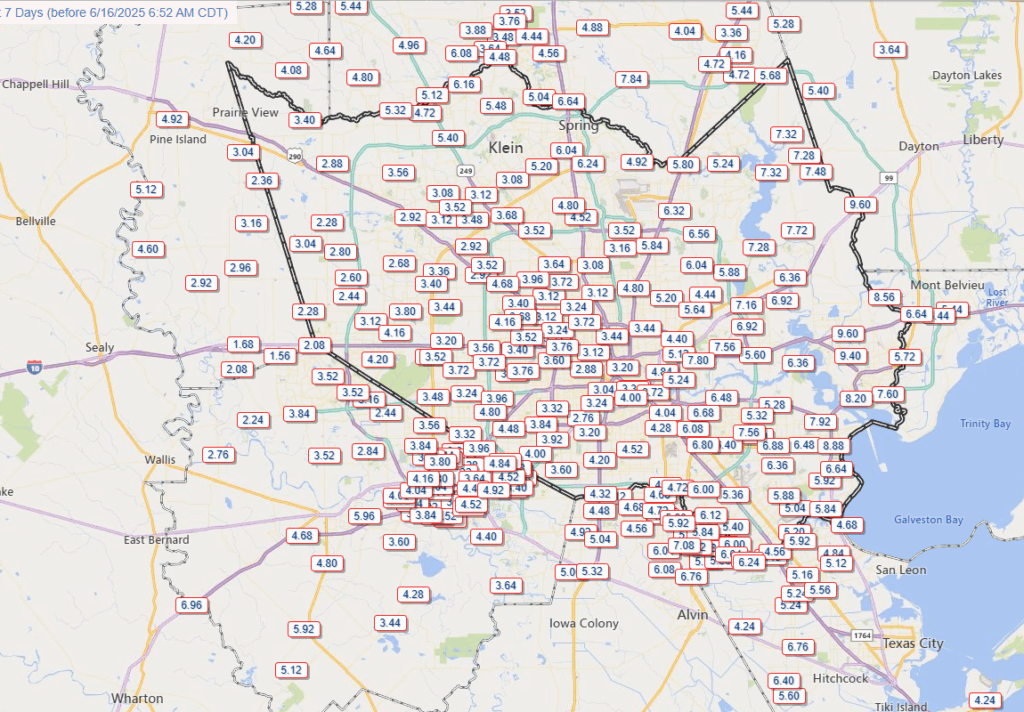
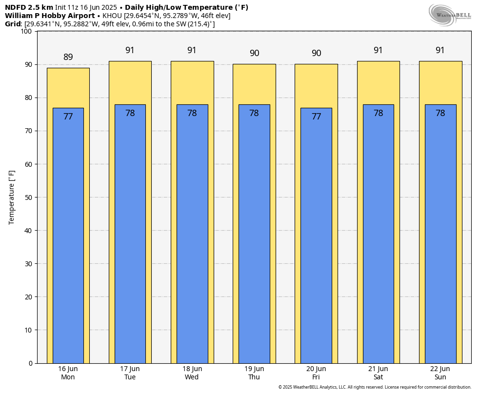
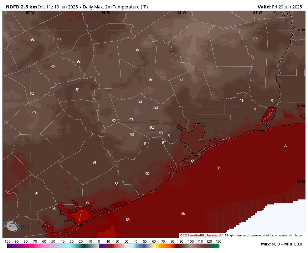
Our weather won’t be changing much from today through the weekend. The predominant pattern remains one of modest high pressure that will limit (but not completely exclude) rain and keep temperatures in the low 90s. For today, that means high temperatures generally in the lower 90s, with mostly sunny skies and southerly winds at 5 to 10 mph. The sea breeze this afternoon will likely spark a few afternoon showers and thunderstorms, but I expect these to be fairly scattered in nature. Lows tonight will be in the upper 70s.
Friday, Saturday, and Sunday
We are basically locked into the same pattern through the weekend. If you have outdoor plans you can generally expect sunny skies, but you may have to briefly dodge a few showers. Overall daily rain chances are probably in the ballpark of 20 percent. Otherwise late June is going to feel like late June.
Next week
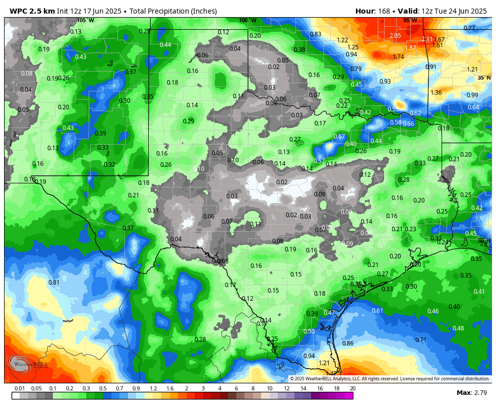
As high pressure begins to ease off to the east, overall atmospheric conditions will begin to favor increased rain chances. I don’t think we’re looking at any type of flooding, but we should see enough light to moderate rainfall next week to help limit high temperatures to about 90 degrees for most of the week. All in all, conditions look to be fairly mild for June in Houston, which isn’t nothing.