In brief: Houston will see slight chance of showers and thunderstorms for the start of this week, followed by hot and sunny weather for the remainder of the work week. More widespread rain chances return this weekend. Also, we discuss how the region is entering its warmest period of the year.
Steel thyselves, we have reached peak summer
Back in 1994 the Houston Rockets played the New York Knicks in the NBA finals. The new lead sports columnist for the New York Post, Wallace Mathews, wrote about visiting our city in June for the Rockets’ home games. Infamously, he wrote one column about the city, denigrating its lack of terrain, its cockroaches, and notably its heat and humidity. It ran under the headline, “THIS PLACE IS A HELLHOLE.”
I, personally, do not feel like Houston is a hellhole. I have lived here for three decades. I like to joke with people that Houston is the opposite of, “It’s a nice place to visit, but you wouldn’t want to live there.” Houston is, in fact, a nice place to live, but you wouldn’t necessarily want to visit here. At least not during the summer. And my goodness, I give a ton of credit to our World Cup visitors who arrived over the last month who managed to see the good things about our region as we were throwing torrential rain, pestilential hordes of mosquitoes, and humidity-so-thick-you-could-grab-onto-it at them.
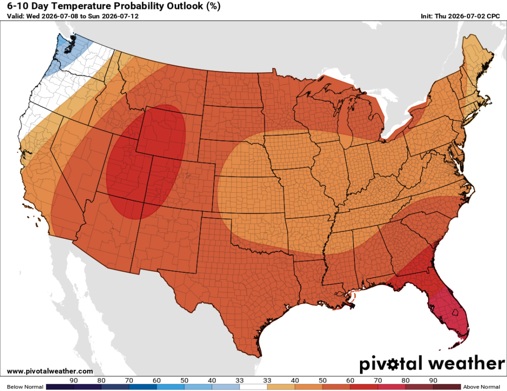
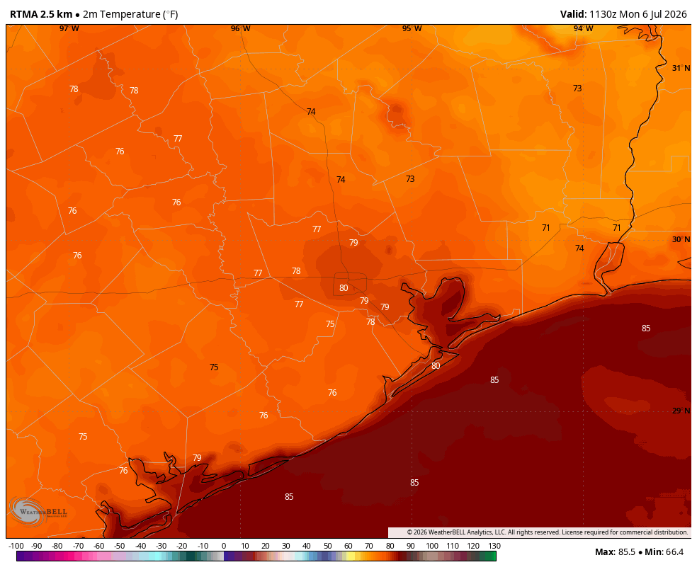
Anyway, Houston’s heat can feel a bit like a hellhole sometimes. And alas, ladies and gentlemen, I am here to tell you we have reached that moment in the story. Starting on Tuesday, July 7, Houston’s nighttime “normal low” is 76 degrees. It will remain at that plateau until August 18 when it very slowly begins to fall. Our daily high temperature will still tick up a bit (it peaks from late July into the first two weeks of August at 96 degrees). Basically, we are staring at maximum summer for the next six weeks. Please clap.
Monday and Tuesday
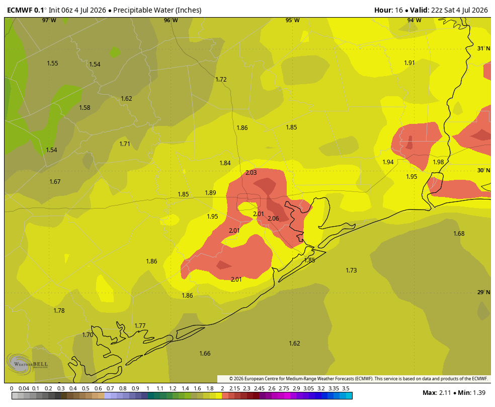
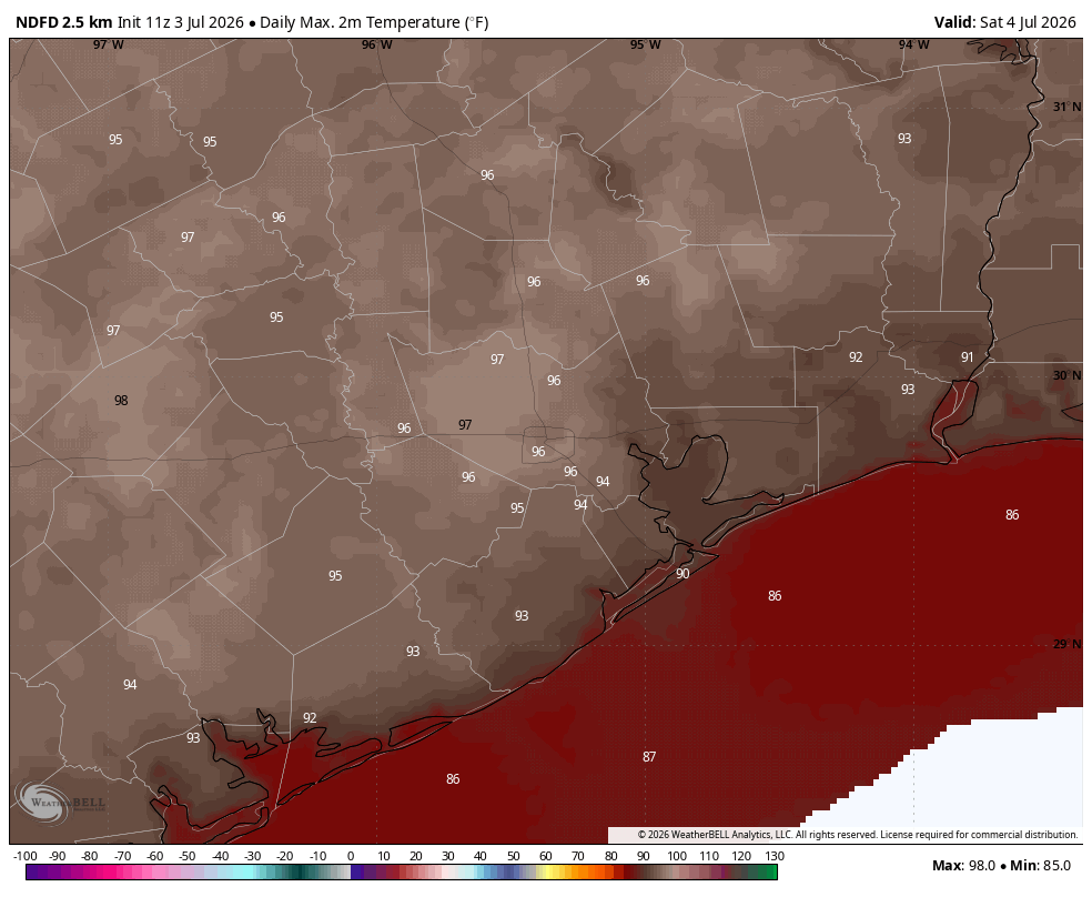
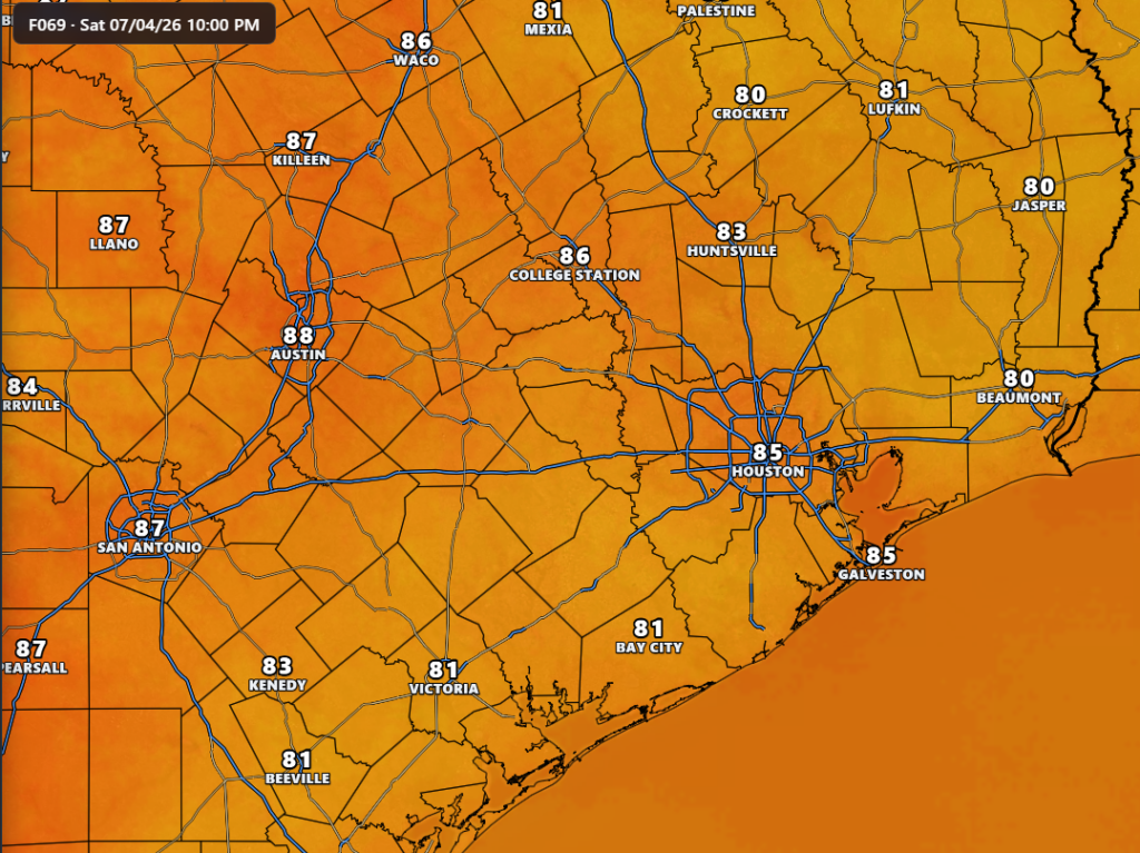
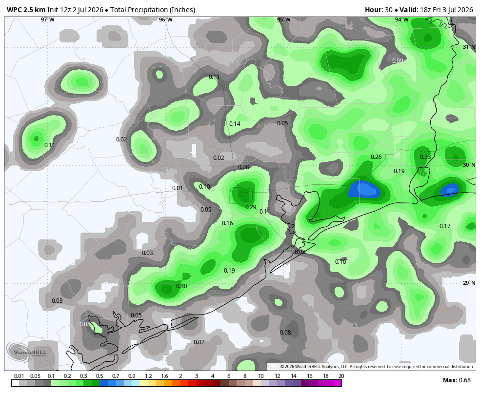
To start this week we are going to see a continuation of the weather we experienced over the weekend, with mostly sunny skies and high temperatures in the mid- to upper-90s. In the absence of high pressure, we will also see the possibility of showers and thunderstorms, some developing during the afternoon and early evening hours along the sea breeze. Overall chances are on the lower end, likely 20 to 30 percent each day, and rain totals will vary widely. But the possibility of a strong storm over your home is not zero. For example on Sunday evening, areas near Oak Forest received 1 inch or more of rainfall, whereas the vast majority of the region received nothing. Overnight lows will be sticky, likely falling only to around 80 degrees.
Wednesday and Thursday
As high pressure builds over the region, our daily rain chances will fall back to around 10 percent each day. We will see mostly sunny skies with highs in the mid- to upper-90s and warm, humid nights. Afternoon winds will be a bit more gusty from the south, up to 15 or 20 mph.
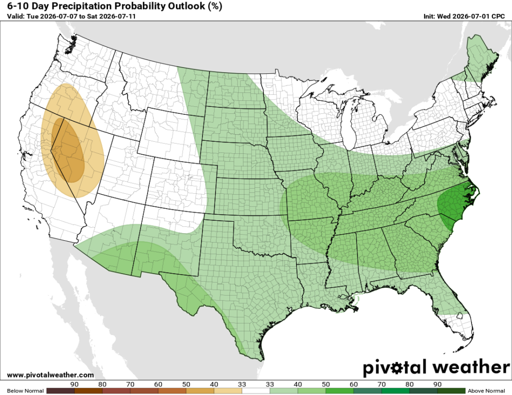
Friday, Saturday, and Sunday
We should encounter a little more weakness in high pressure, and this will increase rain chances for the weekend. How high? It’s difficult to say with confidence, but right now I would ballpark chances at about 40 or 50 percent daily. Overall accumulations are difficult to predict with any accuracy at this point, but most areas are likely looking between 0.5 and 1.5 inches. With a few more clouds in the sky, we may bring daily highs down slightly, into the low- to mid-90s. So overall it will still be quite hot and sticky. Anyway, we’ll get a better idea of specifics for this weekend in a day or two.
Next week
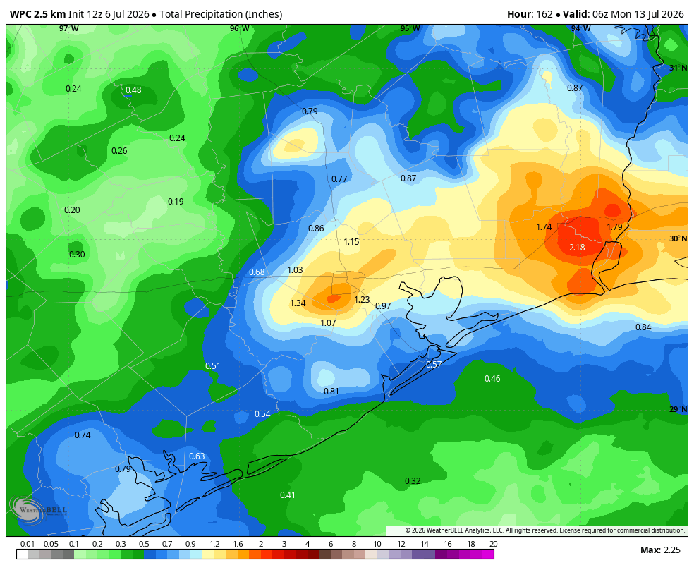
Elevated rain chances may persist into next week before things dry off and heat up a little bit by Tuesday or Wednesday. There isn’t a super strong signal yet for our weather about a week from now—well, aside from the fact that we can count on warm and humid nights. It is that time of year.