In brief: In this morning’s post we recap what was a rather wet weekend for large parts of the Houston region. A mid-week front will bring us another chance of showers followed by a bit of drier and cooler weather. The weekend looks sunny and warm.
A soggy weekend
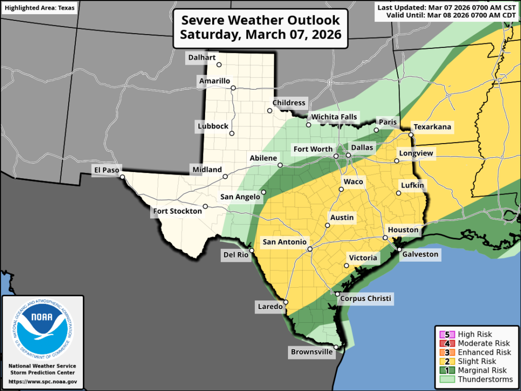
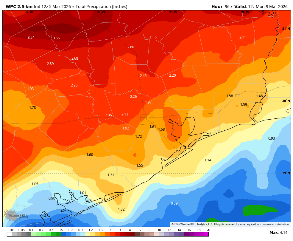
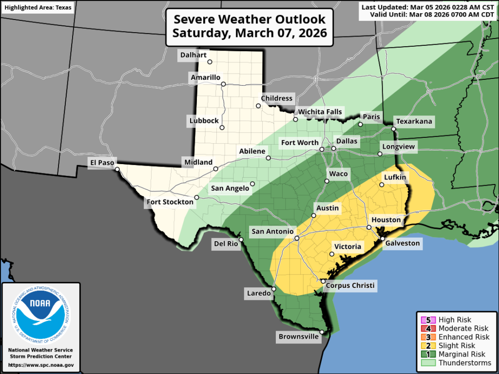
As expected, the Houston area received widely varying amounts of rainfall this weekend, particularly from Saturday afternoon through Sunday morning. While some areas such as Katy only saw a smattering of precipitation, one only need drive along I-10 to the other side of Houston to find totals of 4 to 6 inches. These east-side showers definitely over-performed our predictions.
There was a time, on Thursday evening and Friday morning, when Matt and I debated whether to issue a Stage 1 flood alert for the area this weekend. In retrospect, we probably should have, because these storms produced some decent street flooding in central Houston and areas to the north and east of downtown.
Although these showers were most certainly a nuisance for people out and about Saturday night, large chunks of Houston received 1 or more inches of much-needed rainfall as we are getting deeper into spring. We used “mostly” in the headline because some areas got a little too much rain, and other areas west of Houston not enough.
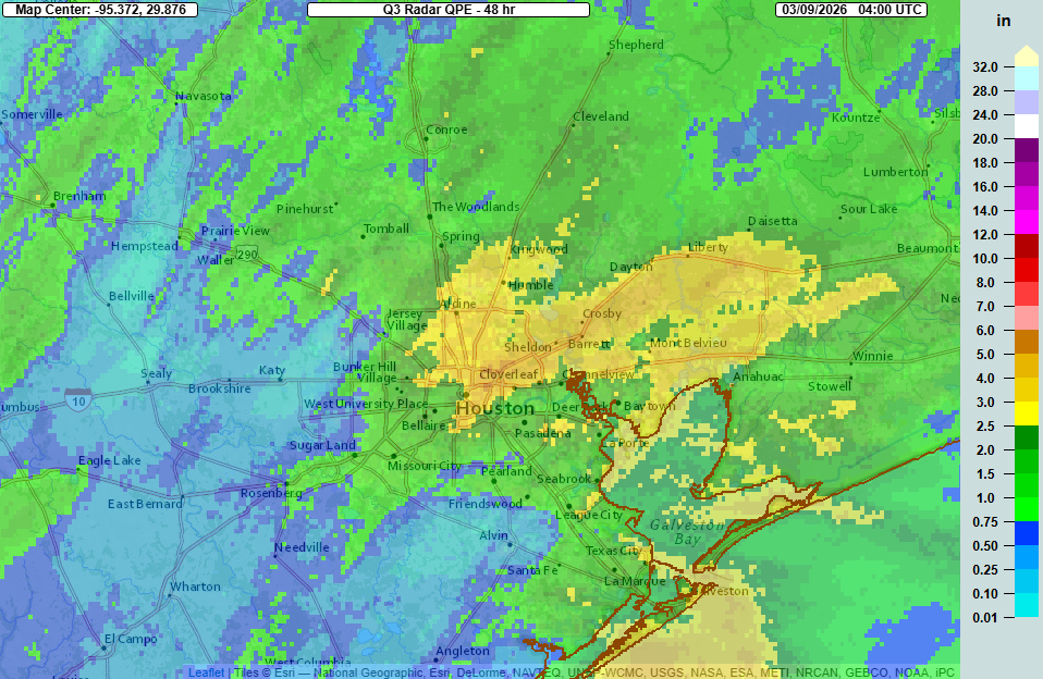
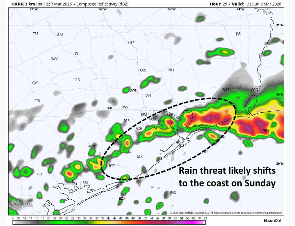
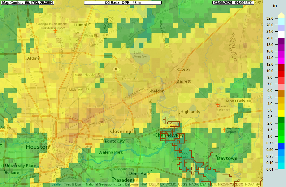
I just wanted to include a zoomed-in view (below) of areas hardest hit by rains this weekend, including Highway 90 and the area near George Bush Intercontinental Airport. These were the heaviest rains so far in our region in 2026.
Monday
The weak cold front that moved into the region this weekend is now lifting back to the north, and so we will be left a warm and humid day today. (Also, the fog is back, and will be possible again tonight and Tuesday night). High temperatures today will generally be in the low- to mid-80s, with winds picking up from the south this afternoon and perhaps gusting up to 20 mph. Scattered, mostly light showers will be possible this afternoon, with perhaps 20 percent coverage. Skies will be mostly cloudy.

Rodeo forecast
Any showers that do develop today should be fading by the late afternoon or early evening hours, about the time most people start showing up for the Houston Livestock Show and Rodeo. Accordingly, I’m not too concerned about any showers before, during or after the show. Temperatures will be in the low 70s this evening and not fall much, with overnight lows in Houston likely to settle out at 70 degrees for most locations.
Tuesday
In terms of fog and temperatures, Tuesday will be similar to Monday. And while our skies will continue to be predominantly cloudy, I don’t expect much, if any rain on Tuesday. Our southerly winds will be more pronounced, however, with gusts up to 25 mph during the afternoon. Expect another warm and muggy night, with lows only falling to around 70 degrees again.
Wednesday
This will be another warm day, but a cold front is likely to push into the area during the afternoon and evening. This will bring a healthy chance of showers and possibly some thunderstorms during this timeframe. However storms are no sure thing, as I could see a scenario in which a line of storms forms north of Houston, but is broken (or even non-existent) in the Houston area. We’ll see. In any case some additional showers are likely on Wednesday afternoon and evening (rain accumulations of 0.25 to 0.75 inch maybe). Please note there is some uncertainty in this forecast as storms could develop further to the south, over Houston. Drier air will follow later on Wednesday night.
Thursday
This will be a breezy, spring-like day with a high of around 70 degrees, low humidity, and sunny skies. Lows on Thursday night will drop to around 50 degrees in Houston, with cooler conditions for inland areas.
Friday
This will be a pleasant day as well, with dry-ish air and highs likely in the upper 70s to 80 degrees. Skies will be sunny. Lows on Friday night will only drop to about 60 degrees as the onshore flow resumes.
Saturday and Sunday
The weekend looks sunny and warm, with highs in the low- to mid-80s. Dewpoints will be in the lower 60s so while it will feel somewhat humid, I don’t expect it to be really muggy like our weather of late.
Next week
Another front will probably arrive early next week, pushing our overnight lows back down into the mid-50s, closer to where they should be this time of year. At this distance the overall likelihood of storms with this front looks low, but we’ll see.