In brief: In today’s post we discuss high pressure and sinking air, which is the reason why Houston is likely to see wall-to-wall sunshine for the next week. We also take a look at just how hot temperatures are going to get this weekend.
High pressure, sinking air
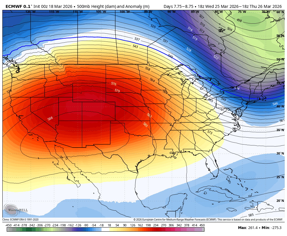
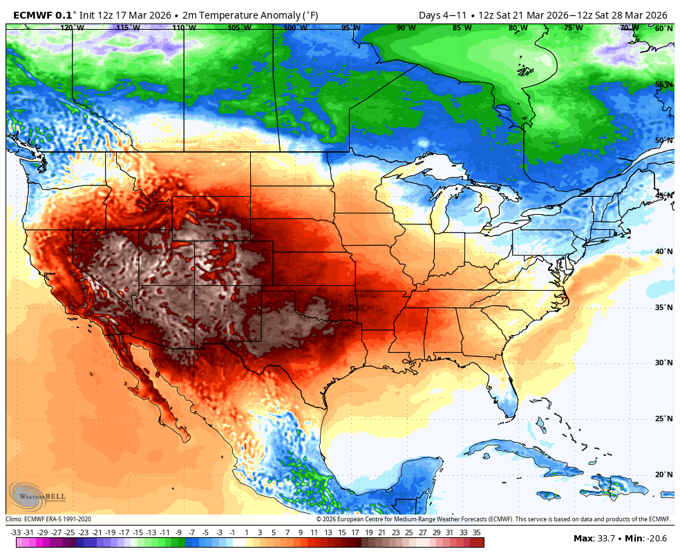
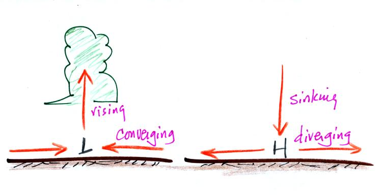
As we discussed yesterday, a rather strong and persistent ridge of high pressure is building over the Western United States, and it is going to hold sway for at least the next week. Such highs produce conditions in which air, generally, sinks rather than rises. In the absence of rising air, it’s difficult to see the kinds of moisture needed for clouds to form to be lifted from the surface. Therefore we get days and days of blue skies. I am highly confident of nearly 100 percent clear skies for now through Sunday, and then I expect partly to mostly sunny skies (at least) to persist for much of next week. This lifted moisture is also necessary to produce precipitation, which is why I’m doubtful that we’re going to see any rain between now and the middle of next week, and quite possibly longer than that.
Thursday

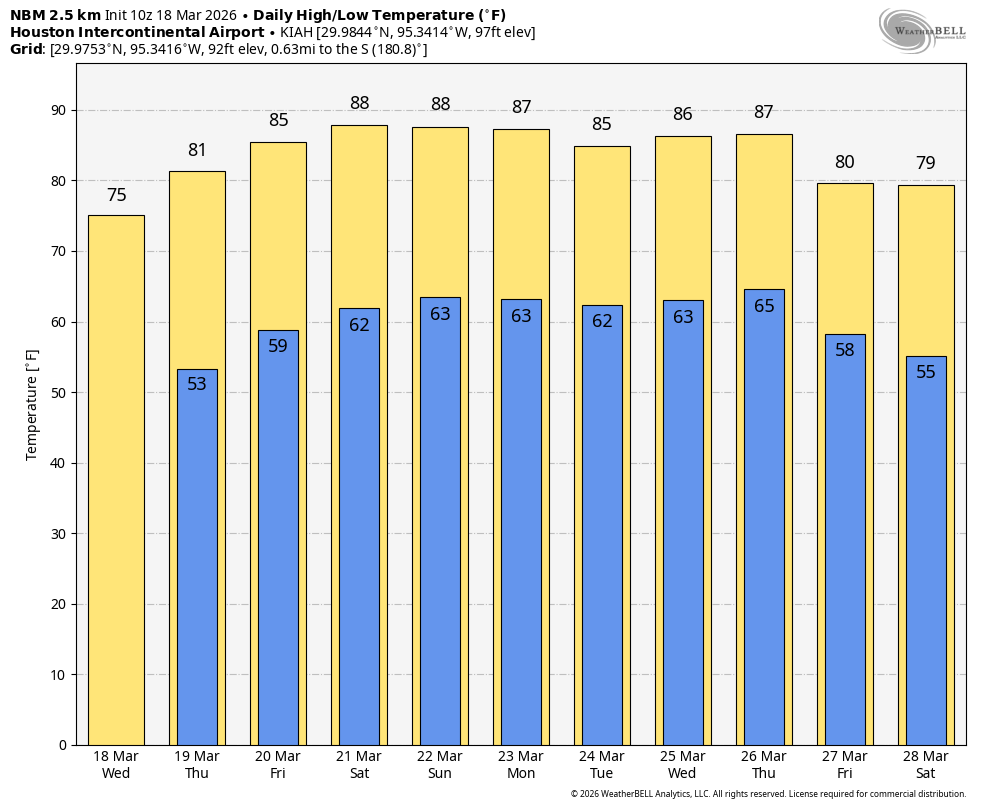
We are experiencing our last ‘cool’ morning today, with lows generally in the upper 40s to lower 50s across the region. Winds are light, from the southwest, and will become a little stronger this afternoon, with gusts up to 15 mph perhaps. Skies will be—if you’ve been paying attention you already know the answer to this—sunny today with high temperatures climbing into the lower 80s.
Houston rodeo
The weather will be mighty fine for the rodeo later today, with temperatures this evening in the 70s, and southerly winds at about 10 mph. Lows will fall into the 60s after the show, and by early Friday morning they should drop to around 60 degrees in Houston. Some outlying areas will likely see lows in the 50s, and that may well be the last time for that until at least next weekend.
Friday
A fine, sunny day with highs in the mid-80s. Winds may be a little more perky from the south, with overnight temperatures a few degrees warmer.
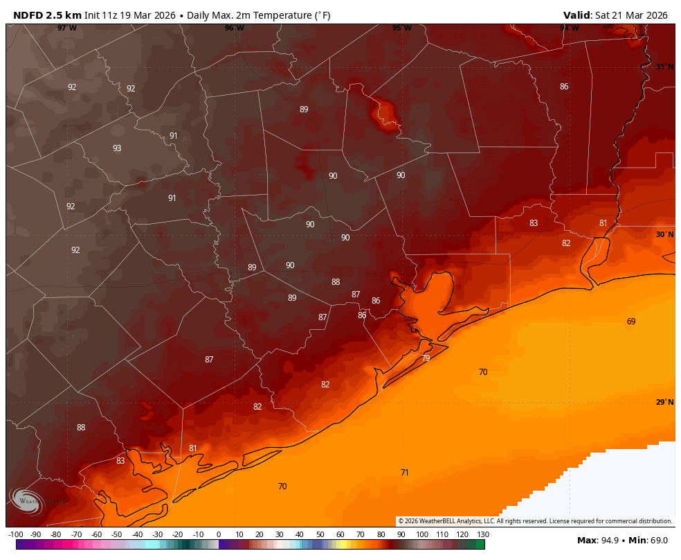
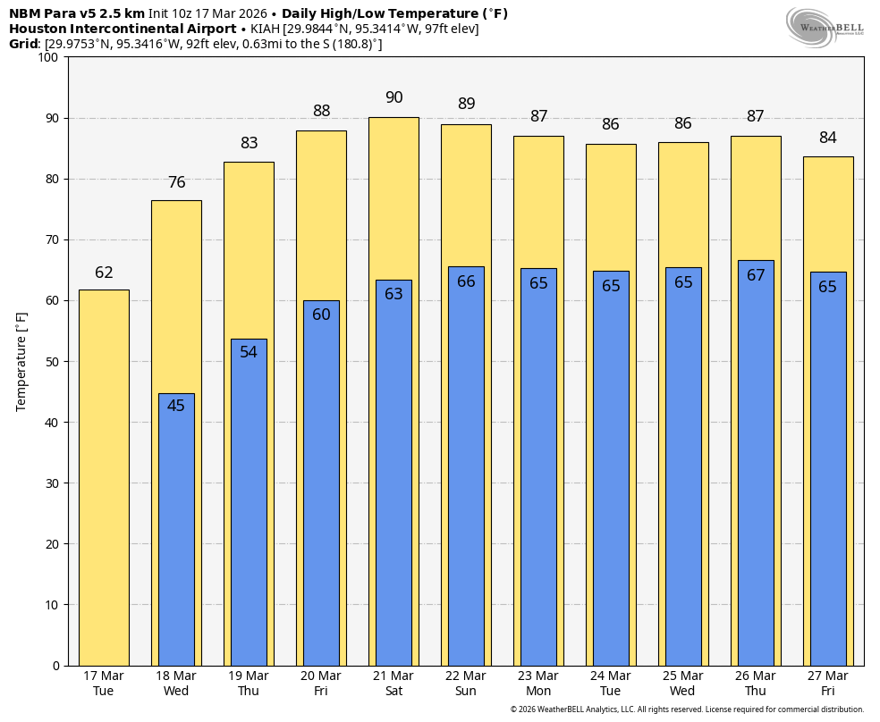
Saturday and Sunday
The ridge should reach its peak strength this weekend, and that will push our high temperatures into the upper-80s for most locations. Some inland areas may well hit 90 degrees for the first time this year. Regardless it’s going to be sunny and borderline hot this weekend. Southerly winds may gust up to about 20 mph during the afternoon hours. Overnight lows will fall into the lower 60s. It will feel moderately humid, but still be far below ‘normal’ humidity in Houston on a summer day. So I guess we’ve got that going for us, which is nice.
Next week
A weak front will approach the area early next week, but I don’t think it will bring us any precipitation. It should help knock a few degrees off daytime highs however, so maybe mid-80s rather than upper-80s. I still anticipate a lot of sunshine next week and low rain chances. That may change toward the end of the week with a frontal passage, but I’m making no promises or guarantees there.