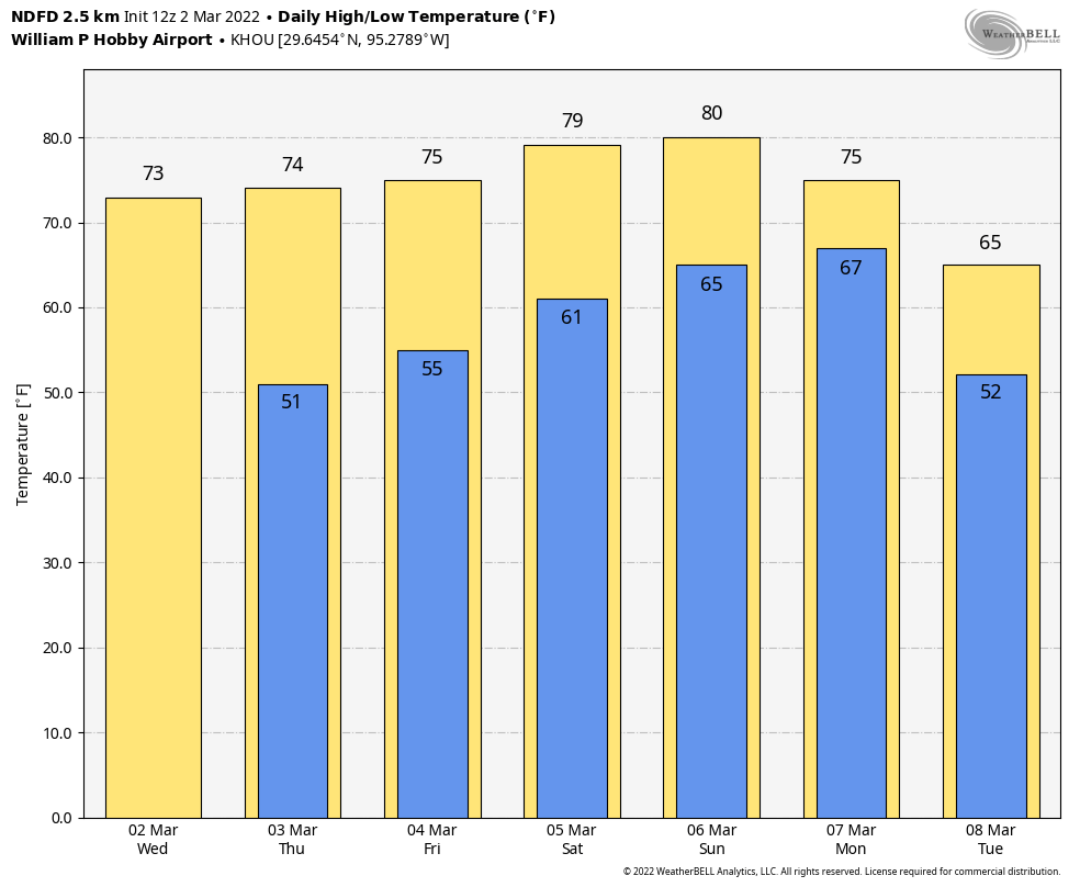
Good morning. It’s cold, dreary, and rainy out there this morning, and we’re not going to warm up much today. And just as temperatures finally start to push back toward 70 degrees at the end of the work week, and even stronger front will arrive on Friday to plunge us back into deep winter this weekend. A freeze will even be possible for some locations. But looking ahead to next week, when most area kids will be on Spring Break, the weather takes a turn to the more moderate side. It looks, dare I say it, quite nice?
Tuesday
As expected, we’re seeing warmer air above thin layer of cold air at the surface, and this lifted moisture is generating light to moderate rainfall across much of the metro area. A few thunderstorms will also be possible this morning before we transition to more scattered, lighter showers this afternoon.

Overall, most areas probably will see about one-quarter to one-half inch of rain, but we can’t rule out some higher amounts for isolated areas. With gray skies, temperatures won’t warm much today, likely topping out in the upper 40s to low 50s for most areas. Lows tonight, generally, will drop into the low 40s, with any lingering showers ending.
If you’re headed to the Houston Livestock Show and Rodeo this evening to see Maren Morris, there is the possibility of some very light rain during the late afternoon and early evening hours, but at this point it looks like even these showers will move off shortly after sunset. Temperatures will be in the upper 40s on the way into the show, and only a degree or two colder afterward.
Wednesday
Skies should start to clear out on Wednesday, with this sunshine helping to warm temperatures to around 60 degrees. Lows Wednesday night should drop into the 40s for all but coastal areas.
Thursday
As stated Monday, this day will be the pick of the litter for outdoor activities this week. Expect sunny skies, highs in the mid-70s, and relatively light winds. Overnight lows drop into the 50s.
Friday
Friday should start out fairly warm, with temperatures rising into the 60s for most of Houston. Then we’ll be on the lookout to the northwest, for the next frontal passage. I still don’t feel great about pinpointing the timing of this one, which could pass through Houston anywhere from late morning to early evening. The front will likely have some rain with it, and while it looks like these will be fairly light, scattered showers, we cannot yet rule out the potential for some briefly heavier rainfall. After the front passes winds will quickly turn to come from the north, with gusts likely above 30 mph. Skies, too, will clear out pretty quickly allowing temperatures to plunge into the 30s by Saturday morning, with a freeze possible for some locations in and around Houston. We probably won’t have a clear idea of where the freezing line will be for a few more days.
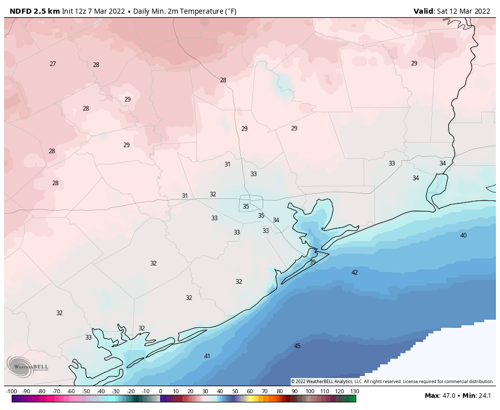
Saturday and Sunday
The weekend looks chilly and sunny, with highs in the 50s on Saturday, another cold night in the 30s, and then highs in the 60s on Sunday.
Next week
This will be Spring Break for many children in the Houston area, including my own. The good news is that much of next week should feel like a really nice spring week. I’m betting on partly to mostly sunny skies for most days, with highs in the upper 70s, give or take. There’s also not too much in the way of rainfall, at least through the first half of the week, if not longer. Enjoy!