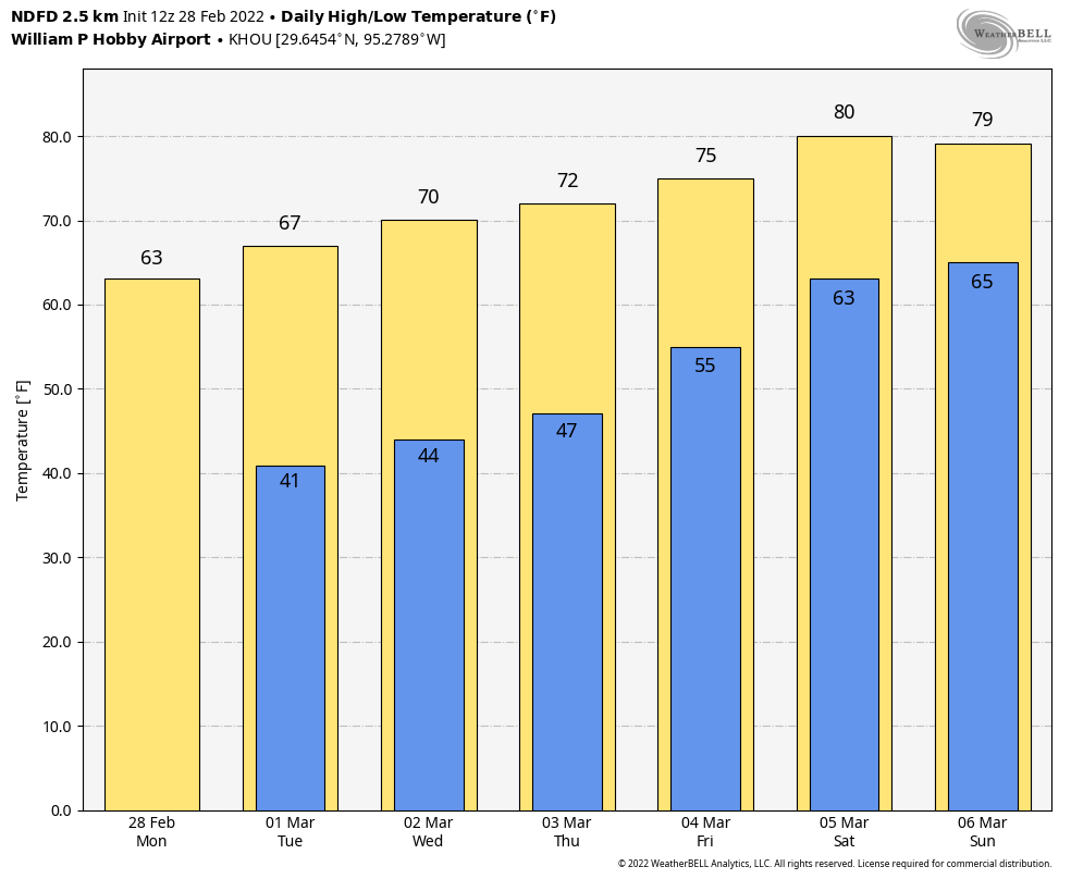
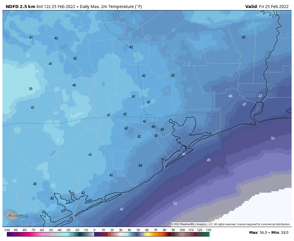
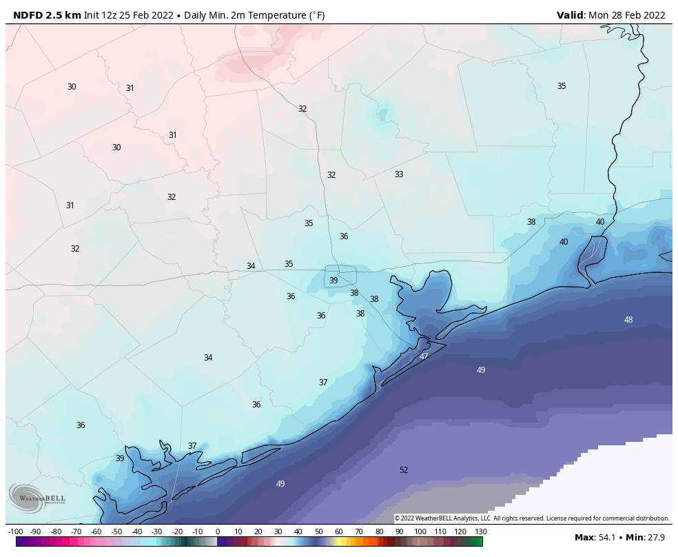
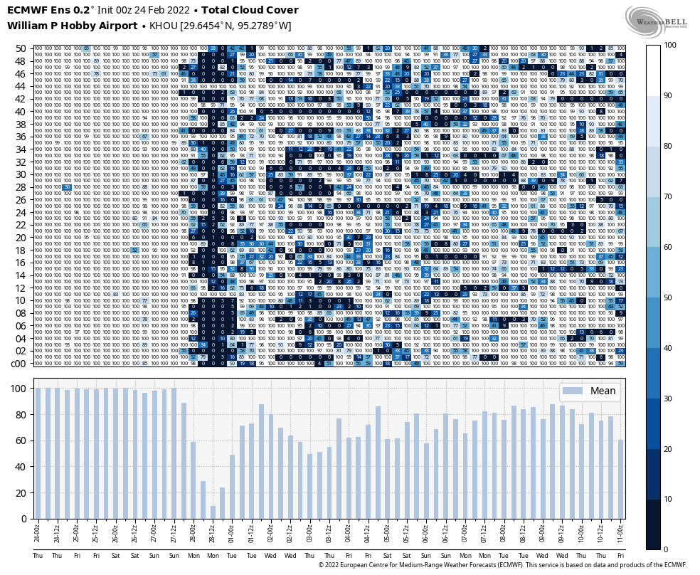
Warm this week, but the new year will bring a new pattern—a much colder one

I hope everyone had a fantastic weekend celebrating Christmas and the other holidays that make this such a special time of year. I’m sorry the weather was not particularly festive.

Overall, the forecast is pretty simple. The last week of 2021 is going to be blazing hot for December—we are going to obliterate this month’s temperature record—and then our weather will turn much more winter-like at the start of next year. Read on for full details.

Monday

Light southerly winds have kept the fog mostly at bay this morning, and these winds will at times gust to 15 or 20 mph this afternoon. This is part of an overall southwesterly flow in the atmosphere that will help to keep conditions very warm this week. Highs on Monday will reach the low 80s for most locations despite partly to mostly cloudy skies. Rain chances are near zero and lows Monday night will only fall to around 70 degrees in Houston.

Low temperatures on Tuesday morning will be 20 to 30 degrees above normal for this time of year. (Weather Bell)

Tuesday

A weak atmospheric disturbance may bring some very light showers to the region on Tuesday, although accumulations should be less than a tenth of an inch. Otherwise, expect partly sunny skies with highs in the low 80s. Winds will again be a bit gusty out of the south.

Wednesday, Thursday, and Friday

These will be three more warm and partly sunny days, with highs likely reaching the low 80s. A weak front will approach the area on Wednesday from the northwest, and this may briefly drop lows on Thursday morning into the mid-60s with some drier air for locations inland of Highway 59/Interstate 69. But this front will likely be gone before you know it.

If you’re planning to be out and about on New Year’s Eve, expect temperatures in the low 70s as the clock counts down to midnight. I’d be concerned about fog, but I think there will be enough wind from the south to preclude that. Rain chances on New Year’s Eve look to be near zero.

Change is coming in the new year. (Weather Bell)

First week of 2022

New Year’s Day should see more of the same warm weather, but sometime during the afternoon, evening, or overnight hours a strong front should arrive. Details remain sketchy, but I think at least a little bit of rain is likely with the front, if not some showers and thunderstorms. We’ll see.

What we can be more confident of is that significantly colder and drier air will follow. We’re looking at daytime temperatures in the 50s and lows in the 30s and 40s for a time. Conditions will be windy and cold. It even seems possible that inland areas may see the season’s first freeze by around the morning of Monday, January 3, but again it’s way too early to put any precision to such temperature forecasts.

Christmas Day will probably at least tie a record for high temperature

For nearly all of Houston, this will be our final morning in the 50s for the year 2021. And overall, the forecast remains much the same as we’ve been discussing for awhile. After emerging from this recent cold spell, Houston will spring back into very warm conditions for the remainder of 2021, with mostly sunny skies and rain chances near zero until the New Year. A strong front at that time seems likely.

Finally, before getting on with the forecast, please let me wish you and your families a very Merry Christmas and other seasons greetings during this holiday period. It really is our pleasure to have so many delightful readers.

Thursday

Basically, high pressure will hold sway over our weather for much of the remainder of the year, drawing in a southerly flow and warming our temperatures, while tamping down rain chances. Highs today will reach the mid- to upper-70s beneath mostly sunny skies, and although it won’t exactly feel “dry” out, this should be the driest air left to us this year. Winds will be out of the south at about 10 mph today, with overnight lows dropping into the low 60s in Houston.

Forecast high temperatures for Christmas Day. (Weather Bell)

Friday

Christmas Eve will see highs around 80 degrees, with moderately gusty southerly winds, and mostly sunny skies. Overnight lows will drop into the upper 60s in Houston, with warmer conditions along the coast.

Christmas Day

The record high temperature for Christmas Day in Houston is 83 degrees, set in 2015. I think we have a good chance of matching or even beating the record high, and if we do it probably won’t be the last heat record we set for 2021. The good news is that skies should be mostly sunny. Lows on Saturday night will drop into the 60s.

Behold, 80s for as far as the eye can see. (Weather Bell)

Sunday and beyond

Really, next week will just bring more of the same. Expect highs around 80 degrees with low temperatures in the upper 60s to nearly 70 degrees. Humidity will be high, but not oppressively so. The only noticeable change is that our mostly sunny days this week may become more partly sunny next week. Rain chances remain virtually zero well into next week. While the timing of our next real cold front—we are supposed to be smack dab in the middle of winter after all—remains fuzzy, I’d pencil it in for around New Year’s Day.

Today’s weather will be nigh on perfect, but it won’t last

Good morning my friends. After a chilly start to today, much warmer weather lies ahead for Houston, with sunshine and 80-degree days through the weekend. In fact, it should remain abnormally warm through the end of 2021. But what about the New Year? You may be starting to see rumors on social media about a snowstorm in Houston about two weeks from now. We’re, uhh, not sold.

There is a nice chilly airmass over the region this morning, but it’s about to be swept away. (Weather Bell)

Wednesday

Today will be simply lovely. With mostly sunny skies, high temperatures will rise to about 70 degrees this afternoon. With modest dewpoints, the air will feel exceptionally pleasant. Winds will be light, out of the southeast at 5 to 10 mph. Really, today will just be super nice for anything you care to do outside. Please enjoy if you can. Temperatures tonight will be 5 to 10 degrees warmer than Tuesday night as the southerly flow continues to modify our air mass.

Thursday

This will be the last day with moderately drier air for awhile. Highs likely will get into the mid- to upper-70s, but dewpoints should hang around 60 degrees which should be nice enough. Skies will remain mostly sunny, and winds will continue from the south. Lows on Thursday night won’t drop out of the 60s for most of the region.

Friday

Christmas Eve will be warm and mostly sunny, with highs near 80 degrees. Winds out of the south may become a bit more blowy, perhaps gusting up to 20 mph. As dewpoints rise, so too will humidity levels. Overnight temperatures will be in the upper 60s for most of the area.

Mele Kalikimaka-like temperatures for Houston on Christmas Day. (Weather Bell)

Christmas Day

Christmas will see unseasonably warm weather, with highs likely in the low 80s for most of Houston. At least it will be sunny, with a zero percent chance of rain. If you went all Clark Griswold and bought the family a swimming pool this year, feel free to take a dip. Expect another warm night.

Next week

It now appears as though the possible front for early next week won’t make it, so we’re staring at a warm final week of 2021. Expect highs around 80 degrees and nights likely in the 60s. There probably will be a few more clouds, but rain chances remain low to very low. The most likely window for the arrival of our next real cold front is New Year’s Eve or New Year’s Day. This should, at least, drive lows into the 40s or 50s.

Snowstorm?

We’ve started to see some chatter on social media about a “snowstorm” coming to Texas in the January 4 to 6 timeframe. First of all, if you’ve read Space City Weather for any period of time, you’ll know to have a sufficiently high sense of skepticism about model forecasts 10 days out, let alone 14 to 16 days.

The northern states are likely to be cold early in 2022, but how far south will the cold air blow? (Weather Bell)

With that said, a substantially colder air mass is likely to move into Canada and the northern tier of the United States during the first few days of the new year—we’re talking temperatures 10 or 20 degrees below zero in places like Minnesota. But we’re not sold on a significant chunk of that really cold air working its way across the United States and into Texas, let alone to find the right conditions for snowfall. So while a snowstorm in Houston is certainly possible in early January, it’s probably a 1-in-20 shot at this point. I’d not buy sleds for the kids’ Christmas just yet.

Quite chilly this morning, but our warming trend begins today

Good morning. Temperatures range from the mid-30s well north of Houston to about 50 degrees right along the coast. Overall, the forecast remains the same, with this being the nadir of temperatures for awhile, and the beginning of a warming trend that will last until … ? That is the question. Certainly we’ll be warm through Christmas Day and the weekend. Perhaps the next front comes by Tuesday or so of next week. More likely, it will be closer to New Year’s Day.

Tuesday

With clear skies and light winds, this morning offers ideal conditions for cold weather, and we’re seeing that across the region. Skies will be sunny today, and this will allow highs to reach about 60 degrees before another cool night. However, as light winds start to return from the south, temperatures will probably be 3 to 5 degrees warmer tonight than Monday night.

Your low temperatures for Wednesday morning. (Weather Bell)

Wednesday

Skies should still be mostly sunny on Wednesday, and highs will reach about 70 degrees. Winds will be out of the south at around 5 mph. Lows Wednesday night should be in the 50s across Houston, except for the coast which will be a bit warmer.

Thursday and Friday

The warming trend continues, with a pair of mostly sunny days and highs on Thursday in the mid-70s and approaching 80 degrees on Friday. Overnight lows will be solidly in the 60s.

Christmas Day

Expect more of the same: Saturday should see mostly sunny skies and high temperatures in the low 80s. Yule not need a log on the fire, that’s for sure. The good news is that rain chances are basically zero.

NOAA rain accumulation forecast for now through Monday. So yeah … dry. (Weather Bell)

Sunday and beyond

Sunday and Monday should see more warm conditions, with partly to mostly sunny skies and high temperatures in the vicinity of 80 degrees. I’d say there’s maybe about a one-in-three chance that a front makes it through around Tuesday, and if not then, a much higher chance a stronger front arrives on New Year’s Eve or New Year’s Day. This front has a chance to drive lows into the 30s in Houston, but since it’s 10 days away we’re basically in the arm-waving portion of the weather forecast.