Good morning. The tropical system in the Caribbean Sea continues to show better signs of organization this morning, and will likely become a depression or Tropical Storm Ida later today or tonight. We continue to watch this system closely, and over the the last 12 to 24 hours most major models have trended east with their forecast. The most likely possibility now is that a strong hurricane comes ashore somewhere in Louisiana on Sunday or Sunday night. But we definitely cannot rule out impacts to Texas. Please find more information below.
Also, as you may recall, we launched a Spanish-language version of Space City Weather this week. At 11 a.m. CT today please join me, the editor of the new site, Maria Sotolongo, and Rolando Salinas from Reliant Energy to talk about why we’re doing this. The event will take place on our Facebook page.
Thursday
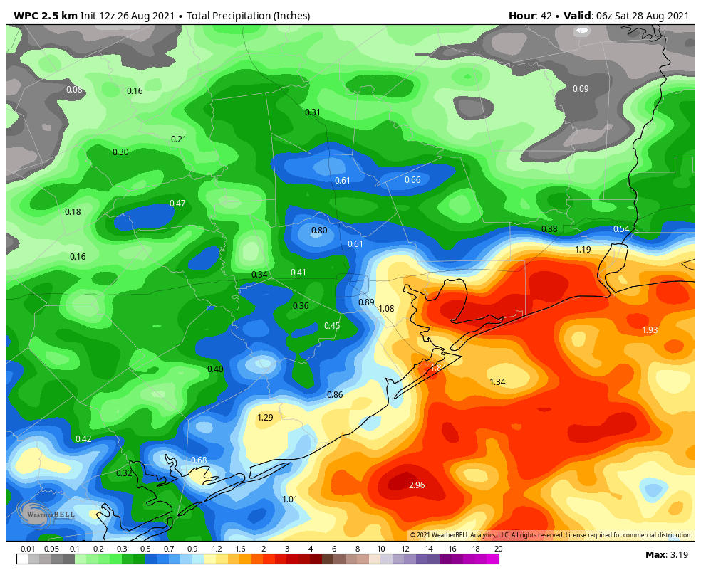
There are some scattered showers offshore this morning, and they should develop inland later this afternoon. This should yield perhaps a 30 to 40 percent chance of rain, but there will still be enough sunshine to drive temperatures into the mid-90s. Winds will be light, generally out of the east. The upper air pattern becomes more favorable for rain this evening, through the overnight hours, into Friday so there is about a 50 percent chance of showers tonight.
Friday
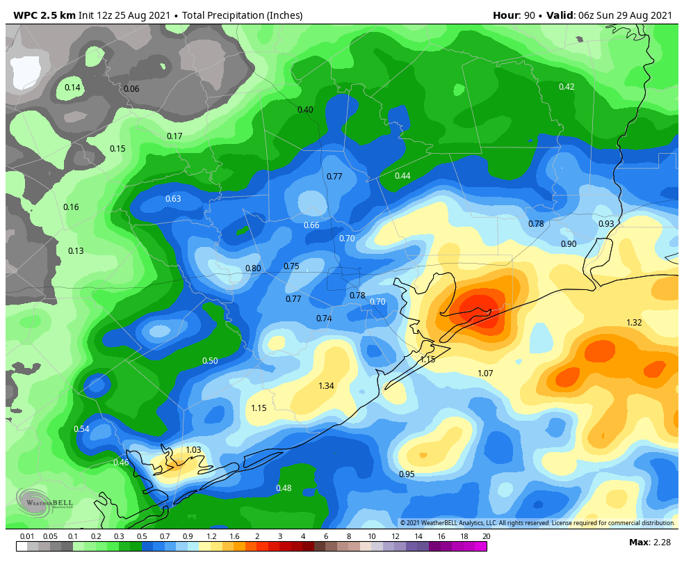
We expect fairly widespread showers on Friday morning, with the potential for some heavy rain to produce a quick accumulation of perhaps 2 inches for some locations. Showers should end from south to north during the late morning or early afternoon hours. Highs will likely reach about 90 degrees under partly sunny skies.
Saturday and Sunday
The overall fairly wet pattern should continue through the weekend, with partly sunny skies, highs in the low 90s, and perhaps 50 to 60 percent rain chances each day. The ultimate track of Invest 99L is going to have a lot to say about our weekend weather so any forecast now is very, very tentative.
Tropics
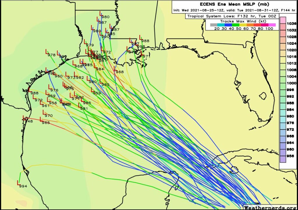
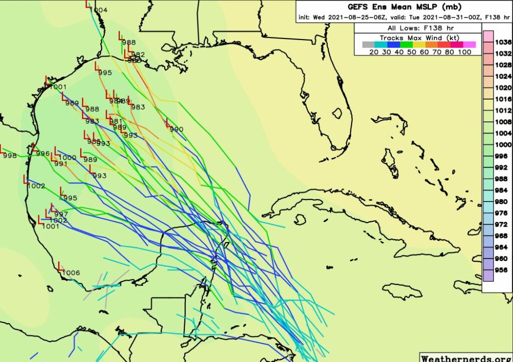
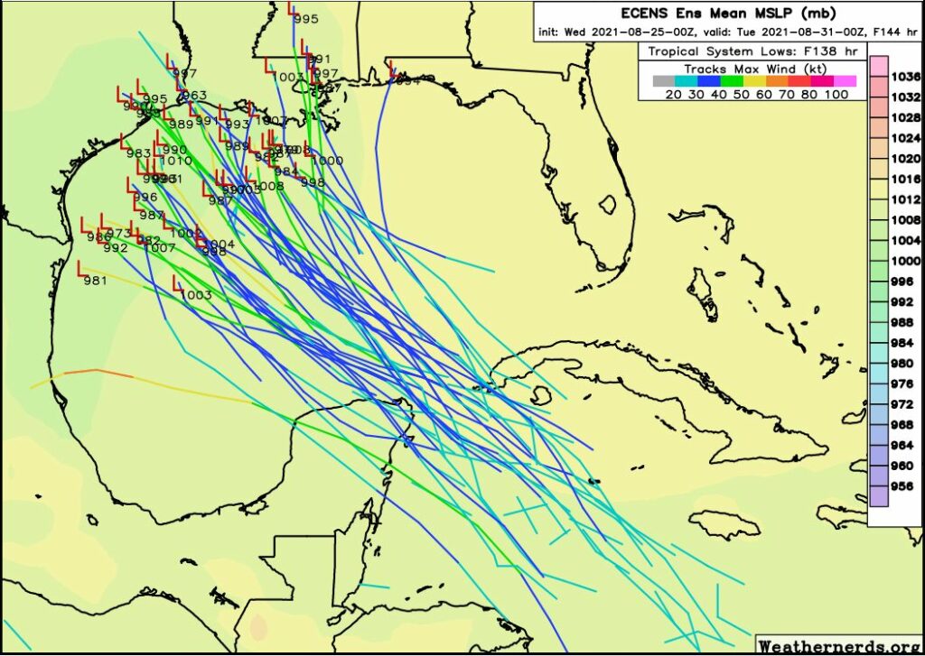
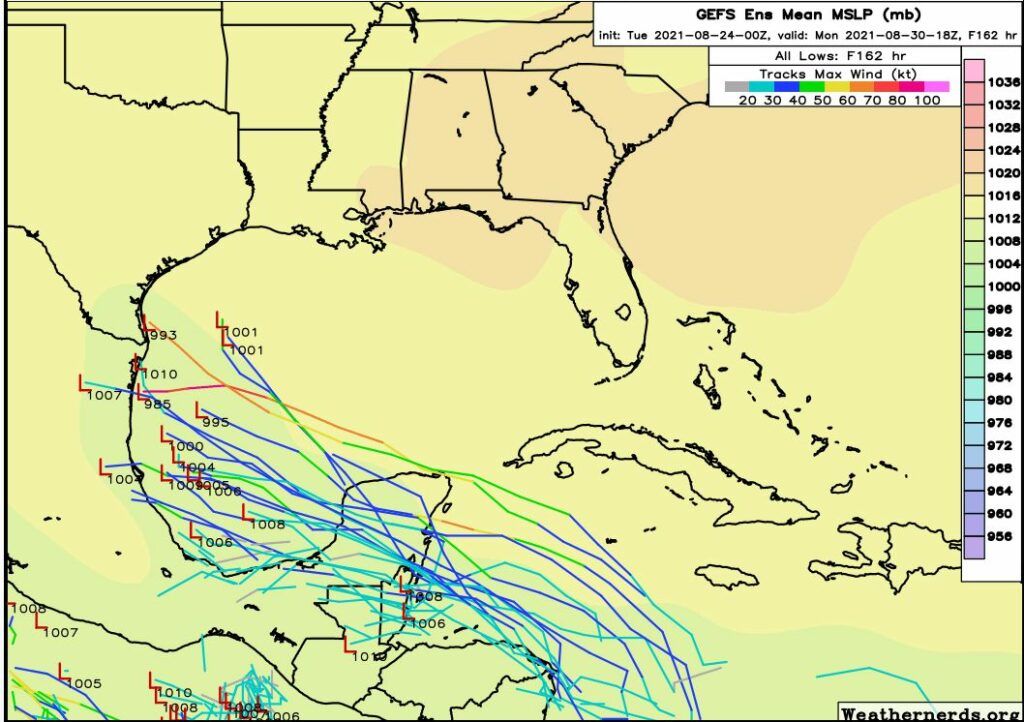
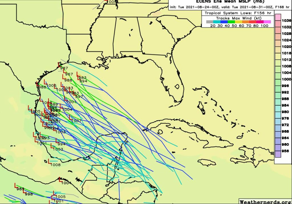
What we know is that Invest 99L is starting to become better organized, and should move into the Gulf of Mexico on Friday night or Saturday morning. After this time there is not much to hamper its organization—there is little dry air aloft, and wind shear is relatively low—and plenty of warm Gulf water for the system to work with. Our expectation is that the storm will become a hurricane, a possibly a major hurricane by later on Sunday as it approaches the Gulf coast.
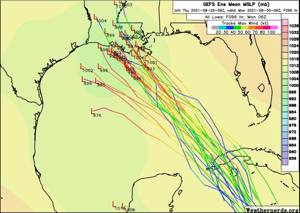
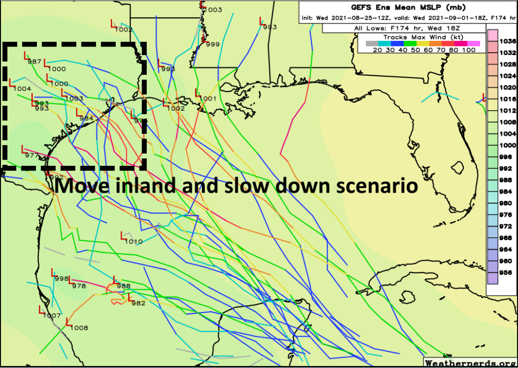
So where will the storm go? That will depend on the extent of a high pressure ridge over the southeastern United States. Most of the model guidance now shows enough of a weakness in the ridge to allow the storm to travel more northeasterly, likely bringing it to the coast somewhere between the Texas-Louisiana border and Mississippi. Because 99L is likely to intensify fairly rapidly, this could facilitate a more northerly turn, which probably puts southeastern Louisiana under the biggest threat for now. The bottom line is that if you live in Louisiana, particularly the New Orleans area, there is a significant threat that a powerful hurricane will come to the coast in just a little more than three days from now.
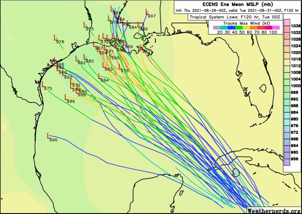
As for Texas, we definitely cannot rule out direct impacts from this system. There are some scenarios in which a weaker storm cannot force its way north by influencing the ridge of high pressure. In this case the storm would turn more westerly, toward the Texas coast. There is enough uncertainty in the forecast to keep a close eye on the system. But at this point I would say we’re cautiously optimistic about the upper Texas coast, including Houston, being spared this weekend and early next week.
Matt or myself will have an update later this afternoon or evening.