Good morning. Houston’s wet pattern continues with the potential for moderate to briefly heavy rainfall across the region this week. However, while it will be wet, these storms are mostly not producing flooded roadways. The upside is that cloud cover will generally keep our highs in the upper 80s this week at a time when the mercury often rises into the mid-90s.
Tuesday
The heaviest rains this morning are concentrated in the Matagorda Bay region, to the southwest of Houston. Short-term models suggest showers will most likely remain along and south of Interstate 10 today, with inland areas likely to have a drier day with perhaps no rain. As a result, inland highs may reach the upper 80s, with mostly cloudy skies, whereas the coast remains in the lower 80s. Winds will be light, out of the southeast, and rain chances will back off a bit this evening.

Wednesday
Wednesday looks similar to Tuesday, with storms starting near the coast or offshore, and again migrating inland. I would again expect better rain chances south of Interstate 10, with warmer temperatures near 90 degrees inland, and 80s closer to the coast. For Tuesday and Wednesday, overall accumulations north of Interstate 10 will probably be 1 inch or less, with 2 to 4 inches along the coast.
Thursday and Friday
The potential for organized storms starts to decrease Thursday as the atmosphere becomes slightly more stable. But we’re still going to see showers fire up with daytime heating, and I’d say about half of the area will at least see some brief showers on each of these days. High temperatures for most will likely get into the upper 80s.
Saturday and Sunday
At this point rain I think rain chances will probably diminish further for this weekend, likely into the 30 to 40 percent chance each day. Sunday probably has a better chance of seeing sunnier skies with only very scattered showers. However, the global models are not in great agreement about the pattern, so stay tuned.

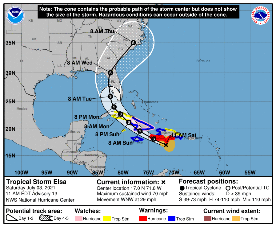
Tropics
Tropical Storm Elsa is passing near the Florida Keys this morning, and will now move northward, just offshore the west coast of the Florida peninsula. Its primary threat remains rainfall, but it will also bring breezy conditions and swells to areas such as Tampa Bay today and tonight. After Elsa moves across Florida and up the Atlantic coast, the tropics should remain quiet for a few days—which is frankly how we expect things to be during early July.