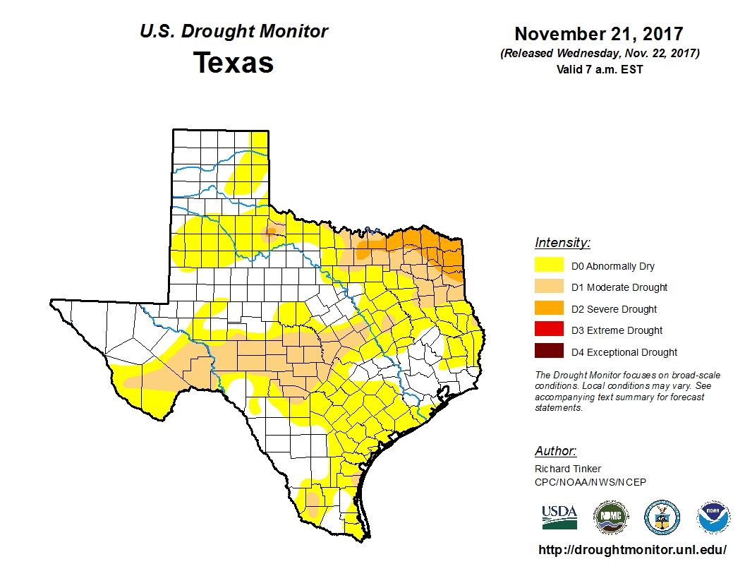
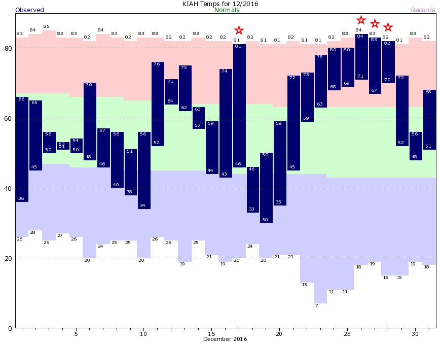
Most of us remember last winter, right? November was 4.4 degrees above normal, and then came December. While the month had a couple of decent fronts, the second half had a run of extremely warm days and nights, including 80 degrees on Christmas and an overnight low of 71 degrees on Christmas night. Here’s what that looked like:
Temperatures this November have averaged about 5 degrees above normal, too, a lot like last year. But I’m willing to bet that December won’t see a repeat. Indeed, as I’ll discuss below, there are good reasons to think that a good chunk of December will see cooler than normal temperatures.
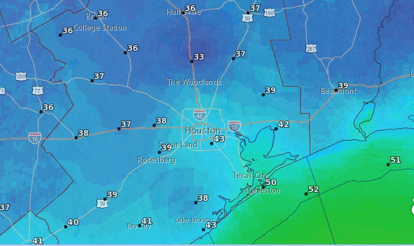
Tuesday and Wednesday
Temperatures will warm into the upper 70s today, and humidity levels will rise a bit. However, a weak cool front will arrive on Wednesday morning to put a lid of temperatures for the rest of the week. This front could spur a few showers near or along the coast, but for the most part we won’t see any precipitation. Highs Wednesday should be in the mid-70s with continued sunshine.