Houston to set record for winter warmth (but it will be quite nice)

Good morning. After Monday’s widespread rain, the region’s weather will now settle down for a while. The continuing story this week will be much the same as it’s been for this winter, warmer than normal temperatures. We’re almost certainly going to smash the record for total number of 80-degree days in “winter,” defined here as December through February. We’ve had 17 days with highs of 80-degrees or warmer this winter, and that ties the previous record set during the winters of 1995-96, 1956-57, and 1910-11. This week we’re likely to pick up at least one or two more 80-degree days before a front moves through.

However, with that said, this week’s weather should be quite pleasant. Despite the warmer days, it won’t be too humid, and nights will cool off. And this weekend? Oh my.

Today

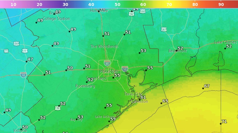
A weak front will move through today, bringing some drier air out of the northwest. Although there’s a slight chance of rain with the front, most areas won’t see any precipitation and skies will remain mostly sunny for the most part. Highs today should be in the mid-70s, with lows tonight in the 50s—warmer for the coast, cooler for inland areas.

Wednesday and Thursday

High pressure will settle over Houston, bringing two sunny days to the region. Look for highs of around 80 degrees, and lows of around 60 degrees. As it won’t be overly humid, both days should feel pretty great.

(Space City Weather is sponsored this month by Darrell Lee’s The Gravitational Leap)

See full post

Heavy showers, severe thunderstorms, moving into Houston at sunrise

As anticipated, a line of heavy rain showers and severe thunderstorms is moving into western Houston this morning, and will move east through the entire metro area during the morning hours. The main threat from these storms is locally heavy rainfall, and some street flooding. A secondary threat is damaging winds, with gusts up to 50 mph possible. Severe thunderstorms appear to be most likely along, and north of Interstate 10.

A line of storms is moving through Houston, shown at 6:25am CT on Monday. (Intellicast)vere

These storms have developed along with an upper-level low pressure system, that will also be moving through the region today. The net effect of this is that heavy rainfall will occur with the main line of storms, and light to moderate showers may linger this afternoon. The flooding threat should end around noon, however, when the heavier storms clear the area. I’d expect rain accumulations for most area to be about 1 to 3 inches, with higher, isolated totals of 5 or more inches.

(Space City Weather is sponsored this month by Darrell Lee’s The Gravitational Leap)

See full post

A quick update on a rainy Monday for Houston

As we’ve been indicating in previous forecasts, Monday is shaping up to be a rainy day in Houston—although we’re not expecting anything too extreme for the region.

It appears as though heavy showers will develop well to the west of the region on Monday morning, before sunrise. They should move into the Houston region between 6am and 9am CT, so there is definitely the potential for a wet mess on freeways and feeders for the Monday morning commute.

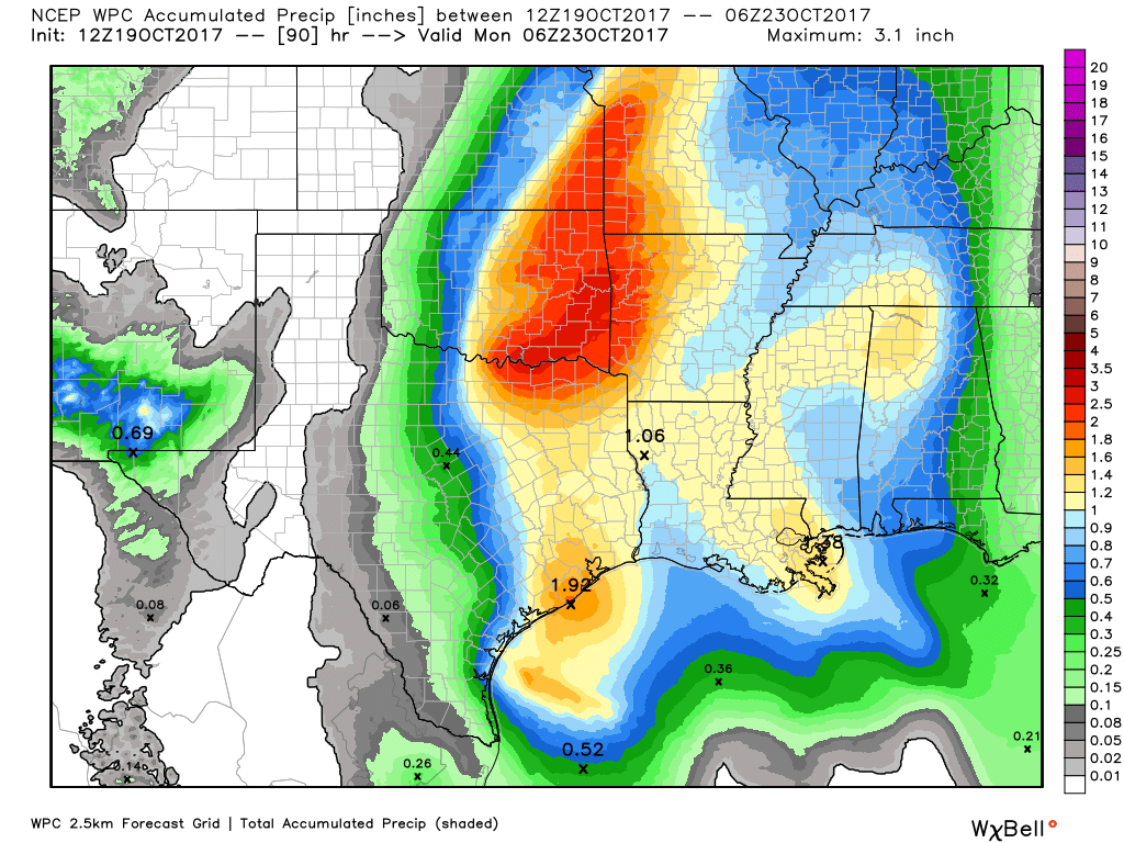
NOAA rain accumulation forecast for Monday and Monday night. (Weather Bell)


I anticipate most areas will see about 1.5 to 2.5 inches of rain on Monday, before showers and thunderstorms taper off during the evening or overnight hours. For Houston, the primary concern is smaller regions where heavy storms establish themselves, and slow down. A few parts of Houston could see 5 or more inches of rain on Monday, which could cause some street flooding. That’s what we’ll be watching for tomorrow morning, and as the day progresses. We will, of course, return with a full update early Monday.

Posted at 8:30am CT on Sunday by Eric

(Space City Weather is sponsored this month by Darrell Lee’s The Gravitational Leap)

After cold spell Houston to warm up, face potential for heavy rain

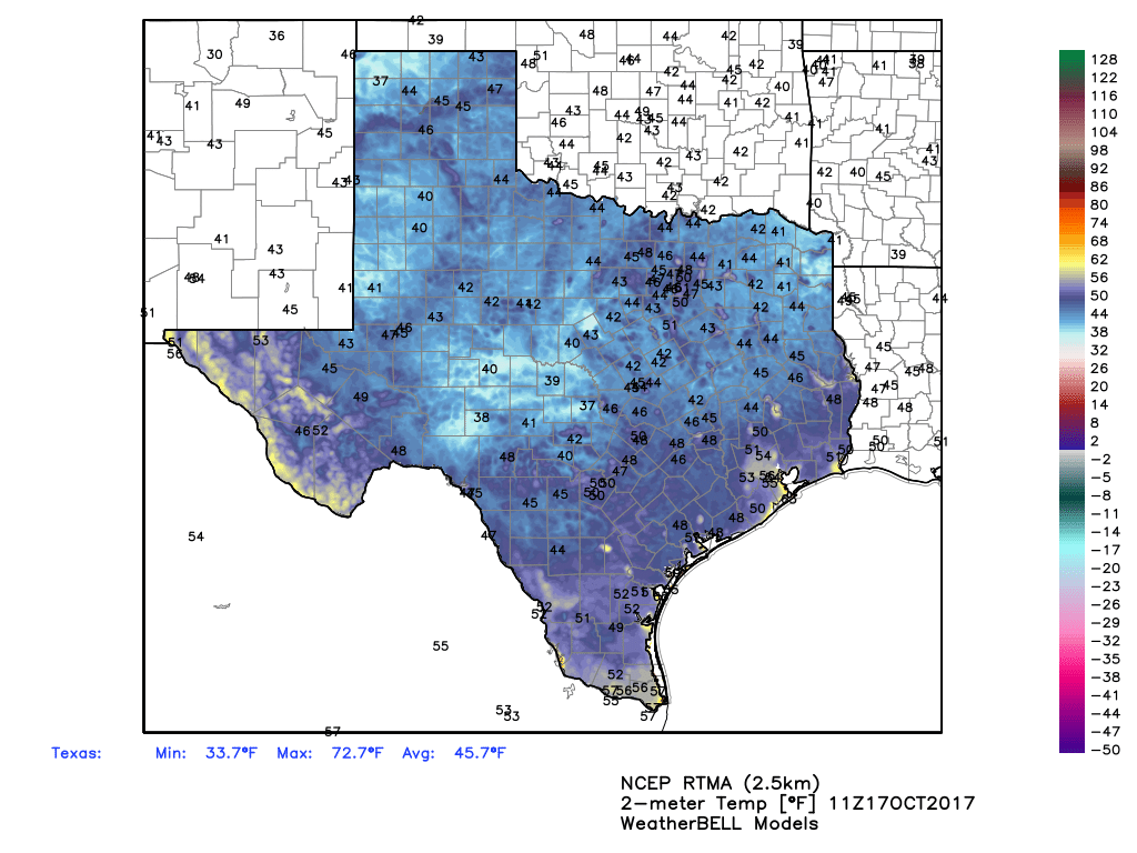
Good morning. Houston is enjoying its coolest morning since late January, with lows in the low- to mid-40s across the region, but warmer air is on the way. And then, on Monday, heavy rain is possible.

Today

This morning’s northerly winds will swing back around to come out of the south later today, but the region should still see partly to mostly sunny skies, with highs of around 70 degrees. Lows tonight will be about 10 degrees warmer than those on Thursday morning.

Friday

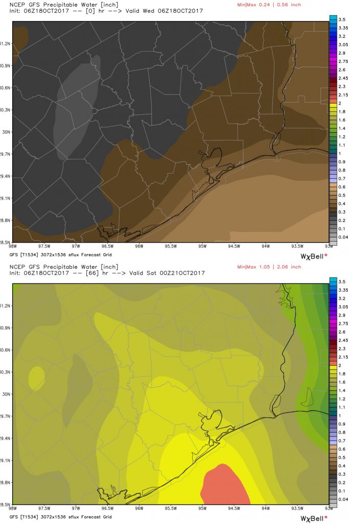
A bit of a complicated forecast as overnight winds start to bring some Gulf moisture back into the area. In addition, conditions in the upper level of the atmosphere will favor rising air, which could generate some rain showers and possibly thunderstorms during the morning and early afternoon hours—especially along the coast.

Precipitable water values for Friday, at Noon, show where rain is most likely. (Higher values indicate more moisture for the atmosphere to work with). (Weather Bell)

The forecast for rain is fairly tricky, because while some areas may see some nasty little storms, most parts of the region probably won’t. With partly to mostly cloudy skies high temperatures should remain at around 70 degrees.

(Space City Weather is sponsored this month by Darrell Lee’s The Gravitational Leap)

See full post