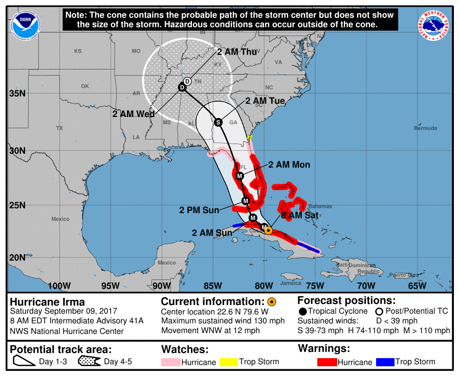
As of 7:30am CT on Saturday, Hurricane Irma continues to move westward, with its center just inland over the northern coast of Cuba. This more westward track, taking the storm over Cuba, is a scenario I discussed a couple of days ago—the Cuban—which would spare the Miami area the worst effects of Irma.
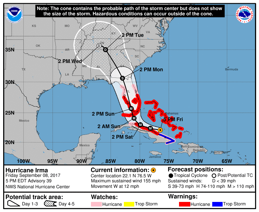
The track over Cuba has weakened the storm’s maximum winds to 130mph, and additional weakening is possible before Irma moves back into the Straits of Florida later today or tonight. Here’s a quick look at the official forecast track:
Here are the implications of this changing track:
Cuba: The island nation is being battered by the storm
Florida Keys: Still in line for a major hurricane today and Sunday. Expect devastating winds, rainfall and storm surge.
Miami area: As Irma continues to move westward, its center will bypass the Miami metro area, sparing the heavily populated southeastern coast of Florida from the worst effects of winds and storm surge. Hurricane force wind gusts are still likely, but they will probably not cause widespread damage. Inland rainfall amounts of 15 to 20 inches are possible, and flooding is a significant concern.