In brief: Light to moderate showers are moving into Houston from the southwest this morning, and this more or less will be the pattern over the next two days. There’s a chance for some heavier rain on Friday afternoon or evening, but overall the threat for significant flooding in Houston and surrounding suburbs is fairly low. After Friday, our weather turns warmer for awhile.
Rain status
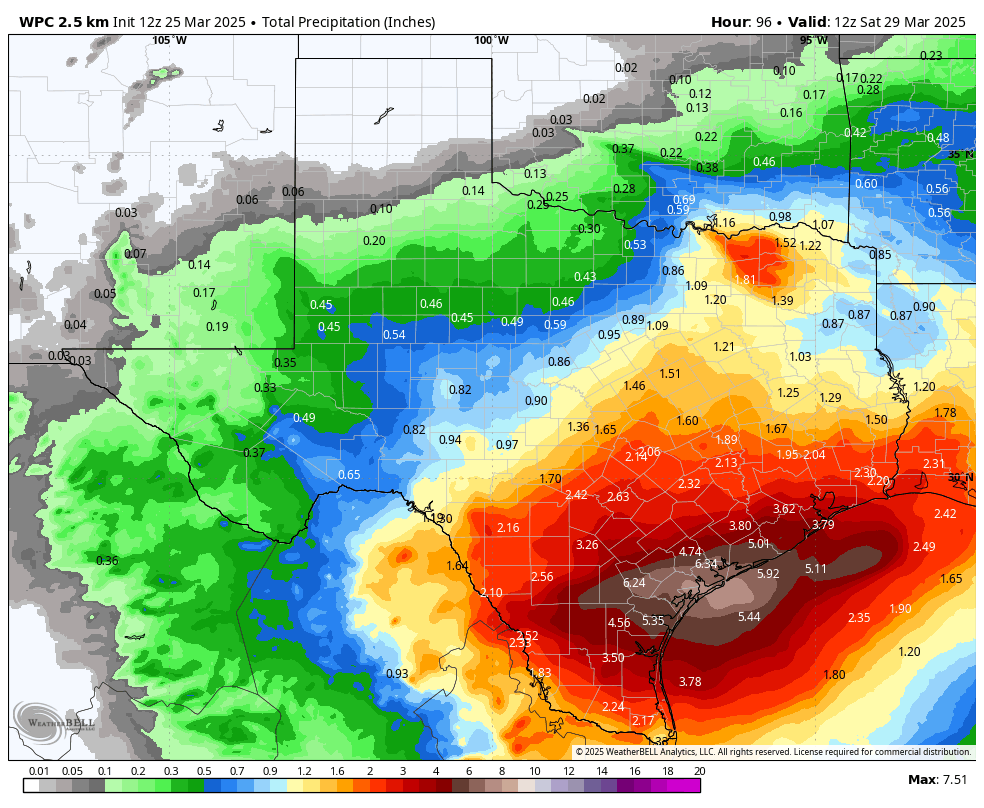
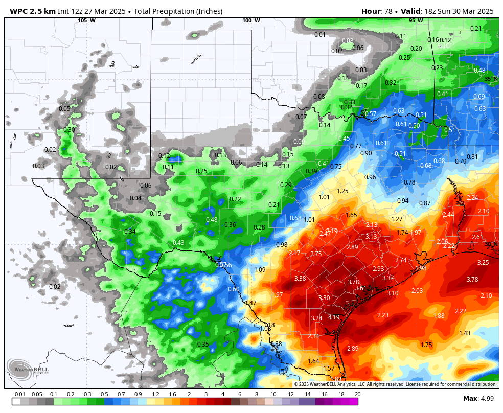
For a few days now we’ve been discussing the impending arrival of a disturbance in the upper atmosphere, and its potential to drop buckets of rainfall over the region. There has been a see-saw battle between global and regional weather models. Now that the rains have finally begun, the contours of this system and its impacts are finally coming into focus. Essentially, instead of seeing mostly heavy rainfall in the Houston region, we are likely to see mostly light to moderate showers over the next two days.
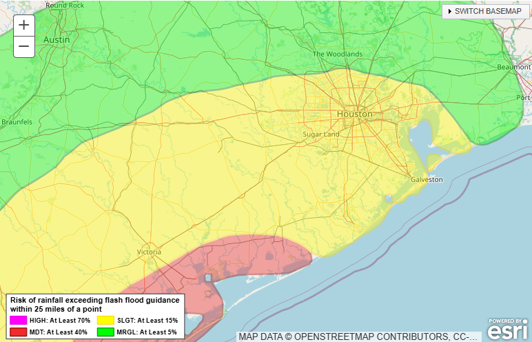
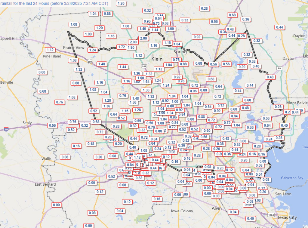
The one exception to this is locations southwest of the Houston metro area, including Jackson, Matagorda,
Wharton, and Colorado counties that have already received 1 inch of rainfall. Some locations within these counties may eventually pick up 4 to 6 inches of rainfall with higher totals. This is certainly enough to cause some street flooding issues. So areas southwest of Houston could get soggy. But as for Houston itself, we are probably looking at rain accumulations of 0.5 to 2 inches between now and Friday night.
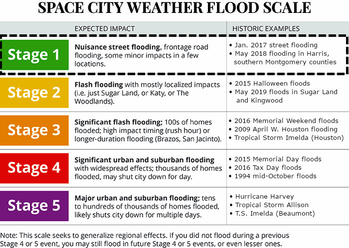
I am going to leave the Stage 1 flood alert in place for areas south of Interstate 10 out of an abundance of caution, because at this time there should not be significant flooding or mobility disruptions in Houston and its suburbs.
Thursday
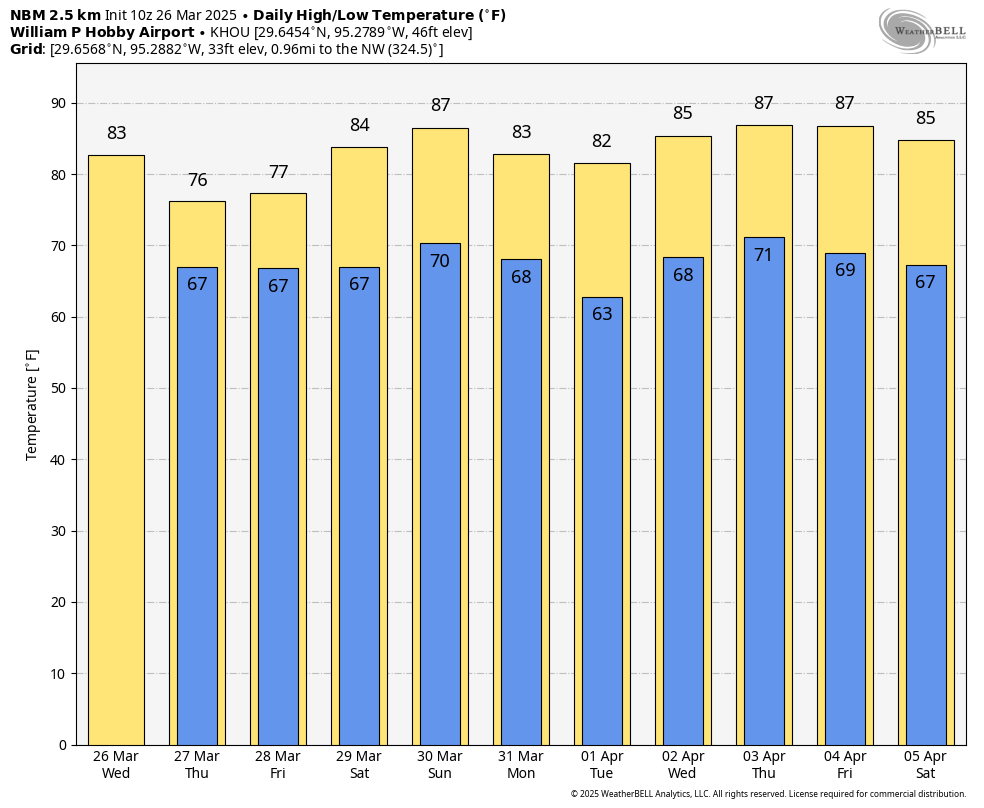
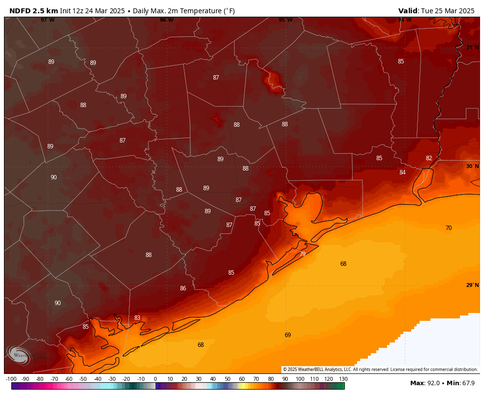
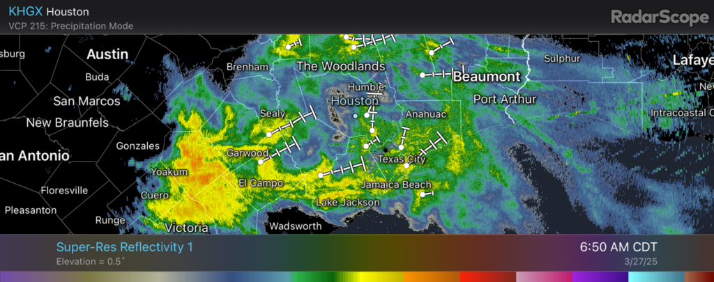
We are seeing light to moderate showers moving in from the southwest this morning, and these should be fairly persistent for much of the day. Expect on-and-off rain, with overall mostly light accumulations. Certainly there could be a few isolated thunderstorms with some heavier rain, but I don’t expect widespread issues. With cloudy skies, high temperatures today are likely to peak in the mid-70s with easterly winds of about 10 mph and higher gusts. There may be a lull in the rain this evening (or not) before more widespread showers return after midnight.
Friday
I expect Friday to be similar. If there is a time when we may see more dynamic weather, including heavier rain, it probably will come on Friday afternoon or during the early evening hours. I don’t have great confidence yet, but it’s possible that some sort of line of storms will push through the area from west to east during the evening commute, and disrupt the start to the weekend. We’ll keep an eye on that. Some rain chances will linger Friday night but generally, by Saturday morning, the upper-level system will have moved on.
Saturday and Sunday
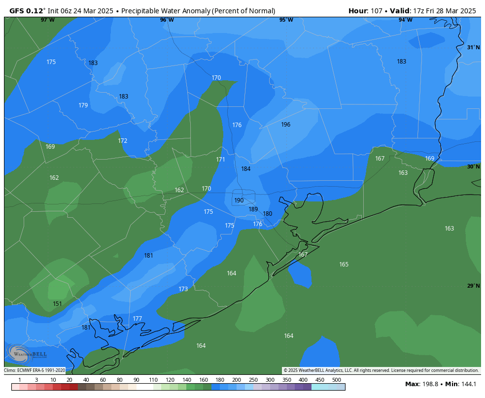
The weekend should see partly sunny and warmer skies. Look for highs in the mid-80s on both days, and sultry springtime lows only dropping to around 70 degrees. With dewpoints in the upper 60s, it will definitely feel pretty humid after winter in Houston. It’s good for the skin, I guess.
Next week
Most of next week should see additional warm and humid weather with highs generally in the mid- to upper-80s and warm nights. We may briefly see some drier air on Monday night and Tuesday with a weak front, but it will not be much to write home about. Some kind of front may push through next weekend to bring cooler weather by Sunday or Monday, but since that’s 10 days out our overall confidence is fairly low.