Good morning. How pleasant it is to wake up to a clear radar and partly sunny skies!
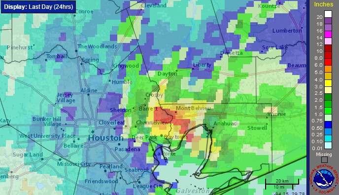
Low pressure is moving away from the upper Texas coast, and as a result so the likelihood of organized storm activity is fading. And thank goodness. I’ll have a more comprehensive wrap-up on Monday, but even yesterday, when most areas saw less rain, parts of the eastern Houston metro area near Mont Belvieu saw in excess of 10 inches of rain in six hours. This was a nasty system and I’m glad to see it go.
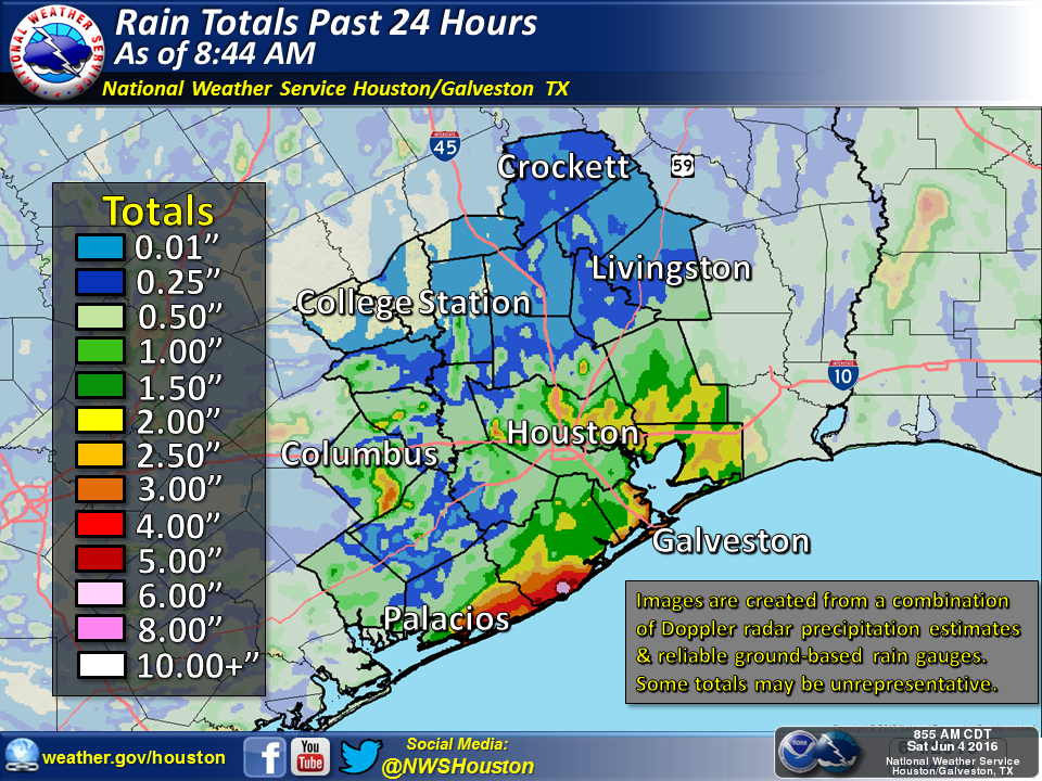
Rain totals from early Saturday morning to early Sunday morning. (NOAA)
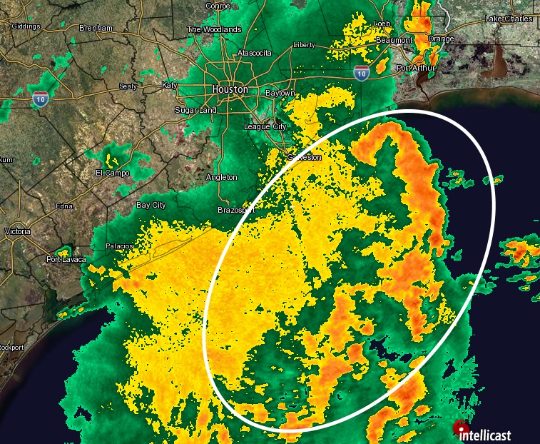
As the upper-level low pressure system has slowly moved south-southeast during the last 24 hours we’ve seen the focus of the heaviest rains move closer to the Texas coast and offshore. This is borne out both in the radar image this morning, and 24-hour rain totals.
Only light to moderate rain is falling inland this morning, at 9:30am CT. (Intellicast)
When we look at total rain accumulations during the 24 hours preceding 9am CT on Saturday morning we can see, too, that the heaviest rains shifted from north of Houston to closer to the coast, and east of the area.
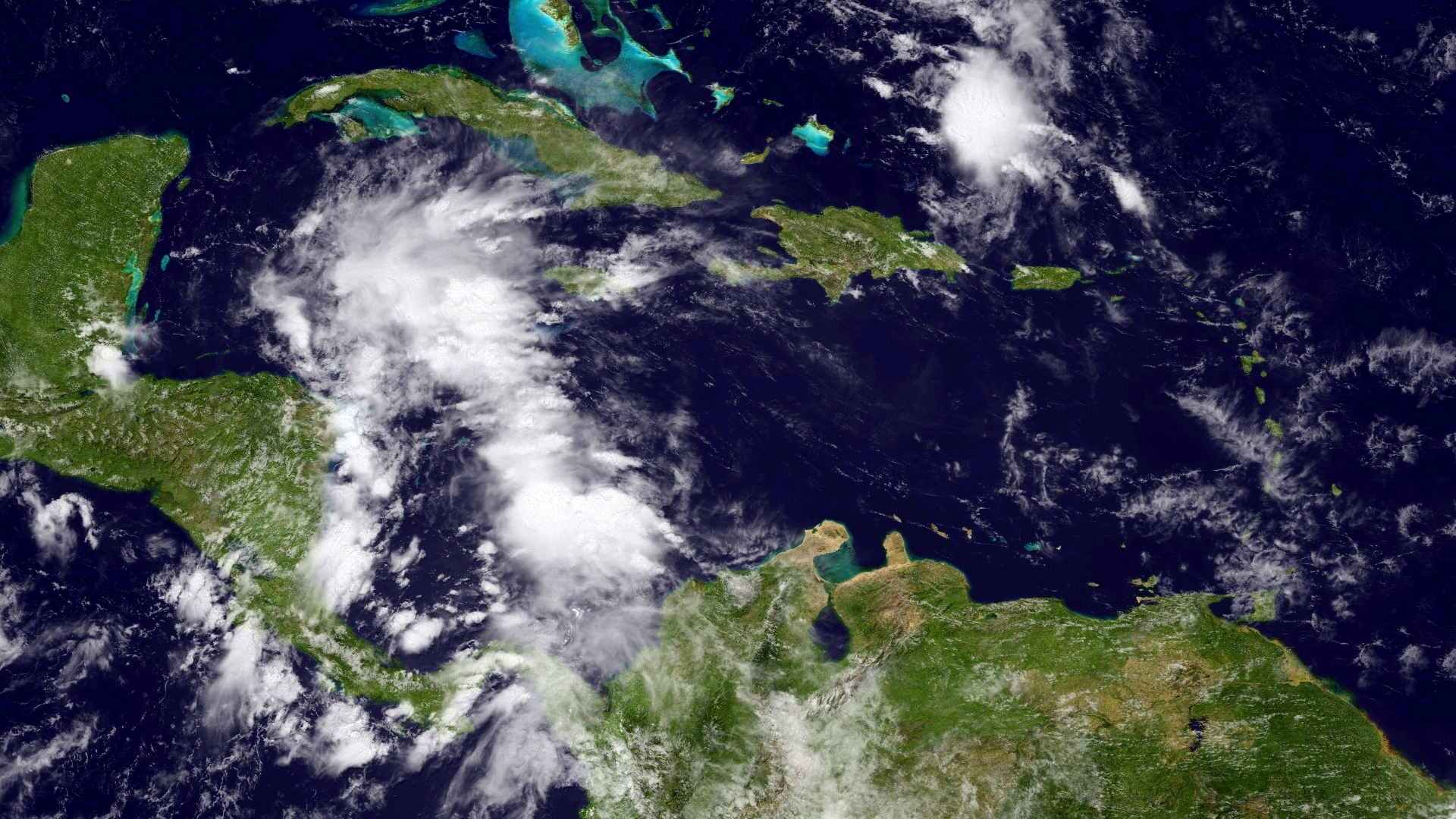
During the last couple of days there’s been a fair amount of hype about the potential for a tropical depression, or storm, to develop in the Gulf of Mexico. As of this afternoon the National Hurricane Center predicts there is a 60 percent chance an area of low pressure near the Yucatan Peninsula does just that.
Oh, hi, tropical system in the western Caribbean Sea. (NOAA)
We have not focused on this system for two simple reasons. First of all, Houston has been dealing with its own super soaker for the last several days, quite apart from this tropical system. Secondly, regardless of whether it develops, this mess is moving toward Florida and will have little to no effect on Texas weather.
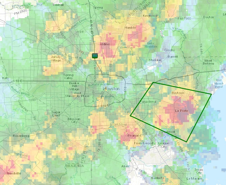
The greater Houston radar remains a mess this evening as a slow-moving low pressure system in the upper levels of the atmosphere has continued to pull moisture inland, from the Gulf of Mexico. For now the heaviest rains have established themselves in southeastern Harris County.
Several roads in the Pasadena/La Porte/Baytown area have flooded with in excess of 4 inches of rain falling during the last three hours, and the National Weather Service has issued a flash flood warning until 9:15pm CT.
Area of flash flood warning now in effect until 9:15pm CT. (National Weather Service)
Being honest, there remains a lot of moisture in the atmosphere tonight, and I expect we’re going to continue to see at least scattered if not widespread thunderstorm development during the rest of the evening and overnight hours. However if I had to guess about tonight, I’d speculate that more of the activity will develop to the east of Interstate 45, than to the west. But confidence is low.
Regardless, tomorrow looks like another potentially very wet day for much of the metro area, and now that southeast parts of the region are getting hammered pretty much everywhere is totally waterlogged. Not a good position to be in with more rain on the way.