Houston faces a significant rain threat later today and during the overnight hours, and the recent forecast model trends are concerning. I think there are two main threats we must consider: the potential for severe weather, and, separately, very heavy rains.
SEVERE STORMS
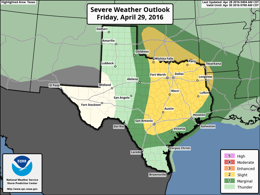
Much of the Houston region falls into the “slight” risk of severe weather for tonight from NOAA’s Storm Prediction Center. I believe this may undersell the risk a little bit.
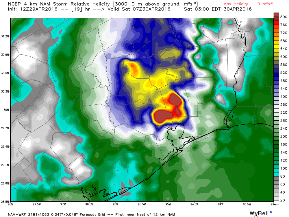
One of the variables forecasters look at when trying to gauge the possibility of severe weather is helicity, which is essentially a measurement of rotation in the upward drafts of a storm system. The greater this value, the higher the threat of tornadoes and damaging winds.
For example, the latest run of the NAM model shows some very high helicity values over much of the northern and northeastern part of the Houston metro area for late tonight. Note that values above 400 allow for the possibility of tornado formation.