In brief: Today’s post discusses the strong cold front in the cards less than a week from today, as well as what to expect before then. We also take a peek at the tropics, where a major hurricane could form in the Caribbean. It’s no threat to Texas, but even so, it’s mid-November. And finally, we’re launching our annual fundraiser. Buy merch! Support us!
Launch of annual fundraiser
This is a big morning for us, as we’re launching our annual fundraiser. I don’t like to ask for money, but it costs a lot to operate a website; develop, update, and support an app; and pay for all of our other activities. And we don’t do this often, just for a few weeks in November each year. This is your opportunity to directly support our hard work, and efforts to provide accurate information, without hype, to the greater Houston region. If you don’t have extra money, please do not feel pressure to give. But if you can help, we’d greatly appreciate it. You’re ensuring our work is freely available to all.
Click here to find how to donate or purchase items to support Space City Weather.

Wednesday
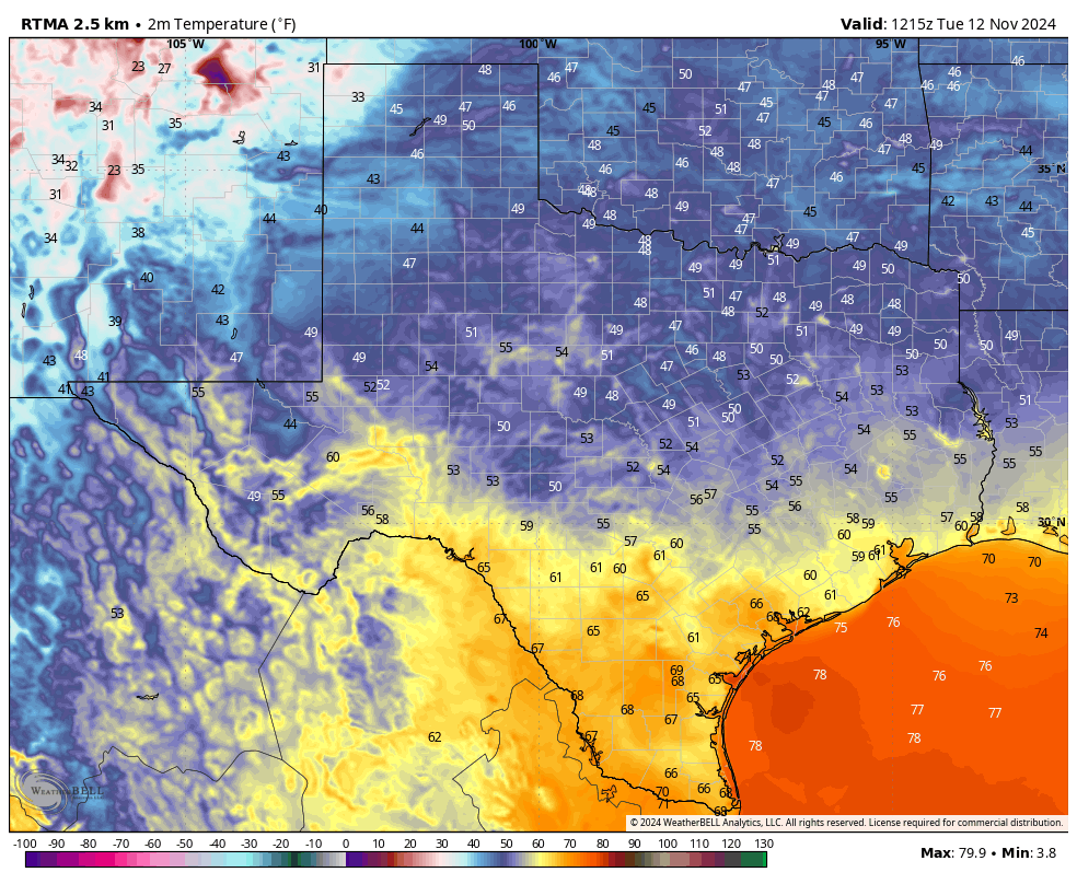
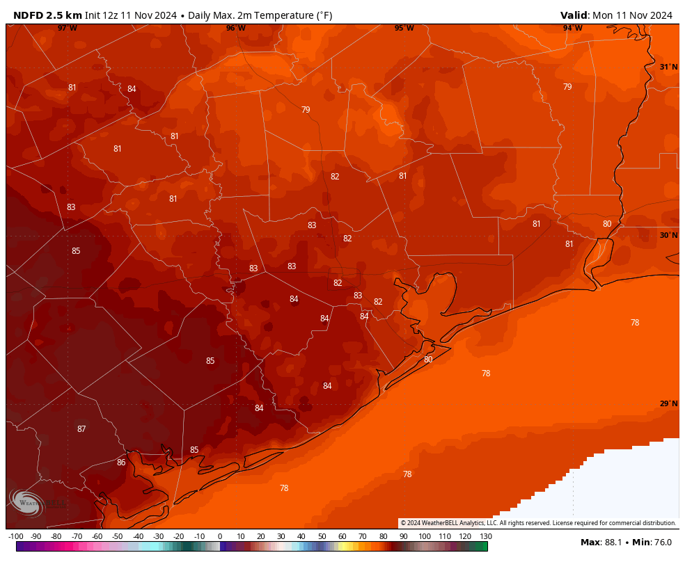
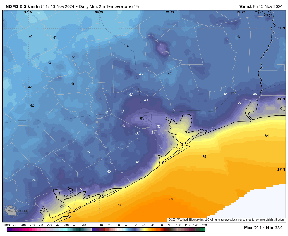
Most of Houston has fallen into the upper 50s or lower 60s this morning. With moderate humidity levels, we will see highs push into the low- to mid-80s this afternoon. Skies will be mostly sunny, with light westerly winds. By this evening we’ll see the arrival of a cool front that will usher in drier air from the northwest. No rain is expected with the front. This will help low temperatures drop into the 50s overnight.
Thursday and Friday
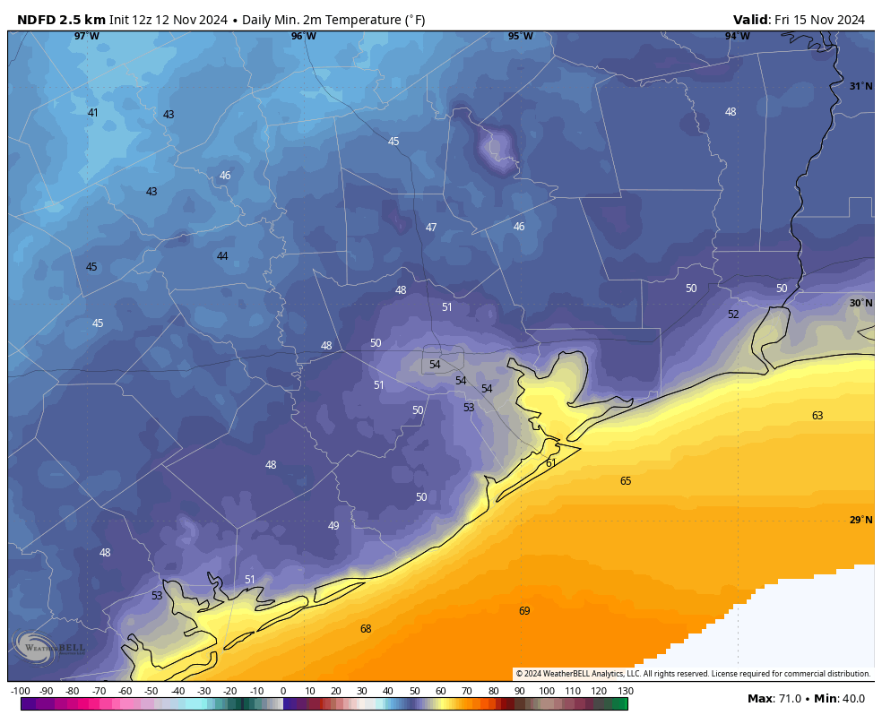
These will be a pair of fine, sunny days with high temperatures in the low- to mid-70s, and sunny skies. With dewpoints in the 40s, it really will not feel humid at all. Lows will bottom out on Thursday night, with temperatures dropping into the upper 40s for outlying areas, and lower 50s in central Houston by Friday morning—so pretty chilly. Friday night is a bit warmer, but temperatures should still drop well into the 50s.
Saturday and Sunday
As the onshore flow resumes we’ll see a few clouds on Saturday, and partly cloudy skies on Sunday. Highs for the first half of the weekend will reach the upper 70s, and top out at about 80 degrees by Sunday. Humidity levels will be on the rise, but not oppressively so. There will still be a bit of a chill in the air on Saturday night, but it will be long gone by Sunday night. A few light showers will be possible by Sunday evening, but I think rain will hold off for the most part until early Monday.
Next week
Monday and Monday night will be warm and muggy, with a pretty good chance of light showers. (Don’t expect much in the way of accumulations beyond a few tenths of an inch of rain). Some time on Tuesday, most likely, a fairly strong fronts will push into Houston. It’s still too early to have details on the precise timing, but all available evidence points to a fairly robust front with a strong northerly flow behind it.
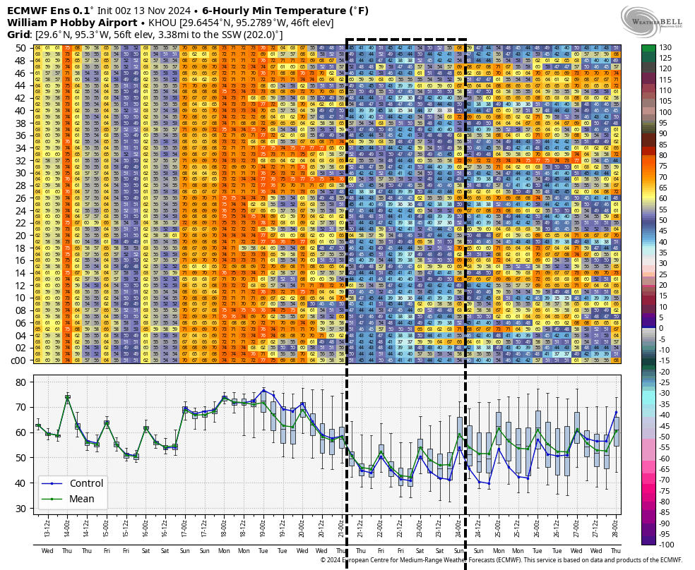
It would not shock me to see a few nights in the 40s during the second half of next week, with daytime highs in the 60s. This really will be sweater weather, and our first real indication this season that winter is around the corner. As a bonus, it seems unlikely that we’re going to bounce back up into the 80s a few days after the front. The overall pattern looks to remain cooler, and more seasonable.
Tropics
I want to be clear: the tropical system developing in the Caribbean Sea is no threat to Texas whatsoever. However it appears increasingly likely that a (relatively rare) November hurricane will develop in the Caribbean Sea this weekend, which is likely to bring significant rainfall to parts of Central America. Much of our modeling guidance suggests it will become a major hurricane.
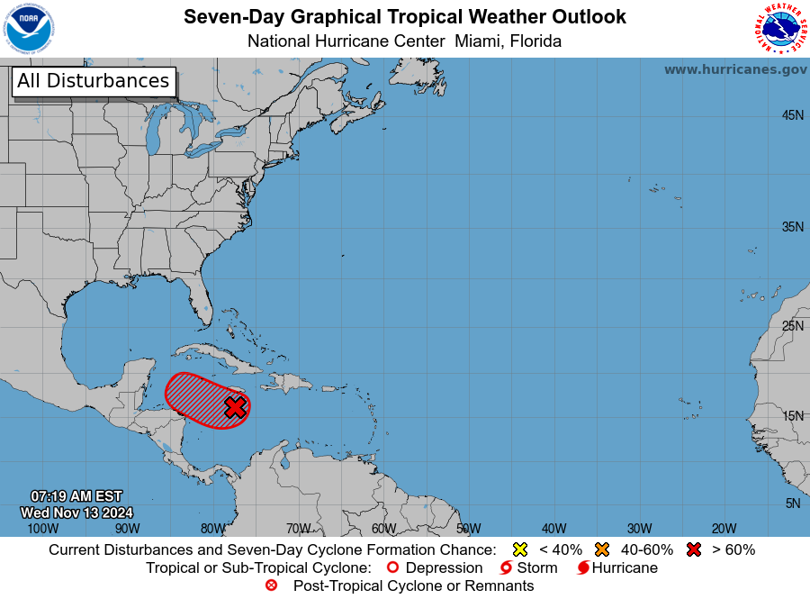
Long term this storm could move into the southern Gulf of Mexico before perhaps turning toward Florida in several days—although there’s plenty of uncertainty about what happens next week. We have a lot of time to watch it, and that’s just what we’re doing on The Eyewall.