In brief: There’s a lot going on in today’s forecast, with the possibility of some storms tonight and Tuesday morning ahead of our region’s next front. Then we’ve got an uncertain weekend forecast and the likelihood of a tropical storm moving into the Gulf of Mexico several days from now. We tackle it all!
Stormy setup
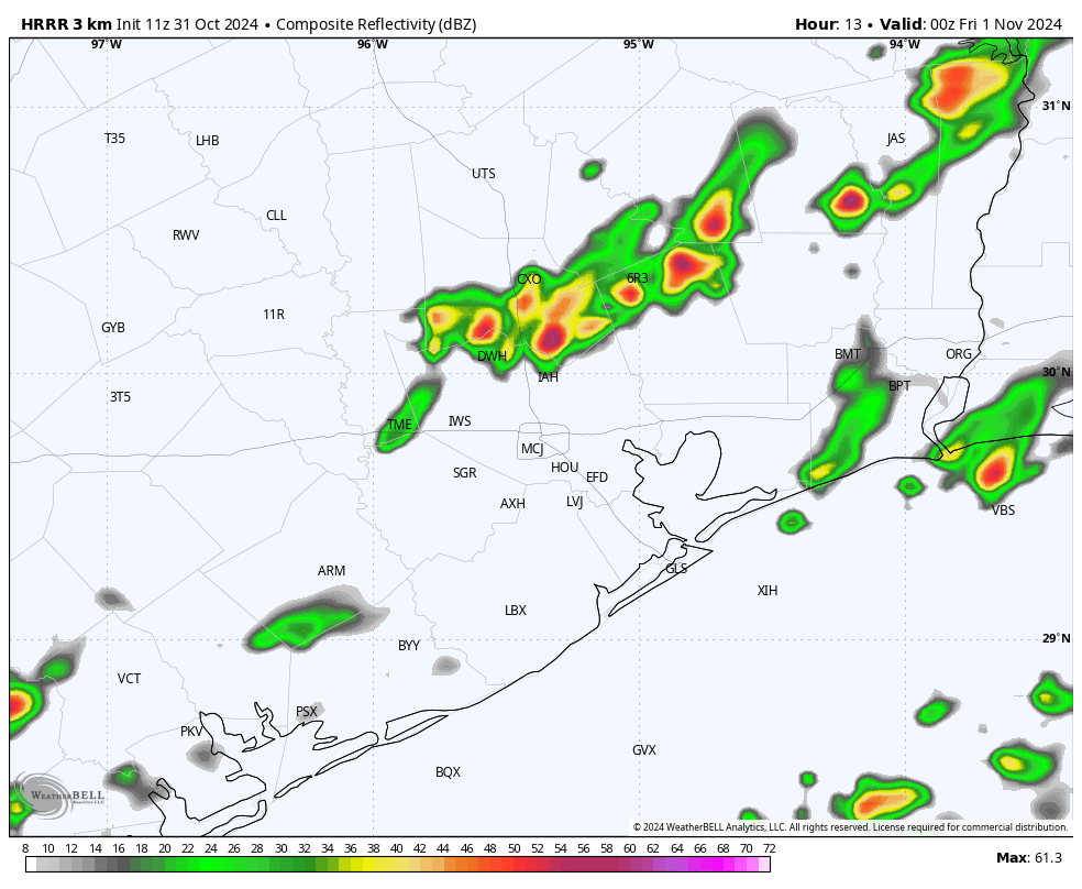
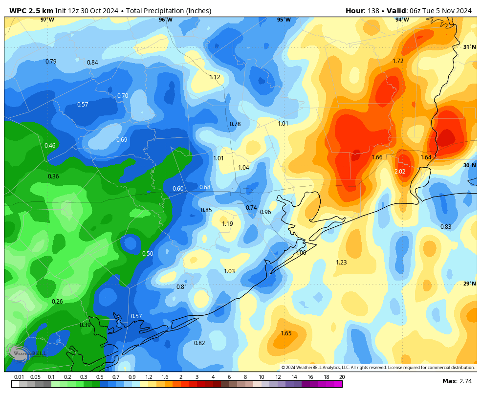
Unlike the previous fronts we’ve experienced this fall, a weak front that remains on track for late tonight should bring a line of showers and storms with it as it passes through Houston. The setup is not perfect, so at this time I would only rate it as a 5 out of 10 on the “excitable dogs scale,” but we could definitely see some thunderstorms and strong winds, along with the slight potential for some hail and possibly a tornado. Conditions for storm formation will be more favorable north of Houston.
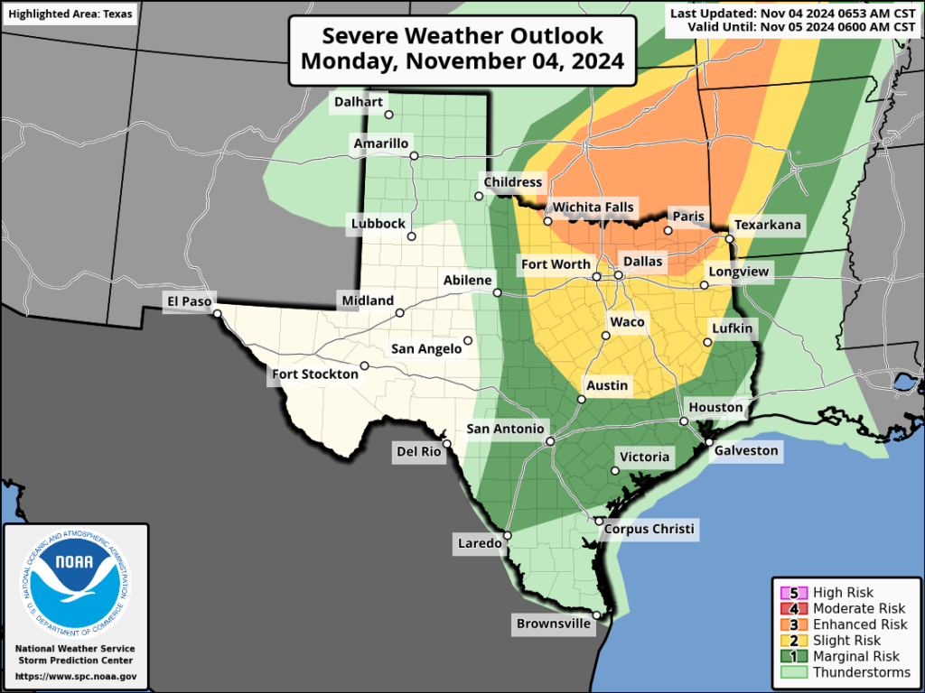
In terms of timing, I’d anticipate the storms will reach College Station roughly around midnight, push into the Katy area and Montgomery County around 2 to 4 am, reach central Houston around 3 to 6 am, and push down to the coast by around 6 to 8 am. Note these times are approximate. While the storms should be ebbing by rush hour on Tuesday, I cannot rule out impacts. Some areas may pick up as much as 2 or 3 inches of rainfall as the storms pass from northwest to southeast.
Monday
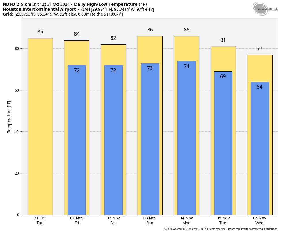
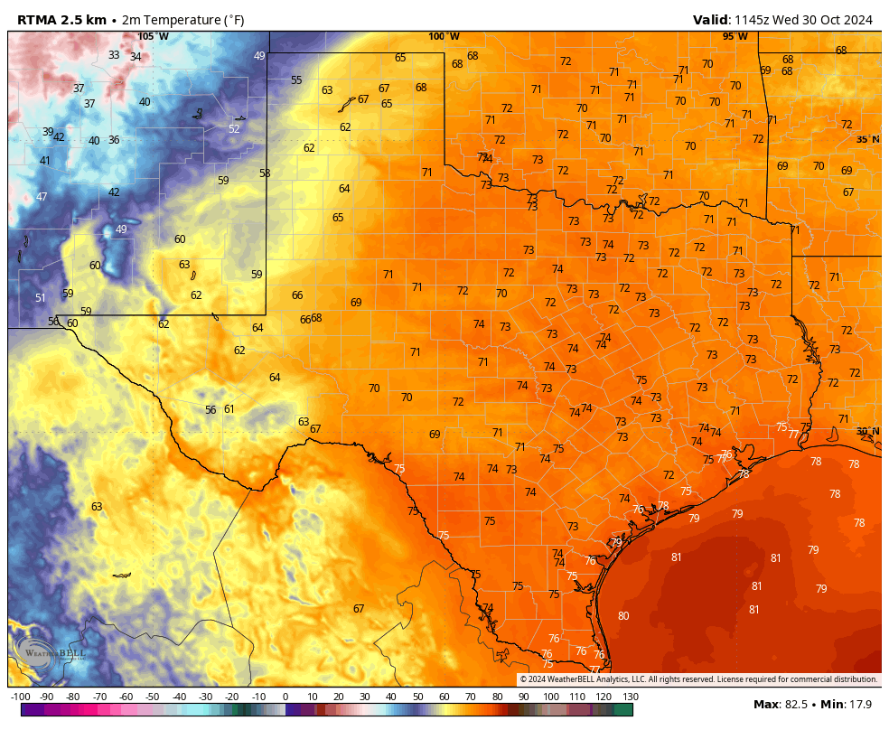
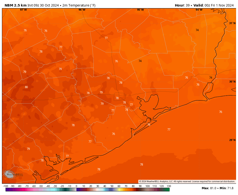
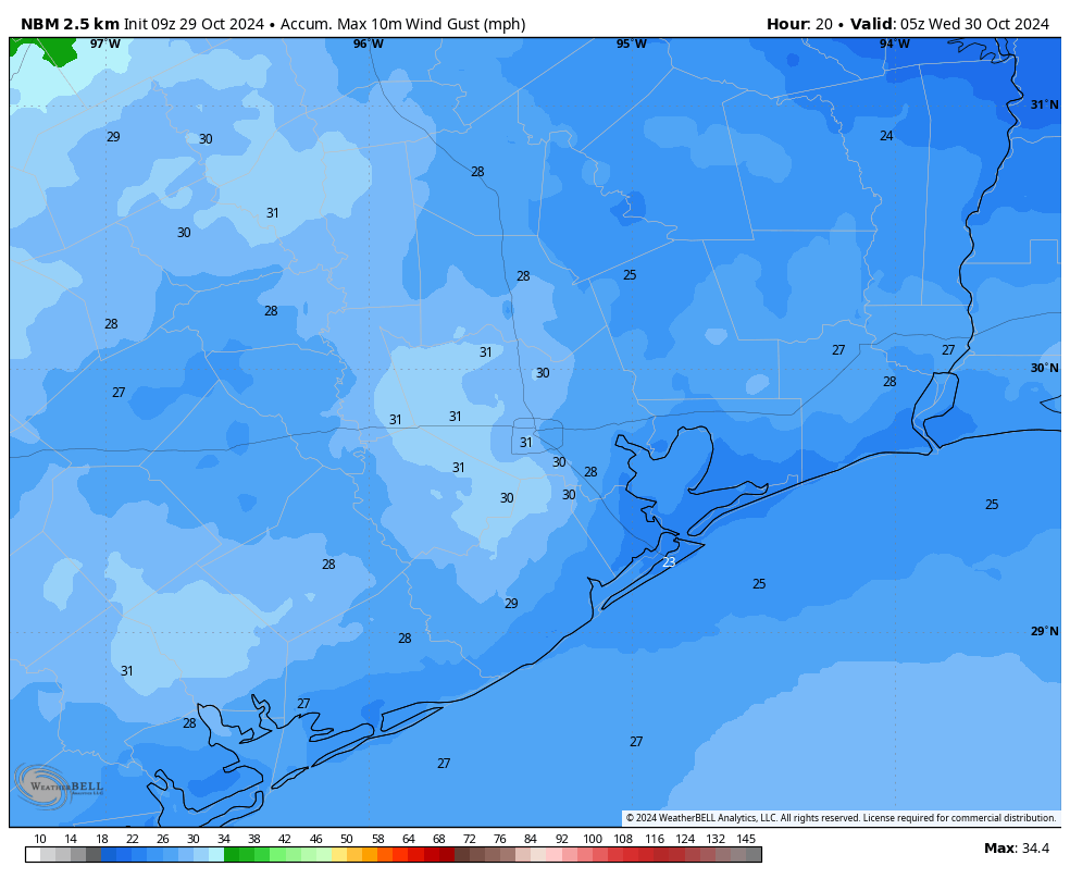
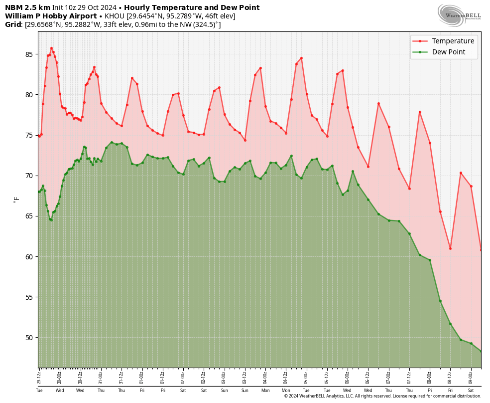
Today, before the front tonight, we’ll see very warm and windy conditions. We’re talking highs in the mid- to upper-80s for most locations, with very high humidity. Winds will be even gustier than we experienced on Sunday, blowing generally from the south at 20 mph with gusts up to 35 mph or perhaps even a bit higher near the coast. There will be the possibility of scattered showers today, much like the region experienced on Sunday. Tonight will be very muggy ahead of the arrival of the front.
Tuesday
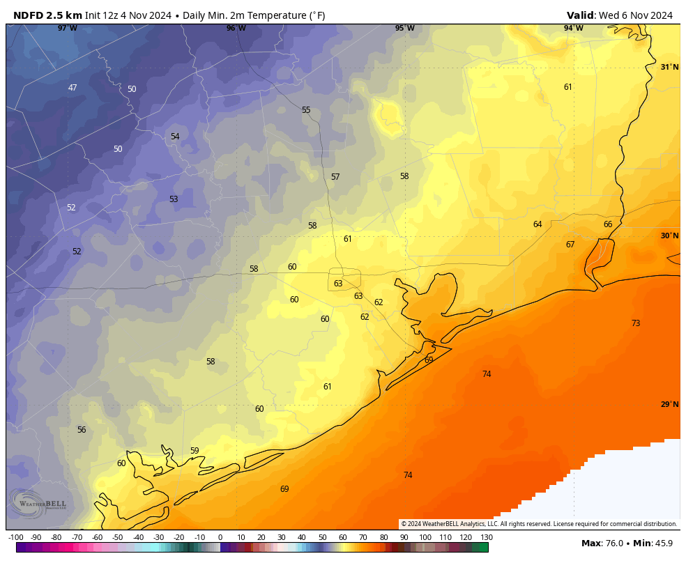
After the front passes we may see some lingering showers on Tuesday, with partly to mostly cloudy skies. Expect daytime temperatures generally in the low- to mid-70s. This is not a particularly strong front, and it will only briefly move offshore, so the period of dry air will probably last from around Tuesday morning through Wednesday morning. Low temperatures on Tuesday night will vary depending on how far you live from the coast, but most of the area should see the upper 50s to lower 60s.
Wednesday
As the front moves back onshore Wednesday, humidity levels will quickly recover during the daytime. Skies will be partly cloudy, with highs in the upper 70s to around 80 degrees. Winds will be light. Rain chances are low, but not non-existent. Low temperatures on Wednesday night will only drop into the lower 70s.
Thursday and Friday
These will be a pair of partly sunny days with highs around 80 degrees, and mild and muggy nights. Rain chances each day will be on the order of 20 percent.
Saturday, Sunday, and beyond
It’s possible that another fairly weak front arrives for this weekend, but I don’t have great confidence in that part of the forecast. In any case, it might be a situation where inland areas see some cooler nights and the coast remains warm and muggy. As a best guess, I’ll predict highs of around 80 degrees with low-ish rain chances for this weekend.
Most of our guidance predicts a stronger, truly fall-like front to arrive sometime during the middle of next week, but that’s far enough into the future that I’m not fully confident in predicting it will happen. But there does appear to be a fairly strong signal for colder weather toward the end of next week. It is November, after all.
Tropics
I cannot believe we’re talking about the tropics in early November, but here we are. The National Hurricane Center has highlighted an area in the Caribbean Sea as a potential tropical cyclone, and if this system develops (which is likely) it will become named Rafael. At first glance, the forecast track might appear to be fairly concerning for Texas, with a tropical storm in the middle of the Gulf of Mexico by this weekend.
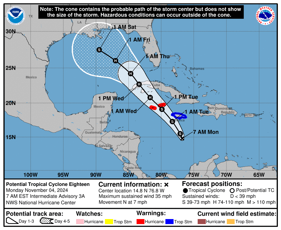
There is a lot of uncertainty over this system’s track over the next week. However, if the storm does make it to the central Gulf, it will find fairly robust wind shear and dry air, which should inhibit strengthening. It would be historically unprecedented to have a tropical storm make it to Texas at this time of year, and much of the modeling guidance keeps the storm away, so it’s doubtful we have much to worry about. My sense is that we may see some higher seas by this weekend offshore, but probably not too many other impacts. Regardless, we’ll be watching closely and keeping you updated.