In brief: Heat and humidity will be a bit worse than usual for August this weekend, and although things ease up just a bit next week, we will remain hot and mostly dry. There may be a shift toward better rain chances next weekend.
Today through next week
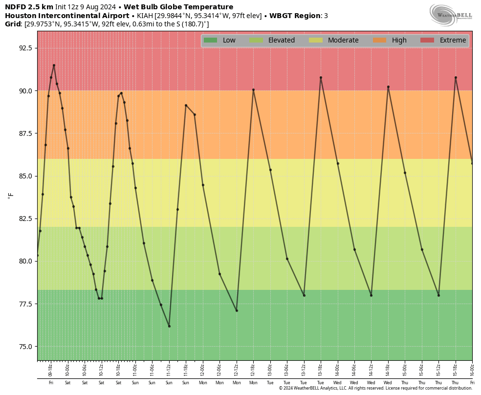
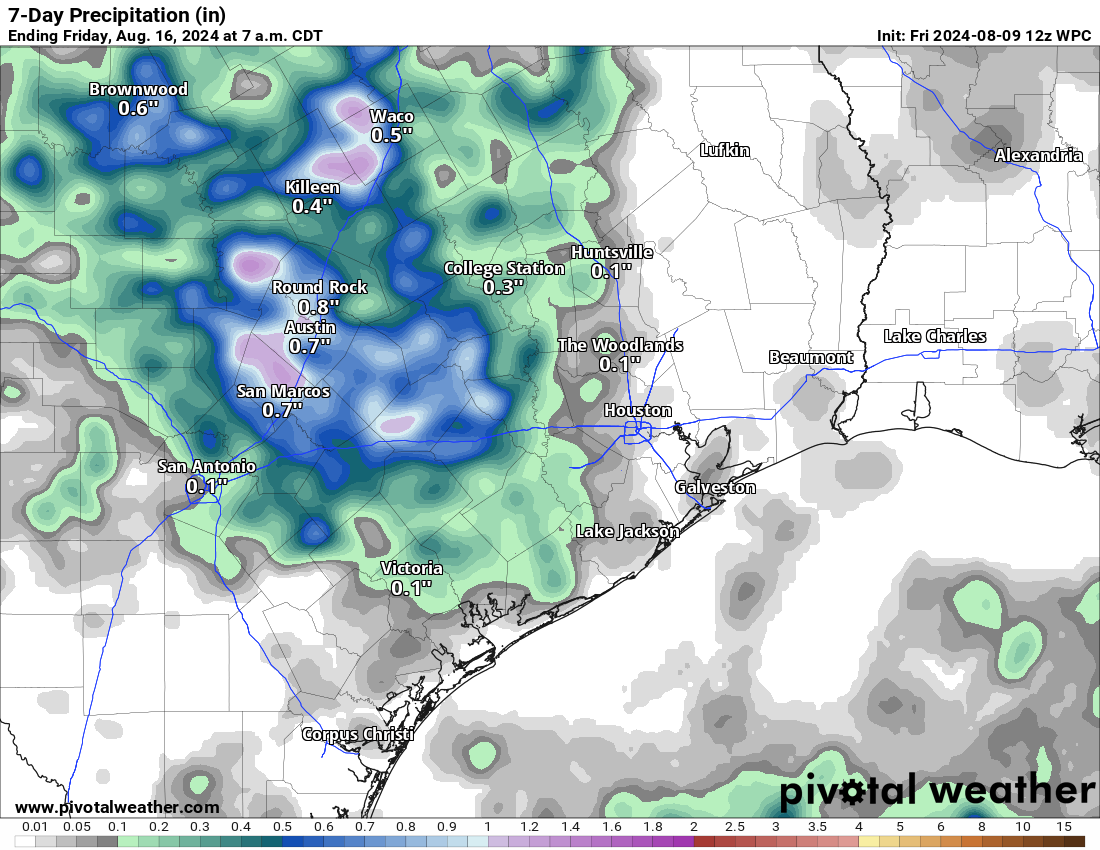
Sunny, hot, humid. Highs in the mid-90s to near 100 degrees. Maybe a rain chance. And you know what? I congratulate my neighbors that have seen showers this week and may luckily see showers into the weekend too. Good for you, I say!
Why is this happening?
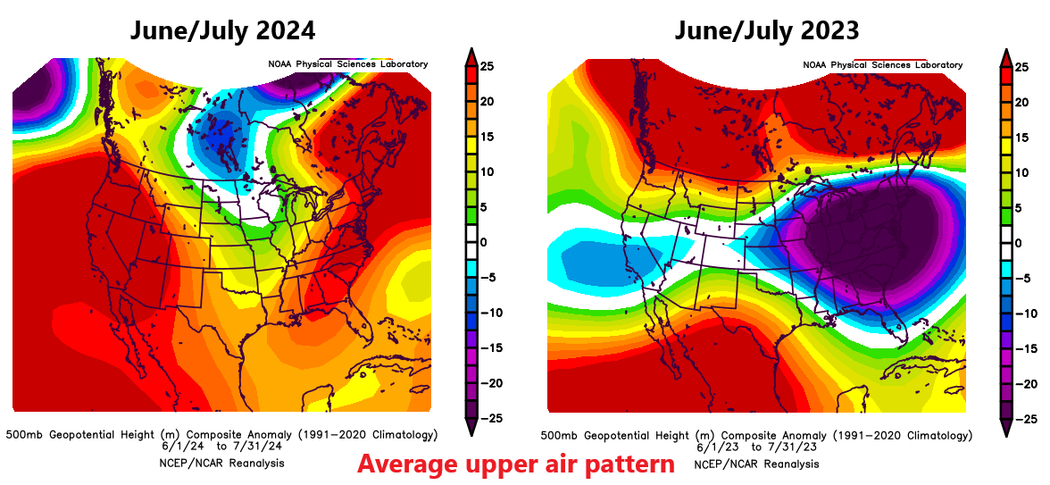
In all seriousness, we all know the forecast at this point, so I figured I’d take a moment to discuss the “why” today. It’s kind of fascinating. Last summer we saw a suppressed, strong ridge of high pressure over Mexico that would continuously flex over Texas. This kept us in the 100s daily and made last summer another level of terrible. This summer? Much different. Texas has been stuck generally between persistent areas of high pressure, one in the East, one in the West. To date, it’s been the hottest summer on record by a mile for Las Vegas and Phoenix. For Atlanta it’s the fourth hottest to date, and for Raleigh, NC it’s the third hottest. For Houston, it’s “only” been the 12th hottest summer and, even less impressive the 24th hottest for our frienemies in Dallas.
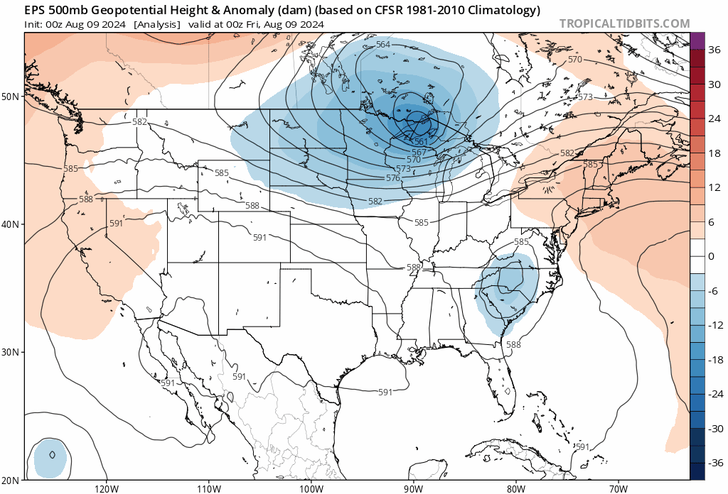
But so far this month, the pattern has changed allowing for the Western ridge to expand into Texas somewhat, which has in turn allowed us to crank the heat. Over the next five days, check out where the ridge of high pressure situates.
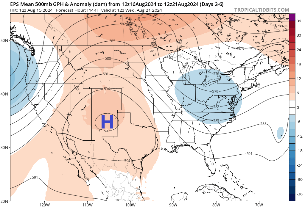
Over the next week it basically sets up shop just to our west, which will keep us firmly under the influence of heat. Unlike last summer, we aren’t directly underneath the high, so we will have some modest rain chances and it won’t be as extreme as was seen last year. But our weather will continue to be controlled by this feature. Odds of above normal temperatures and below normal precipitation will remain strong heading deep into next week. The next few days should be the worst of it for now. We may see a relaxation in this pattern later next week with the ridge retreating a little more to the west leading to slightly better rain chances toward next weekend.
Whatever the case, this coupled with a quiet tropical Atlantic over the next several days (outside of Ernesto) is not necessarily a bad thing for Houston. We’ll take it, but do take it easy with this weekend’s heat.