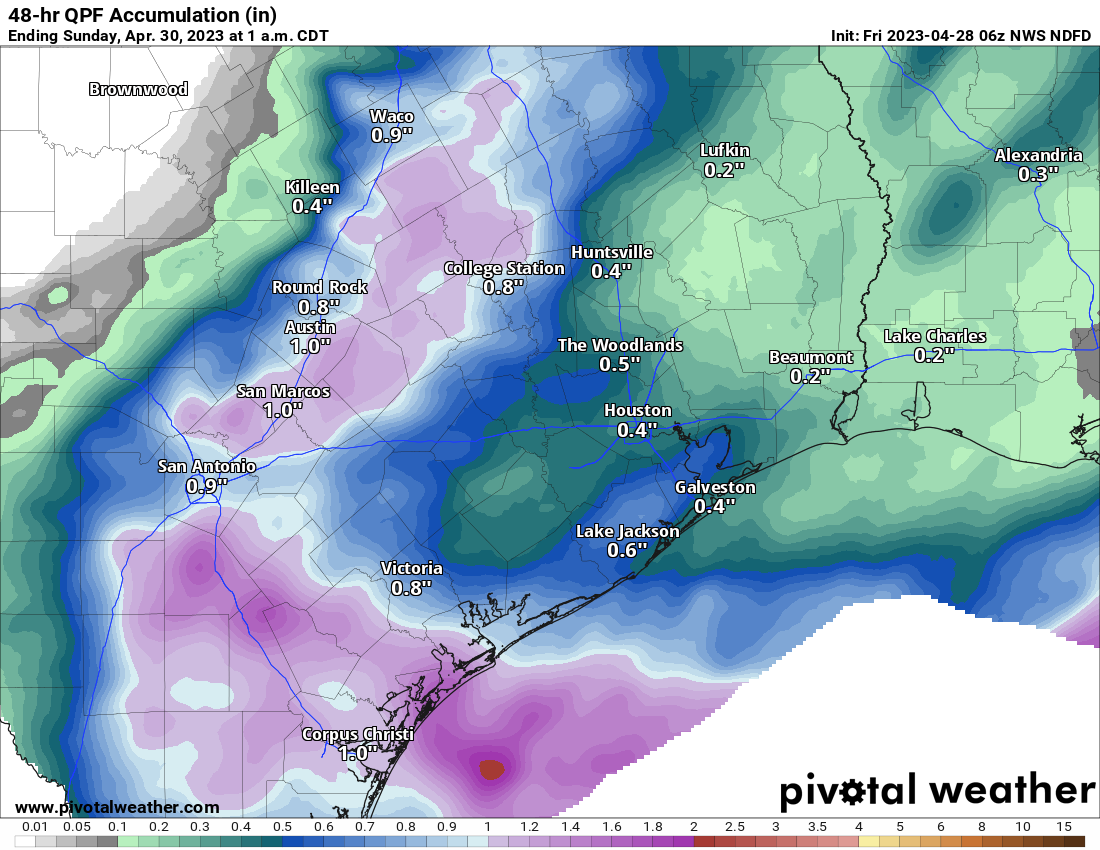
As promised, yesterday ended up being much, much calmer, giving us a chance to exhale and dry out a bit. Things are going to pick back up again as we head into the weekend — but probably not for everyone. We continue to see a pretty healthy split in the weekend outlook, with areas west of Houston more likely to see more rain than the Houston area itself. As a result, the National Weather Service issued a Flood Watch for areas southwest of Houston for the weekend.
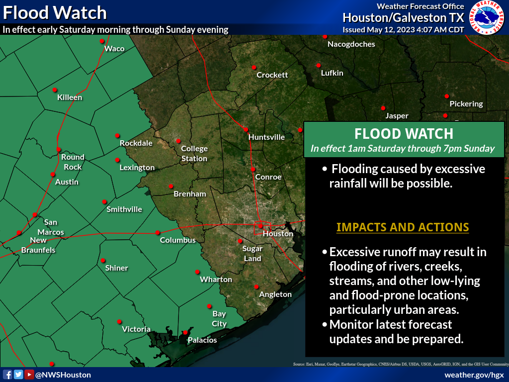
Those areas under the flood watch are the most likely areas to see multiple rounds of heavier rain this weekend. Areas not under a flood watch (which is most of Houston) are likely to see at least some showers this weekend, including the risk of some heavy rain. But it would most likely be manageable. That said, Eric and I will be monitoring the weather this weekend, and we’ll post an update or two if necessary or if things change, which I would caution is possible.
Today
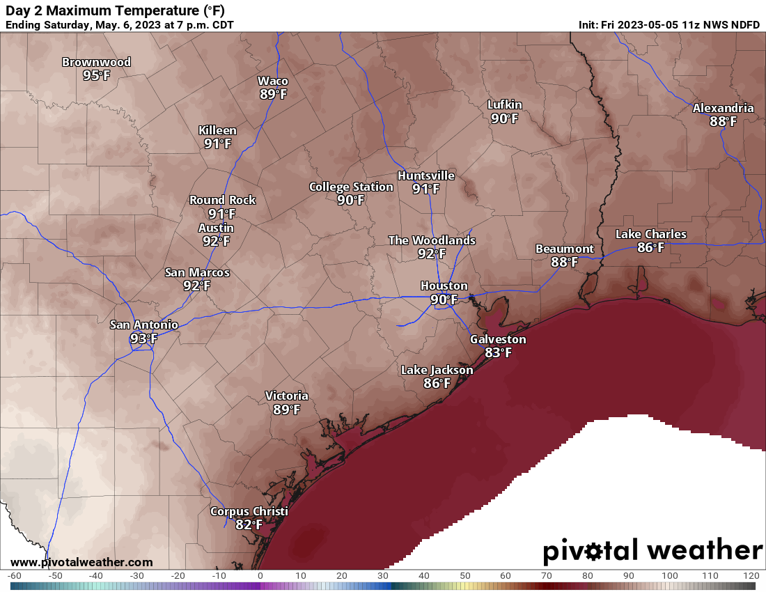
Of the next several days, today looks calmest. Yes, there will probably be at least a few showers or storms around this afternoon in parts of the area. But those will probably be the exception, not the rule. Look for a good deal of clouds this morning, yielding to sunshine with highs well into the 80s, if not near 90 degrees.
Saturday & Sunday
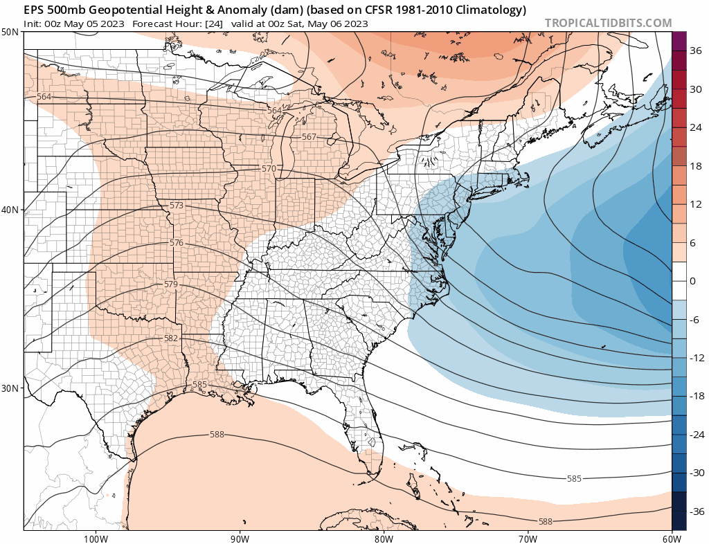
I wanted to split these days up in the forecast to try and give you a better idea of what to expect each day, but the pattern over the state of Texas this weekend is far too chaotic for me to try and time anything out specifically.
Here’s the deal: If you have outdoor plans this weekend, have a backup plan indoors if needed. If your plans take you west of Houston (Austin, San Antonio, Hill Country, the Valley, you will likely run into thunderstorms at some point, including the chance of heavy rain, severe weather, and flooding. Be aware of what’s happening out that way and do your best to avoid flood prone areas if possible.
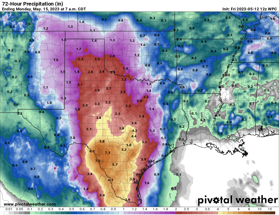
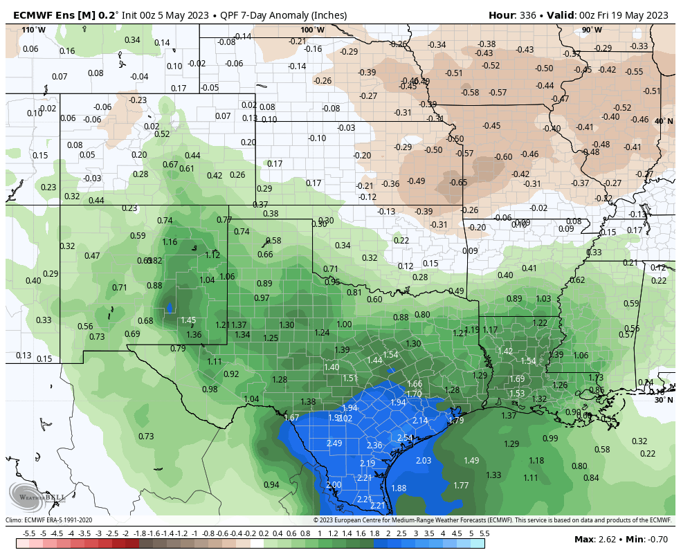
Total rain this weekend across Texas will be highest in the Rio Grande Valley through San Antonio, with high amounts into Hill Country as well. Exactly who sees the most rain is TBD. But these areas need it with widespread drought in west and central Texas.
For us in Houston, while we don’t want to be overconfident, it would appear that Saturday afternoon or evening may carry the highest risk of storms making their way into the metro area. Sunday should, should see slightly lower rain chances for Houston proper and the metro area. Both days will be warm and humid with highs in the mid-80s and lows in the 70s. Outside of any storms, we may see some sunshine. But clouds may be a bit more dominant this weekend.
Early next week
The weather pattern across Texas remains active next week, with scattered showers and storms possible. It may not rain every day, but there will at least be a chance of rain each day. We still look to see a weak “wind shift” front later Monday or Tuesday. Maybe we drop humidity a tick or two, but I wouldn’t expect much more than that. Temperatures will be generally in the mid to upper-80s by day and low-70s by night.
As noted, Eric and I will be watching the weather this weekend and update accordingly, if only to help everyone strategize their weekend plans. In the meantime, to the many moms that read our site, happy Mother’s Day!