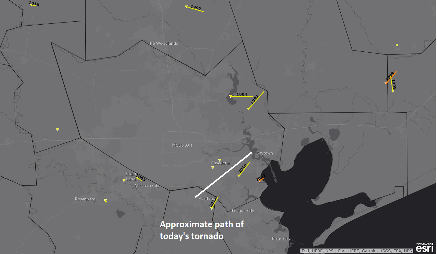
Before we get into the forecast today, we just want to go over some of the news from the National Weather Service office in League City from the last couple days. First off, the tornado that ravaged parts of Pasadena, South Houston, Deer Park, and Baytown was classified as an EF-3.
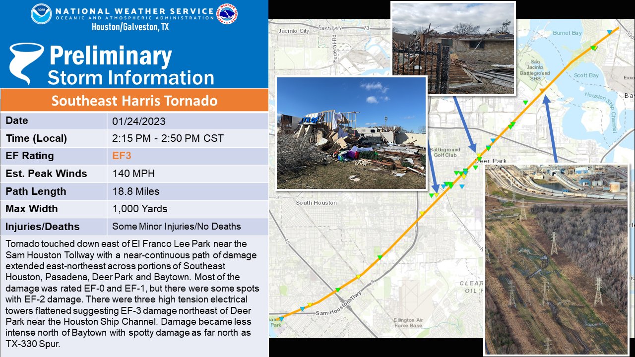
It was the first EF-3 tornado in Harris County since 2002 (La Porte).
Two additional tornadoes have also been confirmed in the Houston area. Both were rated EF-0. One traveled about 14.5 miles from Needville through Thompsons in Fort Bend County. The other occurred in Pearland, preceding the South Houston tornado and was on the ground for a bit over 2 miles.
In Liberty County, an EF-2 tornado has been confirmed, but details are not expected on that until a little later today.
The last couple days have been mercifully placid, and we look to get one more of those before some more rain.
Today
Friday should be a mostly fine day, with intervals of sun and clouds and temperatures popping up to near 60 degrees.
Tomorrow
Clouds will really increase and thicken up tonight into Saturday. By late tonight and early Saturday morning, a few showers should begin to break out, along with periods of drizzle or light rain. We don’t currently expect Saturday to be a washout, but you’ll probably see a few raindrops in much of the area. The clouds and showers will compete with warm air flowing in from the Gulf of Mexico, so after a mild morning in the mid or upper-50s, we will likely warm to near 70 degrees. You will also notice the wind picking up some on Saturday afternoon, with gusts to perhaps 25 mph or so.
Sunday
The next in a series of systems will impact us late Saturday evening and Sunday. Look for rain to break out as a coastal low develops. This system will lack much of what Tuesday’s had for significant severe weather. We do not expect serious severe weather, but a few stronger thunderstorms are possible. That said, we have plentiful moisture available Sunday, and we will be looking for the potential of locally heavy downpours, especially in the morning. This would be most likely south of I-10.

Right now, the Weather Prediction Center has the region in a slight (level 2/4) risk of excessive rainfall. We don’t expect rain quite of the intensity we saw on Tuesday, but given the wet ground, we could see some areas of ponding or street flooding emerge Sunday morning under the heaviest rain. In addition, water levels on creeks are still high in parts of the area, especially north and west of Houston, so any heavy rainfall will likely exacerbate that a bit. Expect an inch or two on average southeast of Houston, with lesser amounts as you go north and west of the city.
Conditions should gradually improve later Sunday afternoon and evening. We will top off in the 70s.
Early next week
Early next week looks dominated by this front that gets hung up over our area on Sunday. That will likely be in place through Wednesday. The problem from a forecaster’s perspective is that it’s going to wobble around. That means that there’s probably going to be a pretty annoying gradient of temperatures over the region next week, with readings ranging from the 50s to the 70s depending on the exact position of the front. In addition, rainfall will be possible through the entire period, although it looks mostly minor in nature until later Wednesday or Thursday. We should have a little more clarity on the exact daily details Sunday or Monday.
Next front
Our next real front of significance after Sunday will come on Thursday it appears. Expect a period of showers and storms, along with some locally heavy rain. This should usher in a slightly less active pattern and a chilly air mass in time for next weekend. We do not expect a significant freeze at this point, however. We’ll update you on that Monday (or Sunday!) as well.