Summertime heat kicks up a notch this weekend

While it hasn’t exactly been chilly this summer, at least July has been running a couple degrees below average for Houston. We’re now set to, in the words of Emeril Lagasse, “kick it up a notch” this weekend. Let’s rock and roll.

We’re gonna add some cayenne pepper to the thermometer to spice things up a bit this weekend

Today

High pressure is going to begin to exert its will on southeast Texas today. The amount of moisture in the atmosphere is going to drop precipitously, allowing for a reduction in rain chances this afternoon. The faucet isn’t going to shut off completely, but it’s likely going to scale back to a slow drip. Call it maybe 20 percent coverage of rain this afternoon. And that may even be generous.

More importantly, the heat is going to ramp up. We topped out at 93° at both Bush & Hobby Airports yesterday. Look for about 95-96° today officially, with a few places hotter and coastal areas a little less hot but quite humid.

Heat index values this afternoon at 1 PM are expected to be 105-110° in most spots. Please take it easy the next few afternoons as this type of heat will remain with us. (Weather Bell)

With the humidity, it’s likely to feel like 105 to 110° at times, which is right about when Heat Advisories should be issued by the National Weather Service. So, don’t be shocked to see at least a couple of those in the days ahead. It may turn a bit hazy as the day goes on and a cloud of Saharan dust arrives from the Gulf, but that will be more noticeable tomorrow I think. High summer’s here folks.

Weekend

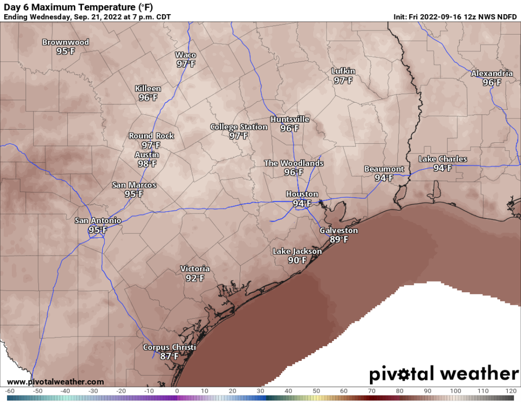
This weekend should feature similar weather on both Saturday and Sunday. I’d expect highs to be 96 to 98° officially, with a few places possibly coming in near 100° and coastal locales in the lower 90s. Lows will likely be in the 70s to low 80s. Heat index values each afternoon will again likely exceed 105° in many spots. Rain chances are about as close to zero as it gets for this time of year.

Saharan dust (in purple/pink above) will settle over Texas for much of the weekend, probably peaking on Saturday afternoon as shown above. (NASA via Weather Bell)

You will notice a good bit of Saharan dust in the air this weekend from that dust cloud overhead. I think Saturday may look more acrid than Sunday. Either way, those of you with respiratory sensitivity to dust events should be ready for some discomfort this weekend. Sunrises and sunsets may be a bit more alluring than usual at least.

Next week

Yesterday, Eric wondered if I might be able to provide some clarity on next week’s rain chances. I can’t tell you too much new, but based on what I see in the weather models, I suspect we’ll see another hot, mostly dry day Monday, followed by a slightly less hot, slightly less dry Tuesday. On Tuesday, Wednesday, and Thursday, the center of the ridge shifts back into Colorado, which should be enough to open the Gulf back up for daytime, sea breeze-driven thunderstorms.

In the upper atmosphere, high pressure is expected to drift southeast from Colorado/Nebraska into Oklahoma between next Wednesday and Sunday. That should mean a slight drop in rain chances (not zero) toward next weekend, with slightly hotter temperatures again. (Weather Bell)

By later Thursday and into next weekend, it appears that the ridge will actually slide back southeast again toward Texas, which means we might recycle hotter, drier weather for several days late next week and into the weekend. I don’t think it will be quite like this weekend, but it may not be too far off.

Tropics

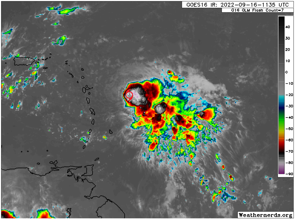
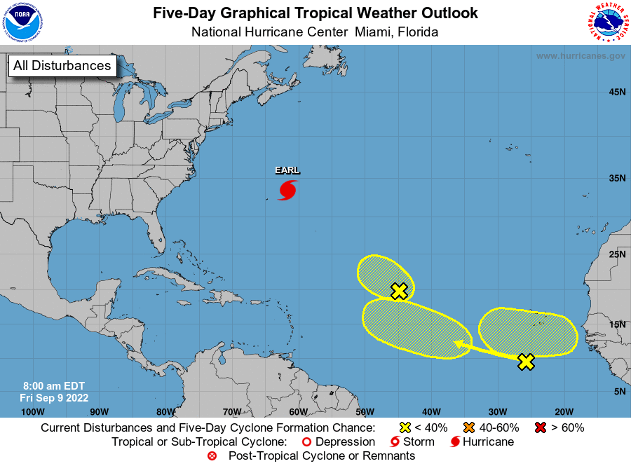
The National Hurricane Center is highlighting a disturbance that is emerging off the Southeast coast today. It has a low chance of possibly developing over the weekend, but at this time it is not expected to turn west into the Gulf.

Rain mostly offshore this morning, but a couple more days of storms around Houston

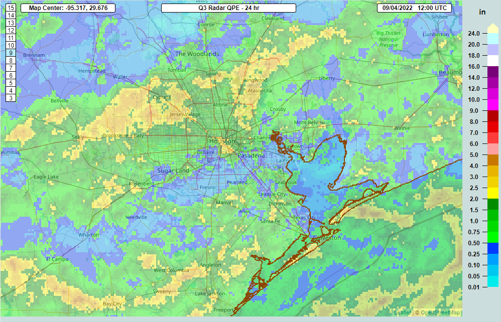
We’ve had quite a 12 hours of storms across the region, particularly from just north of I-10 south to the coast, with some impressive lightning and heavy rainfall. The highest 24 hour total I can find on the Harris County Food Control website is just a hair over 3 inches of rain near Dickinson. Radar estimated rainfall from the last 24 hours is shown here.

Rainfall estimates on radar since yesterday show that areas south and east of Houston hit the jackpot. (NOAA)

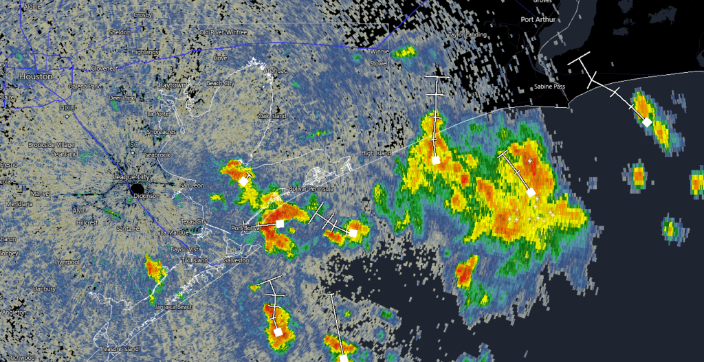
This morning’s radar snapshot below shows the bulk of the rainfall hugging the immediate coast, with the heaviest mostly offshore at this time.

The heaviest rain is mostly offshore now, with the exception of the Matagorda Bay area, where heavy rain was between Freeport and Palacios just after 6 AM (NOAA)

So, what’s next?

Today

Often, when we see this sort of cluster of rain offshore, it helps to cut off moisture inflow from the Gulf of Mexico. In other words, significant moisture is involved with the offshore rain, and it could help reduce rain chances on land a bit, especially the first half of today. That doesn’t mean it will be totally dry, but showers should be very isolated this morning for the most part.

As the day wears on and daytime heating takes over and presumably we see offshore rains weaken a bit, look for a few more storms over Houston and other inland locations. But today’s rain and storms will probably be more hit and miss than widespread, and odds may favor you avoiding rain. We’ll see how that goes. As someone flying to Houston in just a bit, I am okay with this.

Other than rain chances, expect clouds and sun. Highs will probably approach 90 degrees.

Wednesday and Thursday

Look for afternoon showers and thunderstorms, driven mostly by daytime heating and the sea breeze for the middle of the week. Not everyone will see storms, but those that do could easily see an inch or two of rain between both days. The overall pattern will stay pretty unsettled on both days, but it’s tough to get too cute with details today. We will know more tomorrow morning. Highs should be in the upper-80s with lows in the 70s.

Friday and weekend

The storm system in the upper atmosphere that will help the midweek period be so unsettled will continue working back to the west Friday, into West Texas. By Sunday, it ends up in Arizona (good news for the drought plagued West), so things should begin to really settle down around here this weekend. With more sun, that means more heat, and high temperatures should go from the low to mid-90s to mid to upper-90s as the weekend progresses. Rain chances are never zero in summer here, but they look to be quite low. We’re coming up on our hottest time of the year, so this isn’t too surprising. But still, be ready.

In addition to all that, it’s likely we’ll be seeing another blast of Saharan dust this weekend.

Saharan dust (purple) is going to blast ashore in Texas this weekend, coinciding with high heat. (NASA via Weather Bell)

It’s going to look, feel, and taste like high summer around Southeast Texas.

There are signs this very hot, drier weather will continue well into next week. If you’ve managed to keep the sprinklers off most of this summer, that may change next week.

Due to travel and work for both Eric and myself, we’ll be foregoing our tropical post today, but there’s honestly not much to discuss right now. The tropics remain quiet, and that should continue for at least another week or so. Things may change heading into August, as they often do, but for now we have nothing in particular to discuss. We will let you know when that changes.

Eye on the Tropics: Quiet for a bit

After a frenetic start to the 2021 Atlantic hurricane season, we’re settling down into a bit of a quiet period, and I am sure no one is complaining. Last week saw Elsa, which was the earliest “E” storm on record. We’ve already fallen off 2020’s insane pace however, as Fay formed on July 9th last year. Gonzalo did not form until the 22nd of July, indicating that we had a bit of a lull last year too.

Tropical outlook in a sentence

The next 7 to 10 days are not currently expected to produce any organized tropical systems of note anywhere in the Atlantic Basin.

So what’s next?

I thought I would keep this post fairly brief this week. Looking at satellite across the Atlantic, there just isn’t much happening right now.

The Atlantic basin has a couple minor tropical waves but nothing that will significantly develop. (College of DuPage)

The National Hurricane Center is tagging that one system off the coast of New Jersey for a 10 percent chance of development, but, yeah. Moving on.

In addition to a lack of any beefy tropical waves, the Atlantic basin is choked in dust at the moment. Dust doesn’t prevent tropical systems from forming, but it does indicate the presence of drier air, which usually inhibits storms.

Anywhere you see yellow, orange, or red color, it indicates dust or dry air. The Atlantic is full of it. (University of Wisconsin)

We are basically in peak dust season now, as is typical, so this is not terribly surprising.

On top of all that, if you look out in fantasyland on the GFS or European models and ensembles, you can’t even scrounge up some make-believe activity. Even the usually turbocharged Canadian ensemble only has one or two members showing minimal systems in the Atlantic over the next 2 weeks. So it’s quiet, and model agreement is strong for that. Without going into too much detail here, this is true for good reason: The background environment over the Gulf, Caribbean, and Atlantic is not favorable for tropical development right now or over the next 10-plus days. What is happening in the background is helping to “suppress” thunderstorm development a bit. That doesn’t mean something can’t spin up, but the overall base state of things right now is hostile toward tropical systems, which is good news for all of us.

This may change in the final days of July and first few days of August, so I do expect we’ll have something to talk about when you see this post on July 27th (due to schedules we won’t be posting next Tuesday). But there is no sign of anything right now.

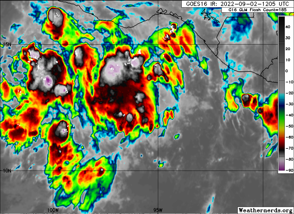
Where activity is busy is in the Eastern Pacific. There are two areas of high probability development over the next 5 days, and there may be more to follow beyond that.

While the Atlantic is quiet, there will likely be a handful of substantial systems in the East Pacific. None are a threat to land for now, and none are expected to reach Hawaii at this time. (Weathernerds.org)

Everything is currently projected to head out into the open ocean, away from Mexico, and not reach Hawaii so that is also good news.

That’ll do it for this week. Hopefully our next tropical post is equally quiet!

Some street flooding possible in spots for the Friday morning commute; drier weather for Houston this weekend

Well, the rains of last night didn’t get going until very late in any organized capacity. So the significant flooding feared last night southwest of Houston never materialized. That’s good news for sure. But that has changed this morning.

This morning

We have a pretty healthy area of rainfall this morning that extends from The Woodlands south to the coast. This started south of the area and has migrated north, and flood advisories are posted for Brazoria County, Brazos Bend State Park, and just east of Bay City in Matagorda County, as of 6:30 A.M. A new flood advisory was just hoisted for most of Houston inside the Beltway, Sugar Land, Kingwood, and Baytown as well. Also, a Flash Flood Warning is in effect for Jackson and Matagorda Counties (west of Bay City) through at least 9:30 AM.

As of 6:30 A.M., areas of heavy rain are lifting north across much of the area, most heavily concentrated southwest of the city. (RadarScope)

Rainfall is occurring right now at the rate of 2 to 3 inches an hour at its worst. Things are moving enough to keep the heaviest rain from falling over the same area for long enough to cause serious problems, but with wide areas of heavy rainfall around, it would seem that some street flooding is going to be likely in spots this morning, especially in the western half of the metro area. Additionally, heavy rain is clobbering western Matagorda County this morning, so folks down there and into Wharton County should expect areas of flooding over the next few hours. That particular area of rain may also get into Fort Bend County later this morning as well, so please be on the lookout for areas of street flooding.

The rain is all lifting generally due north, with some “noise” within the overall rain. This should prevent the heaviest rain from settling over any one area for too, too long. Still, it will likely be enough for some street flooding in spots. (College of DuPage)

Everything is moving generally due north. Again, this setup should prevent any one area from seeing so much rain at one time to cause serious problems. We are going to refrain from invoking the Space City Weather Flood Scale this morning for that reason (and given a few radar trends here late). This is a ripe street flooding setup for scattered areas, but it shouldn’t be too out of the ordinary for us. Just please use caution and give yourself extra time if you are commuting or you must be out and about this morning.

Eric or I will have another update on the rainfall situation before Noon today.

Rest of today

Look for this mess to gradually begin to wind down. The rain may actually not so much exit as “thin out” in place today. Coverage of showers will probably diminish beginning early to mid-afternoon and by evening, just some isolated downpours should be expected. Highs will likely be in the 80s for most spots.

Total rainfall between now and evening will be 1 to 3 inches on average, with some smaller, highly localized areas perhaps seeing as much as 4 to 6 inches, especially southwest of Houston and Sugar Land. Areas east of Houston and down toward Galveston may see a bit less total rain.

Saturday

The good news is that the weekend should see things begin to finally unwind a bit over Texas. This doesn’t mean bone dry every day, but this does mean that showers will ease back appreciably and we should return to some element of “normal summer.” We will go from widespread showers and storms like we’ve been having to more scattered showers and storms tomorrow. Look for highs near 90° after morning lows in the 70s.

Sunday

There is a chance that the vast majority of the area stays dry on Sunday. It will probably be sunny and hot and humid, with highs back up into the low-90s. Sea breeze showers may be the only game in town and those may even be a bit spotty. The best chance for anything organized will likely be north of Huntsville as yet another front drops into Texas Sunday afternoon.

Next week

Sunday’s cold front will try to nudge closer to our area Monday, which means we should see more numerous showers and storms. This will be especially true north of I-10 I think. So be prepared for a wet start to the week. Fortunately, that front pretty much washes out over the state to our north by Tuesday, meaning we can resume “typical summer” for most of next week. I would expect sun, clouds, low-90s by day, mid to upper-70s by night, and the requisite 20 to 40 percent coverage of showers each afternoon with daytime heating and the sea breeze. Days with less rain coverage could be a little hotter, days with more a little cooler.

The tropics look quiet Gulf and Atlantic-wide for the next 7 to 10 days. Our first real Saharan dust event of the season may occur Monday and Tuesday, so be on the lookout for that. Additional dust may arrive late next week. We’ll update you more on Tuesday when our weekly Eye on the Tropics series resumes.