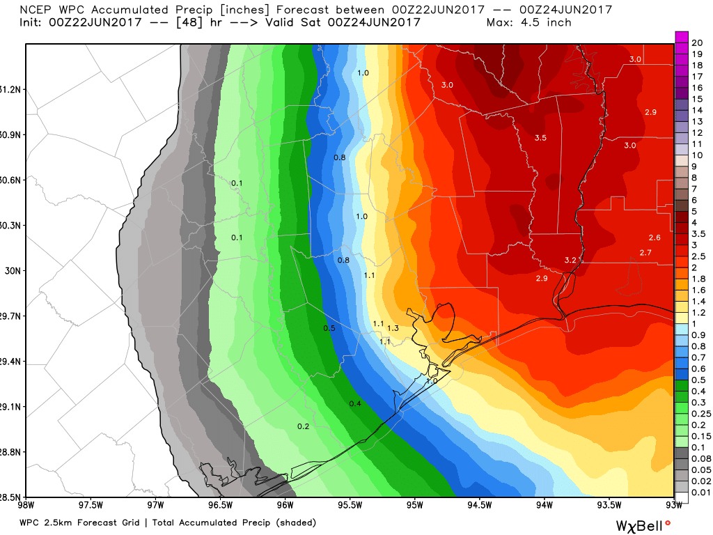
Just a quick update tonight. As expected, Tropical Storm Cindy appears to be headed toward landfall near the border between Texas and Louisiana. This north-northwest movement has spared the Houston metro area from heavy rainfall this evening, and kept the bulk of precipitation over the Beaumont area, and Louisiana.

During the overnight hours it seems likely that some of those rain bands will work their way into Houston, at least on the east side of Interstate 45. But even so I’d expect moderate accumulations, likely no more than 1 to 3 inches, and probably less than that for most people. Because the storm is turning to the north-northwest now, it looks like Houston will also escape sustained winds of tropical storm strength during the overnight hours. I’d expect winds to die down on Thursday afternoon.
After Cindy moves inland on Thursday morning, likely around sunrise, the storm will gradually move north throughout the day, taking the potential for heavy rain with it. I’d expect a chance of scattered showers and thunderstorms to linger, however. We’ll take a comprehensive look at the forecast ahead in a new post tomorrow morning. Until then, breathe a sigh of relief—this bout of tropical mischief has left us largely alone.
Posted at 10:10pm CT on Wednesday by Eric

An acquaintance’s significant other was wondering what the big deal was about. I told him to goggle TS Allison and Hurricane Like. Also to check news east of us. Things can change, so be prepared. Thanks for the coverage.
You’re quite welcome.
Thanks Eric,
Can you point me to where I can find what the forcasted or projected rainfall amounts would be for Knoxville, TN as a result fron Cindy?
Thank you again
Here you go, Monty. http://www.wpc.ncep.noaa.gov/qpf/qpf2.shtml
I would like a post-mortem comparing the actual storm track with the cone of best guess.
Thanks Eric! We got not quite 1/2 inch here in Cypress. Just as expected. Thanks for all you do!