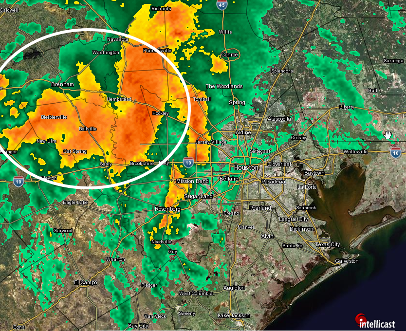
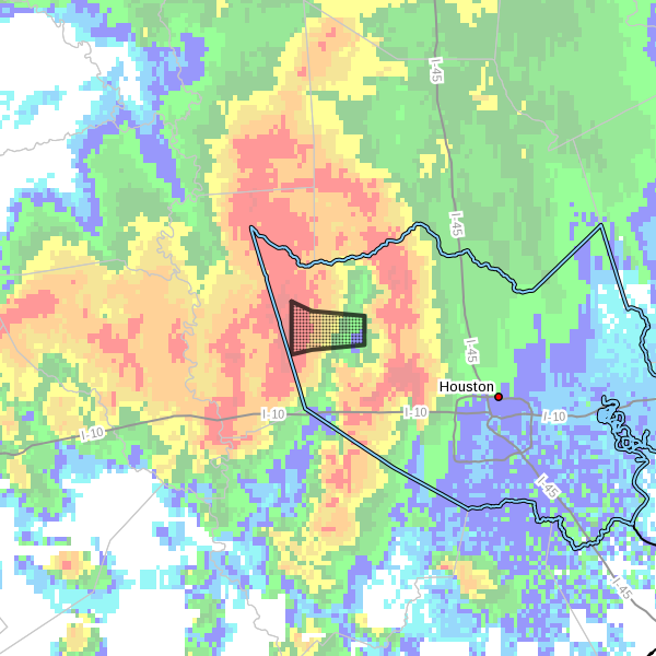
The moisture has found the rising air, and it is just to the west of Houston.

Already, as of 11:15pm Sunday, more than 6 inches of rain have fallen across Austin, Waller and northwestern Harris County this evening, with rainfall rates in some locations exceeding 3 inches per hour. Moreover there is very little motion with these storms as they are obstructed at this time. This is creating “life-threatening” flash flooding conditions in these areas.
These storms may slowly slide eastward, into western portions of Harris County, during the next several hours. It is not clear if they will move all the way into central parts of the metro area, although I expect they will not. Regardless, they are already doing work to bayous and waterways, such as the San Jacinto River, to the immediate west of Houston. The National Weather Service says Cypress Creek Near Katy-Hockley Road will soon approach flood stage. And there will be more to come.

So what does all this mean for the metro area tonight and on Monday? We are seeing the effects of an exceedingly moist atmosphere and a potent upper level low pressure system; and with the Gulf recharging the atmosphere, and the slow-moving low, these conditions won’t change soon. That means we will continue to see bouts of very heavy rainfall through Monday, and Monday night. The question is where.
I suspect that the heaviest rainfall tonight will occur to the west and north of Houston, including Montgomery County, with the bulk of heavier showers sagging southeast into the city, and through the city, later Monday morning or during the early afternoon. But that’s just a guess.
Posted at 11:35pm Sunday
Squall line is carrying nickle to quarter sized hail. Katy Fw/Barker Cypress
Quarter size hail barker cypress area
Any advice for citizens of Katy?
It has been quite a downpour here in Northwest Houston.
Thanks for the updates!
Stay put today, if possible That is my advice.