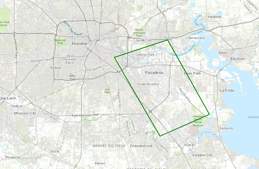
Storms this afternoon were expected to dump heavy rain in a few small areas around the region. What we are seeing is something more robust than that, as widespread heavy rain and some areas of street flooding are ongoing. Flood Advisories are posted for the entire Houston area, and the Pasadena area is now under a Flash Flood Warning through 5:15 PM.

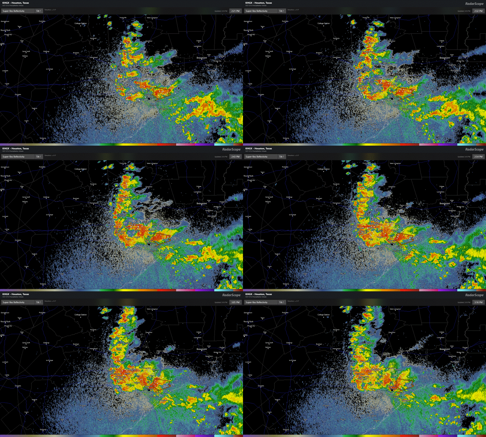
Radar as of 3:15 PM shows a cluster of heavy rain that has migrated west over most of the Houston area.

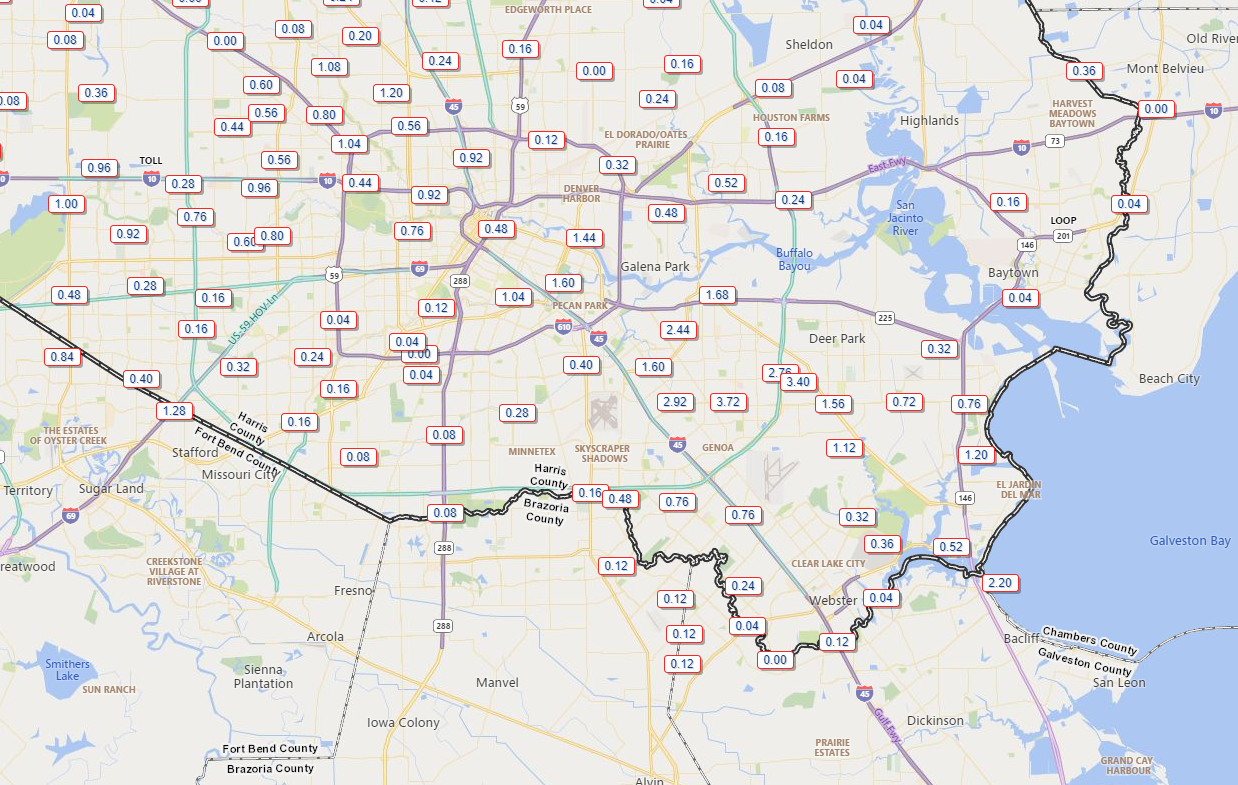
This is basically going to need to rain itself out now over the next 3 to 4 hours. Pasadena has been fairly hard hit with nearly 4 inches of rain so far.

For the sake of simplicity I’ve just shown part of the metro area above. You can always check rain totals over various times over the larger area at the fantastic Harris County Flood Control gage site. Some folks will see little to no rain (especially northeast of IAH Airport and perhaps well south toward Lake Jackson and Freeport). Others may tally 5 to 6 inches or more when all is said and done this afternoon.
So heavy rain, storms, and street flooding are likely in many spots through 7 PM. Storms will fade after that. We enter a quiet period later this evening and into the early overnight.
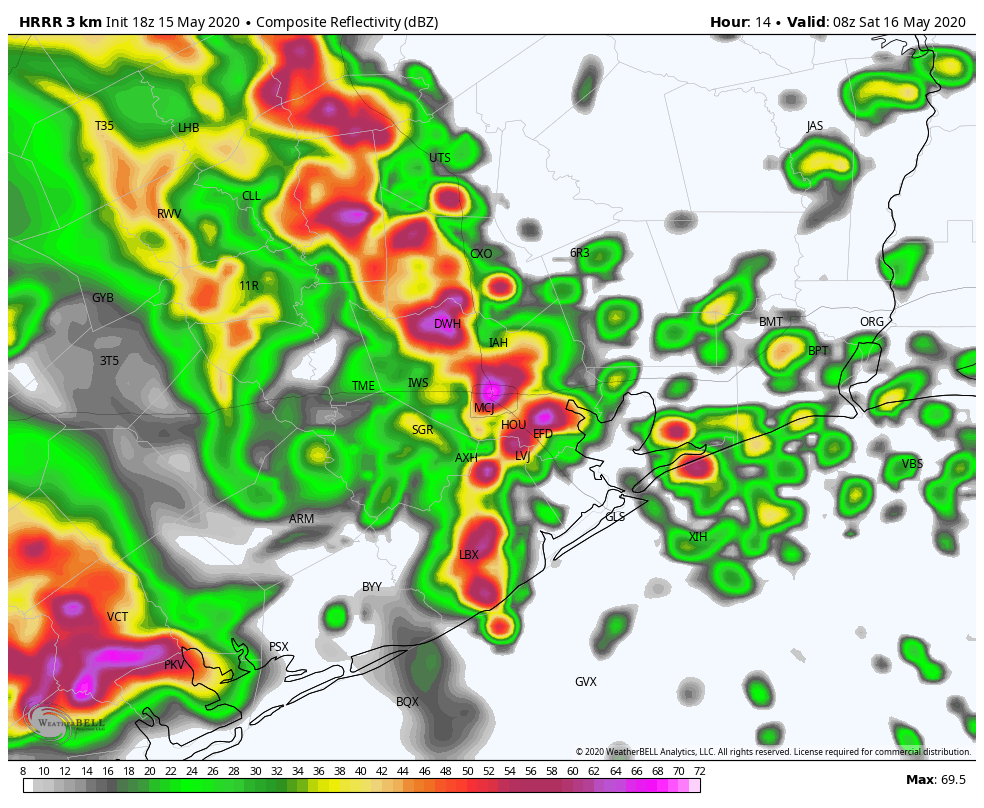
Round 2 of storms will arrive here later in the overnight. The timing of the next wave of storms has sped up since this morning, and it now appears we will see heavy rain and storms resume after 2-3 AM (about 2 to 3 hours faster than expected this morning). Below is what one model thinks radar will look like at 3 AM Saturday.

Other models vary a bit on timing and orientation, but all show the entirety of the region seeing a period of heavy rainfall. Another 1 to 3 inches of rain will be possible with this. This would likely lead to widespread street flooding, especially around the hardest hit areas so far with today’s rains, where the ground will be very saturated.
As for Saturday afternoon? There is a chance we see another round of rain and storms, but we still do not have much confidence in details yet to determine whether we need to be concerned or not. We will update you either tonight or early Saturday morning. A reminder that we went with a Stage 1 on our Flood Scale this morning. See our earlier post for more details on that. Stay safe, and remember to never drive through flooded roadways.

Just over an inch here in 77095 in about an hour.
No knock on you guys but seems like whatever rain total is expected we should always double it at minimum
I almost always double all predictions………..that’s just been my experience in the past 5 years, so it’s not your imagination!
Honestly this is the attitude that fails when things go bad.
Over 2 inches in about an hour in Cypress, Tx. Spring Cypress and Barker Cypress rds.
Sitting in a driveway at the entrance to my subdivision waiting for high water to recede. It’s horrible here in Pasadena.
6 inches in Missouri City, streets flooded, some water in house
We’ve had heavy trickles here in Texas City. Drought drought, drought. However, worrying about the olde addage that it never rains til it pours! My Morton salt still runs fine.
I had a 6am run planned for Saturday Morning, is it looking like that will be a washout on the Northwest side (Jersey Village)?
Depends on advancement of the front, but you’re likely to be wet regardless.
An y chance 3 inches of rain washes away the stink in Pasadena? Just curious?
We had almost 6 inches here in League City/Dickinson area. My street flooded and water got up into the yards in my neighborhood. It was very unsettling.
I am grateful for Space City Weather. Always points me in the right direction with the weather. Thanks guys!
Whenever it rains now in SE Texas some neighborhood floods. It happens every time. City has failed in whatever drainage Infrastructure they claim to have