On Monday, Houston topped off around 95°, after a 94° on Sunday and 93° on Saturday. So far at least, our temperatures seem to be underachieving a bit. That may be a bit of cloud cover or the relatively wet weather we had through late spring acting against heat. Regardless, it will remain plenty hot through the week.
Today
Today’s upper air temperatures are expected to be about 1 to 2°C warmer than they were yesterday, which should translate to a bump of a couple degrees to our high temperatures. Look for mid to perhaps some upper-90s in most inland spots, slightly cooler at the coast. Storms are expected to remain well north of the area today, but some clouds from those storms could filter into some of the region.

Peak heat index values (or feels like temperatures, if you prefer) will be in the 103 to 107° range in Houston, just shy of heat index criteria in most of the area. But to the west, they are expected to flirt with 108°+, requiring a heat advisory. This could be expanded later today and certainly will be as the week goes on.
Wednesday
Morning lows will be in the upper-70s tomorrow. We tack on another 1-2 degrees on Wednesday in the upper atmosphere, so look for mostly upper-90s for highs here. As seems to be the case, some passing storms well off to our north may send some “debris” clouds this way which may keep the risk skewed slightly lower for high temps. We’ll see.
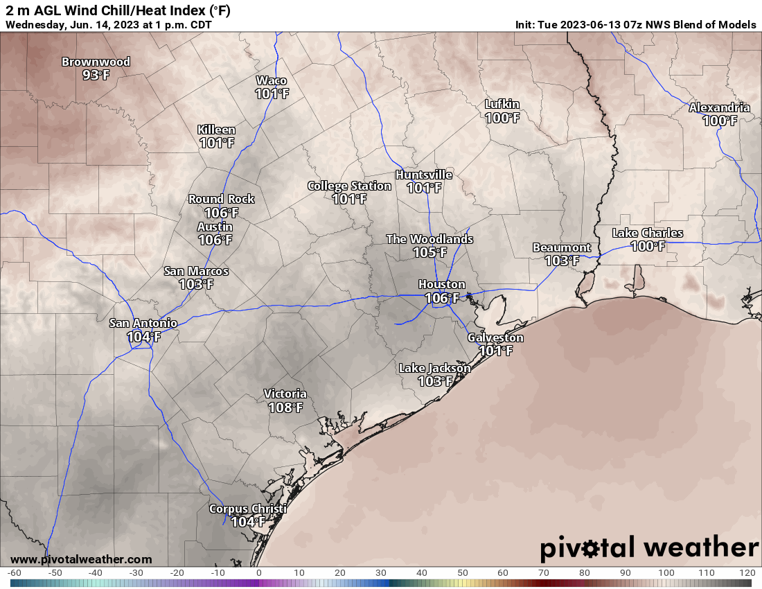
Heat index values will nudge up some tomorrow, with peak readings perhaps more into the 105 to 110° range, which could yield wider coverage of the heat advisory.
Thursday through Sunday
No changes to the forecast here with minimal rain chances (model probabilities are under 15 percent all days) and a mix of sun and clouds each day. High temperatures will likely be in the upper-90s most days with at least a chance at 100+ officially. But admittedly, after yesterday I am not as convinced we do that. But, whether it’s 100+ or not, we will likely see heat index values average in the 105 to 110° range on all days, meaning we will potentially put together a string of heat advisory days, so make sure you’re keeping cool and drinking plenty of water.
We still cannot confidently answer when this heat will start to relax. Maybe later next week.
Tropics
We continue to update the tropics daily over at The Eyewall, and we have little to discuss right now! Good news for sure, and with this dry, hot air mass dominating Texas and the western Gulf, we’re very much in the clear for the next 7 to 10 days. Look for a larger feature at The Eyewall tomorrow that goes in depth on what has been happening in the Gulf of Mexico in recent years.


Throwing in a little Celsius to keep us on our toes I see.
Wondering if other references today to 1-2 degrees without a designation means C or F?
F…sorry, should have made that clear!
The A/C is already on the late July/early August level struggle bus. Come on, cloudy days!
It hit 106 in Katy. Yow!
No it didn’t. Unless you mean the heat index then maybe.