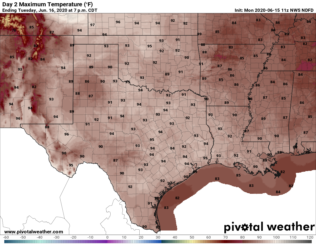
Good morning. High pressure will dominate our weather this week, but it won’t be completely oppressive. Summertime highs typically peak in the upper 90s and lows in the upper 70s to 80 degrees in August. But this week, we should see more June-like weather with highs in the low- to mid-90s, with overnight temperatures in the low- to mid-70s. Oh, and if you’ve stepped outside this morning, you’ve already noticed that the humidity is baaack. That should be a constant companion for at least the next three months. Speaking of heat and humidity, if you have not yet signed up for Reliant’s AC Sweepstakes, you’re missing out on a chance to win a free AC System.
Monday
Some isolated showers developed to the southwest and northeast of Houston on Sunday, and we should see a similar pattern today as some higher atmospheric moisture levels help a few showers to form. While we will probably see these fast-moving showers this afternoon, most of us will just be sunny. Look for highs in the low 90s with light southeast winds. Overnight lows should fall below 75 degrees for most areas except the coast.
Tuesday
A similar day to Monday, with a chance of isolated showers popping up during the afternoon hours. Highs should reach the low- to mid-90s. Winds will be calm, to very slight from the southeast. Between the lack of wind, and the high humidity, it will feel very warm during the afternoon hours.

Wednesday, Thursday, and Friday
The second half of the work week looks pretty sunny and pretty hot, with highs in the low- to mid-90s, and very low rain chances. High pressure will be doing work as Houston continues its summer-like pattern.
Saturday and Sunday
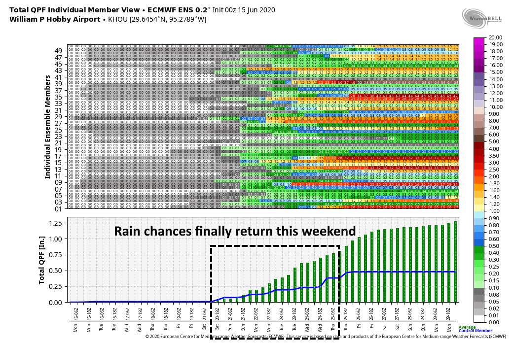
Some change in our weather pattern should finally begin to arrive next weekend. For one thing, as high pressure moves off, we should see a deeper flow of atmospheric moisture into the region, and this should bring the return of partly cloudy skies. This will help limit high temperatures a bit, and should introduce better rain rain chances in the 30 to 40 percent range this weekend, and continuing into next week. At this point we’re not looking at anything like a washout, however. Rain chances should continue into the first half of next week.
Tropics
After this year’s early flurry of tropical activity, the Atlantic has quieted down into a pattern more typical for June. It’s probable that we will not see another named storm develop for the rest of the month—but there are few guarantees with mother nature.
Interesting last graphic from ECMWF. Is the bottom graph from the ensemble mean?
I have seen a few reports of an influx of Saharan dust into the Houston area. I assume that is one of the big reasons why the Gulf is quiet in terms of tropical storm development. Is that right? Are the reports of Saharan dust accurate?
You can see current SAL levels here: http://tropic.ssec.wisc.edu/real-time/sal/salmain.php?&prod=split&time=
Eric
What was the final number of consecutive hours of dewpoints in the 50s?