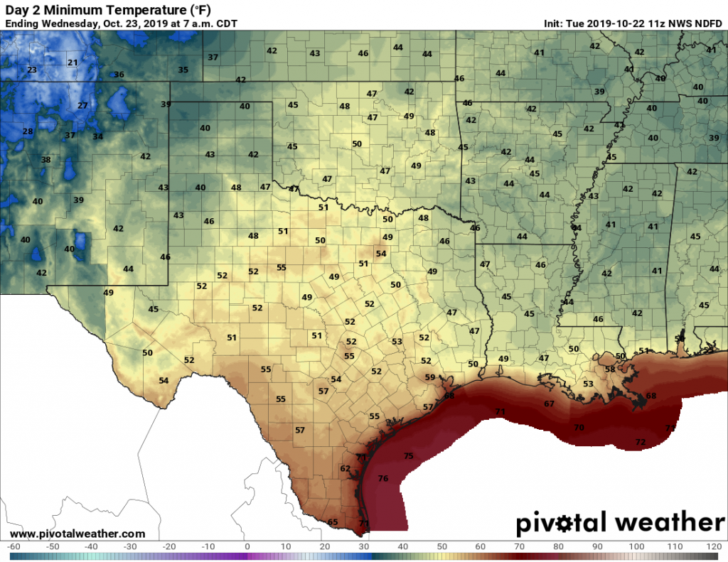
Good morning. We hope everyone enjoys today’s absolutely stunning weather, from a cool morning through a pleasant, sunny day, and clear skies this evening. We’ll have more of the same on Wednesday before confidence in the forecast plummets heading into the weekend. Let’s discuss why below.
Tuesday
As mentioned, today will be a grand affair, with sunny skies and high temperatures around 80 degrees. With dry air, lows on Tuesday night will cool down to about the same temperature as on Monday night.

Wednesday
As high pressure moves off to the east on Wednesday, the region will begin to open up to an onshore flow from the Gulf of Mexico. But daytime conditions will still be quite pleasant, with sunny skies and highs around 80 degrees again. Wednesday night lows should get into the 60s for all but the immediate coast.
Thursday and Friday
And here, the divergence begins. The forecast models are struggling with how to handle the evolution of a large area of low pressure over the southwestern United States. One camp of models, led by the GFS model, brings this system eastward pretty quickly, and drives a strong cold front into Houston on Friday. Under this scenario, we may see a smattering of rain as the front blows through, with much colder weather afterward. The second camp of models, led by the European forecast model, holds up the front, allowing a surge of tropical moisture to push into Texas on Friday and Saturday. Under this scenario, Friday is rainy and muggy.
Saturday and Sunday
The weekend forecast depends entirely on what happens with the cold front. If it makes it through, as the GFS suggests, Saturday will be sunny and cool. If it does not, Saturday will be warm (in the 70s) and wet. It is conceivable that, in the slow-front scenario, Houston picks up 1 to 4 inches of rainfall on Friday and Saturday. I don’t have high confidence in either outcome, sorry.
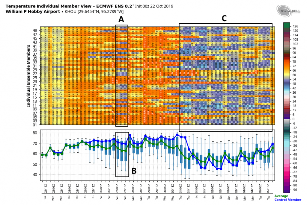
Below, I’ve attached the European model’s ensemble forecast and highlighted its predictions for low temperatures on Saturday night. If you look at Box A, you’ll see that about half of the ensemble members have low temperatures in the 50s following a frontal passage, and about half are in the 70s. In Box B, the range of possibilities for Saturday night range from 45 to 75 degrees.

Some kind of front will probably, finally, have dragged into Houston by Saturday night or Sunday, but again, overall confidence is low.
Next week
Medium-range models suggest a stronger front is in the offing for next week, and right now their timing indicates the front will move through before Halloween. In fact, in Box C in the attached graphic, you can see a lot of ensemble members are forecasting quite cold temperatures to end October and begin November. We’ll see!

I vote for the GFS model….besides, we don’t need Europeans telling us what our weather will be.
Like MURICA controls the world’s weather.
Shhhhh!!!!…….we cant have the Russians finding out
I know this may be an unfair question-
But…..what would be your best educated guess as to the weather forecast for Galveston the weekend after Halloween? Cold is ok, but rain possibilities?
A few (lot) of motorcyclists would appreciate a heads up.
It’s S.E. Texas…who knows.
I always feel like the European model is more accurate the majority of the time. I hope it is wrong this time!
I hope so too!
Thanks guys. I looked at guidance this morning and decided to go back to bed. What a variance. Had to check GFS to make sure I didn’t screw something up. Guess things will tighten up a little better in the next couple of days. Glad you guys are here.
Well despite the model disagreement, WPC has us pegged for heavy rain….not sure want gives them so much confidence though if everyone uses the same guidance.
Well, it was 49 degrees at my house this morning, 10 degrees below the forecast low. That’s a pretty big miss.