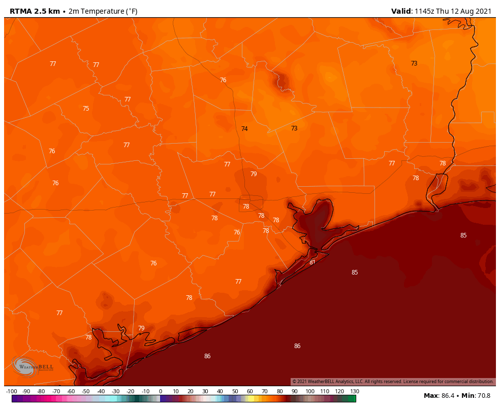
Houston will continue to see hot summertime weather, but with the absence of dominant high pressure the region will also see scattered rain chances each day. The pattern changes slightly on Sunday, as a weak “cool” front pushes into the area. This may spark heavier rainfall in some areas, but the details remain sketchy.

Thursday
Some fairly sporty showers popped up over parts of the Houston region on Wednesday, and we could see that again today with fairly high atmospheric moisture levels. I think coverage will probably be about 30 percent, with areas east of Interstate 45 having a better chance of seeing a shower or thunderstorm. Highs, otherwise, will be in the mid-90s with partly sunny skies. Any showers should end as the Sun sets. Winds will be light, out of the south.
Friday
This should be another hot day, with mostly sunny skies, highs in the mid-90s, and rain chances in the 20 to 30 percent range.
Saturday
More of the same, with a chance of an afternoon shower, sunny skies and highs in the mid-90s.
Sunday
The aforementioned cold front will not be particularly noticeable on Sunday. High temperatures may be a couple of degrees cooler, and dewpoints slightly lower. But it’s still going to feel like summer out there with partly to mostly sunny skies. What the front may do is induce a rising motion in the atmosphere, which would increase rain chances and at least bring the potential for heavy rain into play. I don’t think this rain will be particularly widespread, but a few areas may pick up some stronger showers on Sunday. Hopefully Matt can better pin down the details of this in tomorrow’s forecast.
Next week
We’ll see more August-like heat next week with highs generally in the mid-90s. The main question remains whether the upper-level pattern will spin a few disturbances toward Houston, and thus some reasonably healthy rain chances, or keep us mostly dry. The jury is still out on this, I’m afraid, although I’d welcome a somewhat wetter pattern as things have really dried out this month.
Tropics
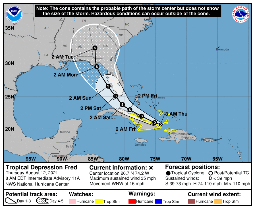
Not a whole lot has changed. Fred has weakened into a tropical depression overnight, but its main threat was always going to be rain anyway so that’s not really a big deal. It still should regain tropical storm status as it moves away from Cuba, and should bring 2 to 8 inches of rain to parts of Florida this weekend.

Invest 95L is the tropical system further out in the Atlantic. This system most likely will follow a track similar to Fred, although we can’t entirely rule out a more westerly path into the Caribbean Sea. Either way, the atmosphere isn’t overly favorable, so it seems likely that 95L may struggle to intensify much as Fred has.
All in all, for Texas in mid-August, things look pretty good in the tropics right now. We have about six weeks left in the “prime time” of tropics season for our state.
Sporty showers are always open to game of Pickle Ball.
Sporty showers are always open to A game of Pickle Ball.
Checking here during hurricane season is like signing on to Twitter without knowing what’s in the news. A whole lot of “Ohnoohnoohnoohno….” followed by either “Whew” or “(Not fit to print)!”
Interesting GFS results for the Southeast coast 12 days out…..