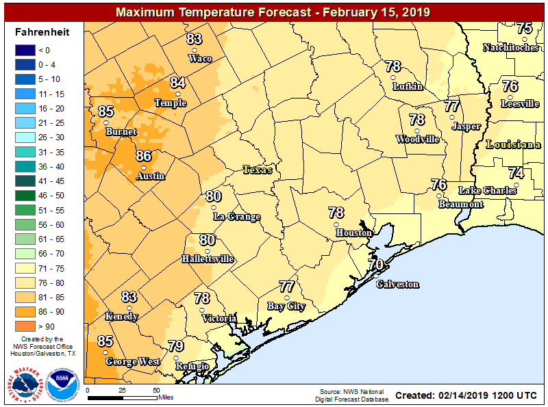
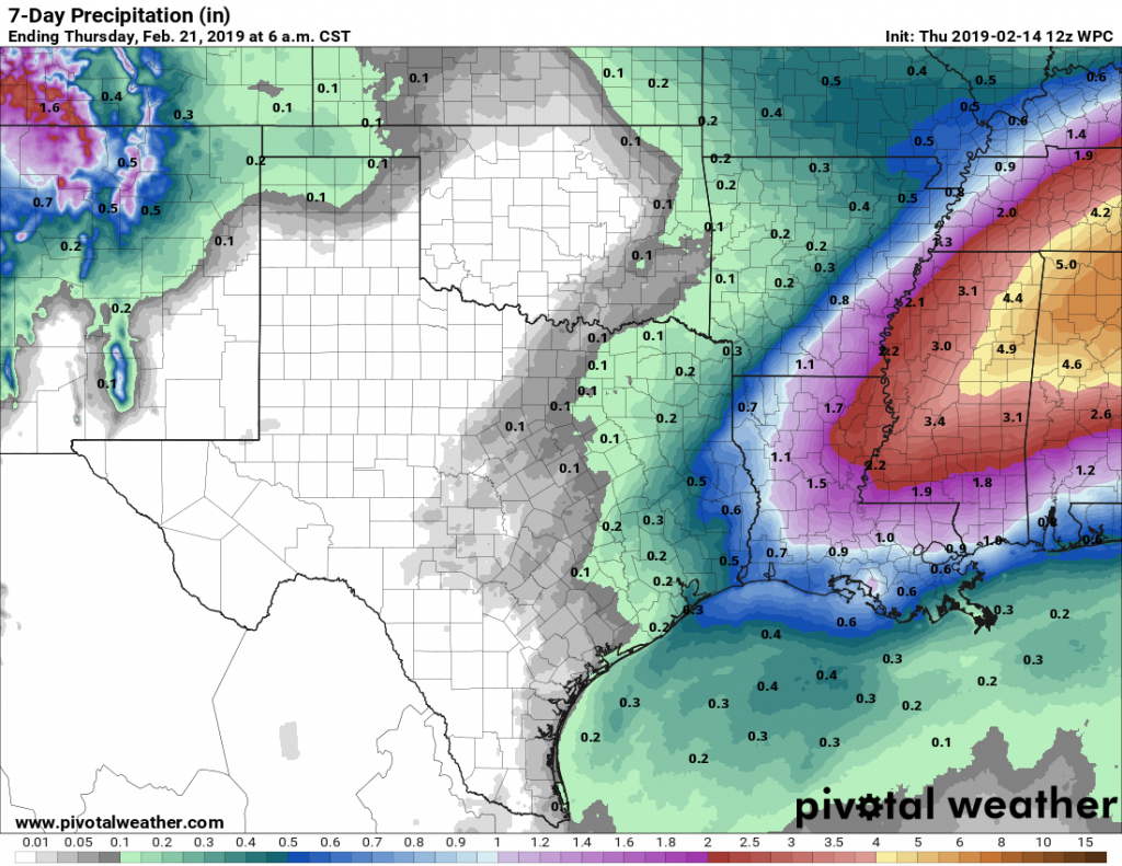
Our forecast remains on track through the first half of the weekend, with mostly sunny conditions and warmer weather. After this, however, our weather turns a bit murky both literally and figuratively as a cold front stalls out near, or over the region. Certainly we’re not expecting anything too extreme, but for now the forecast is hard to parse with any great detail.
Thursday and Friday
The work week will end with a pair of fine, partly to mostly sunny days, with high temperatures generally varying from the low 70s to the upper 70s depending upon cloud cover. Nights will be moderate, with lows in the upper 50s for inland areas ranging into the low 60s for the coast. Rain chances are near zero and humidity levels will be reasonable with some drier air mixing in.

Saturday
The first half of the weekend will see more of the same, although cloud cover may increase some later during the day on Saturday. This still should be a dry day for most, with highs in the mid-70s, so plan those outdoor activities with confidence. Nighttime temperatures on Saturday will be quite warm, likely in the 60s pretty much area-wide.
Sunday
The region’s next front will approach Houston on Sunday, and now looks set to stall somewhere near the city—perhaps overhead, perhaps just offshore. As a result, your conditions on Sunday will depend on where you are in relation to the front, meaning the coast could still be relatively warm in the upper 70s while inland areas far inland are in the 60s. Some moderate rain chances (30 to 40 percent) will accompany the front and its stalling motion, but we’re not expecting any accumulations above a few tenths of an inch. In short, Sunday could be a reasonably pleasant day, or it might not. We’ll see.
Next week
Highs on Monday and Tuesday of next week will be drop into the 50s and 60s as more cooler air moves in behind the front, and skies will remain mostly cloudy, with generally unsettled weather over head. This may lead to on-again, off-again light rain, and the potential for some thunderstorms, for the greater Houston area. Hard to say for sure at this point.

By Wednesday or so, a reinforcing front looks to make it through, cooling things off and bringing the sunshine back. Highs probably will recover to about 70 degrees next weekend, but the jury is out on whether we’ll be dry, or continue to see some light rain chances.

Question about Sunday – do you think there will be rain chances in the afternoon?? Have an outdoor party planned and starting to stress a little😑
“The region’s next front will approach Houston on Sunday, and now looks set to stall somewhere near the city—perhaps overhead, perhaps just offshore. As a result, your conditions on Sunday will depend on where you are in relation to the front, meaning the coast could still be relatively warm in the upper 70s while inland areas far inland are in the 60s. Some moderate rain chances (30 to 40 percent) will accompany the front and its stalling motion, but we’re not expecting any accumulations above a few tenths of an inch. In short, Sunday could be a reasonably pleasant day, or it might not. We’ll see.”
So does that imply rain chances all day or more in the AM/PM? That’s what I’m trying to figure out 🤪