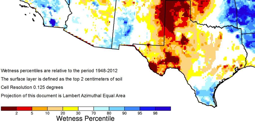
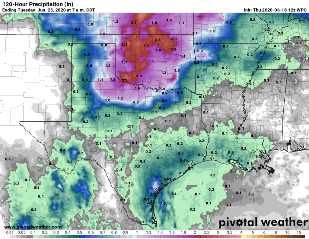
For most of Houston, it’s been two weeks since substantial rain fell across the area. Compounding the problem has been that most days since then have been sunny and hot, allowing for ideal drying of soils. While rains earlier this spring have helped keep Houston out of a drought, the top layer of soils in the region is nonetheless very dry due to recent weather conditions. The map below shows the “percentile” level of moisture in the top 1-inch of soil across Texas. Much of the Houston area is at the 10th percentile or lower, based upon observations by NASA’s GRACE satellite, and a few areas are at 5 percent or lower.

These conditions have not yet sunk deeper into the ground, which would indicate a true drought. But were we to see another week or two of this hot and dry weather, the region would likely enter a drought. Fortunately, it does not appear as though that will happen given the modest pattern change ahead for this weekend.
Thursday
There are no surprises in store with today’s forecast. We can expect hot, humid, and sunny weather, with highs in the low- to mid-90s, light southerly winds, and almost no chance of rain. Lows will be in the mid-70s.
Friday
As high pressure dominates for one more day, we should not expect any substantial changes for Friday’s forecast either. Continued hot and sunny.
Saturday
The overall flow into the Houston region will become more moist by Saturday, but it’s not clear how quickly the region will begin to see its effects. Saturday should see mostly sunny skies again, although there will be a small, perhaps 20 percent chance of some showers firing up in the afternoon and evening hours along the sea breeze. Highs should reach the low 90s.
Sunday
Rain chances improve on Sunday, probably to about 40 percent. We should also see some more clouds develop, although there still should be a fair bit of sunshine. Highs again will be in the low 90s.

Monday and beyond
For next week the forecast is fairly tricky. High pressure should move off. Moisture levels will go up. But for the first half of the week there does not appear to be a real trigger for widespread rain showers. However, toward the middle or end of the week, the European model suggests a good slug of tropical moisture may move into Texas, and that could bring heavier showers. It’s something to watch for, but overall confidence remains pretty low as the GFS model goes in the opposite direction—hotter and pretty dry.

If it were true that TX has a greater than 50% chance of getting hit with a tropical system this summer, you’d warn us right? Is it really possible that Accuweather can “know” that? Logic would dictate that you won’t know where a system is going until it develops. I am presuming it might be true that the Gulf will be more active (as they say) if it’s warmer than normal, but it’s June and there are no active systems, so how can they say these things? (It was an article they released)
It is a forecast of >50% which simply means that if the weather patterns play out like history has shown then >50% of the time a tropical system makes its way to Texas. And given this is essentially a coin toss I’d bet we’re close to that each and every year. This is a viewpoint from the macro level, but storms can develop anywhere and are driven by the micro level of nature.
My point is….don’t worry about these “season” forecasts. Worry about a developed storm and where it is headed.
How does the Saharan Dust affect moisture next week?
Just a gut statement here, but I imagine the dust would have about zero impact on overall atmospheric moisture. If there is a transport mechanism for warm, moist(er), Gulf air to come to Texas, it’s coming, dust be-damned. We might get a replay of the splotchy raindrops we had last year.