A sense of normalcy has returned to Houston this morning, as temperatures have fallen into the upper 40s across most of the region. This will be but a fairly brief respite, however, from the warmer weather of late. Also, we’ll probably see rain this weekend.
Today and Friday
In the wake of Wednesday’s cold front, pleasant weather will predominate for Houston, with highs in the upper 60s to 70 degrees, and cooler nights. How cool? Temperatures tonight could fall into the low- to mid-40s for many inland areas, and this will bring a real chill into the air. Friday night will be warmer, with the onshore flow starting to resume, but I still expect lows to fall to around 50 degrees for most areas. Skies will be partly to mostly sunny, with winds around 10 to 15 mph.
Saturday and Sunday
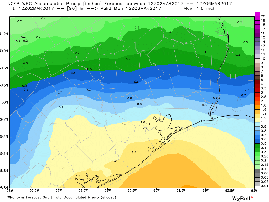
As the onshore flow resumes, rain chances will return to the metro area this weekend. The temperature forecast, at least, seems fairly clear. Both days will see highs from the upper 60s to low 70s, dependent somewhat on cloud cover, and lows probably down to around 60 degrees. The difficult part of the forecast comes in determining rainfall, which will depend upon the evolution of a low pressure system moving up into the region from south Texas on Saturday. The forecast models just don’t have a good handle on this yet.

My sense is that Saturday morning should start out dry for Houston, but rain chances will increase during the afternoon hours, especially along and down the coast, near Matagorda Bay. A healthy chance of rain will remain the forecast through Sunday night. While rain showers will threaten, I don’t think any part of Houston will see any kind of a flooding threat, as accumulations should remain at or below 1 to 1.5 inches.
Next week
The first part of next week looks pretty warm, with highs possibly nudging back up toward 80 degrees on Monday. Tuesday, the opening day of the Houston Livestock Show and Rodeo, will probably see mostly the same warmth before some kind of front approaches the region. Right now there’s low confidence in whether this front will pack some significantly cooler and drier air, or be of a much more weaker sort. I’ll lean toward “less punch,” given what we’ve experienced so far this winter. In any case, there is the possibility of some mid-week rain with whatever system gets dragged through the area.
Posted at 6:50am CT on Thursday by Eric
Any strong thunderstorms likely with this system, Eric?
I don’t think so.