Good morning, and happy Go Texan Day, y’all! Today looks great, but this weekend should get mixed reviews, as we’ll be dealing with some rain chances dampening things a bit. On to the details.
Today & Saturday morning
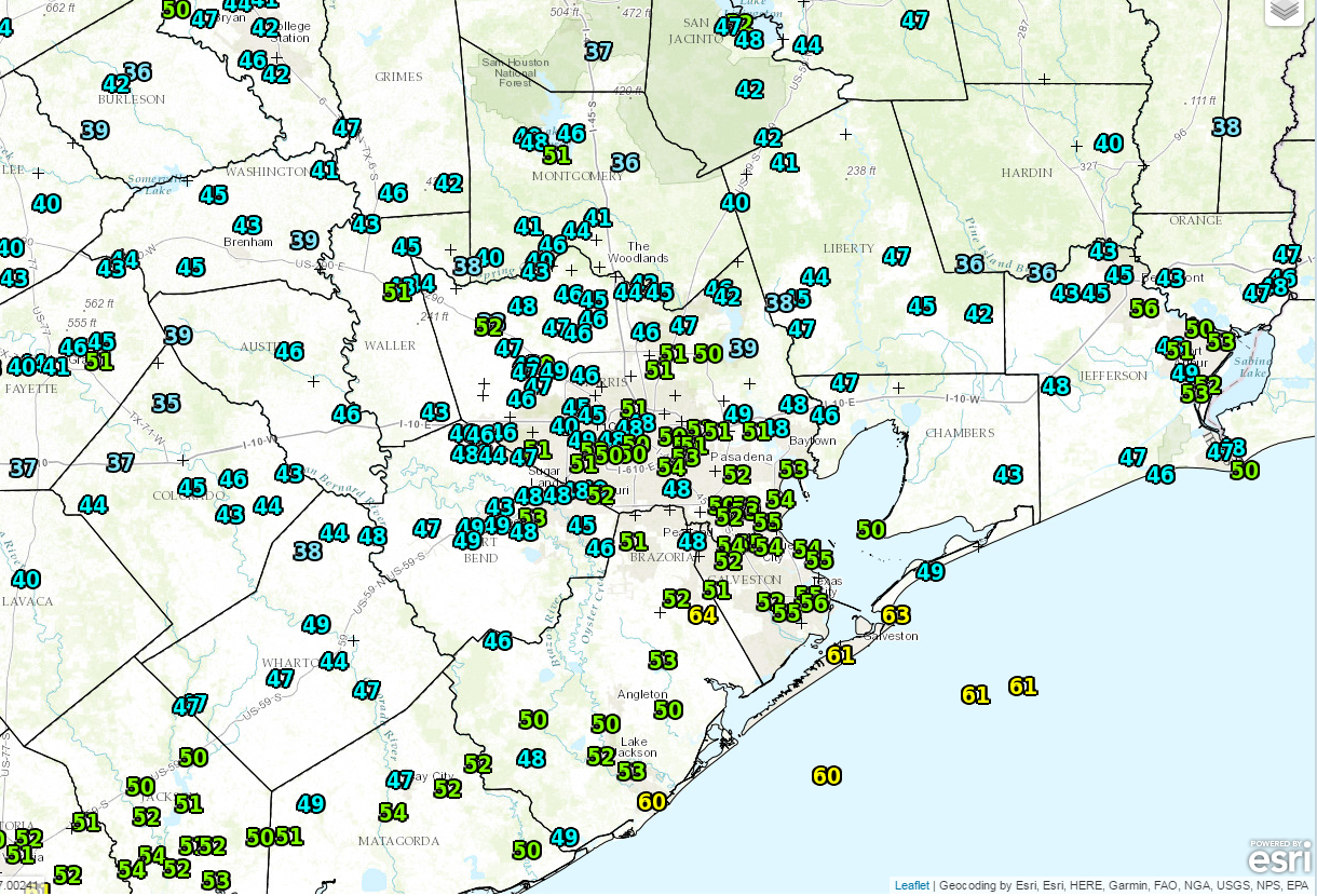
Today will be a fine day. We are starting off a bit chilly this morning, with a lot of 40s on the board north and west of Houston.
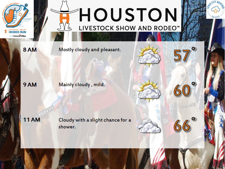
It looks mostly sunny and dry this morning and afternoon. We’ll have some high clouds skirting through from time to time, but overall it looks to be a nice day. Temperatures should get up to near 70 degrees with a modest breeze.
It should be a quiet evening, though it won’t be quite as cool as this morning or Thursday morning. Temperatures should start Saturday about five to ten degrees warmer than those days. Clouds will begin to increase tonight as well, leading to a mostly cloudy, but likely quiet Saturday morning. It *should* be good weather for the Downtown Rodeo Parade or the Rodeo Run. We can’t entirely rule out a sprinkle or some light rain, but steadier rain should hold off until after Noon.
You’ll still want to keep tabs on the forecast before you head out in the morning, just to be safe.
Saturday afternoon through Sunday
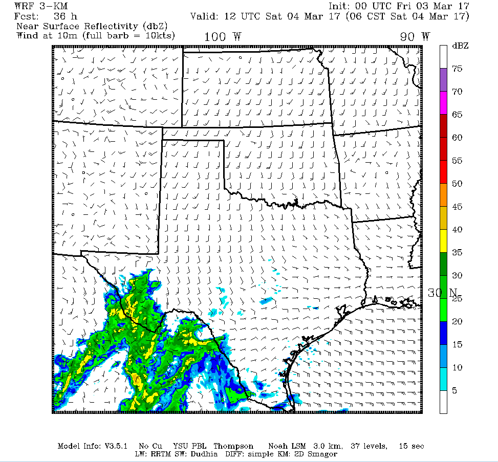
A storm system is going to lift northeast out of South Texas during Saturday afternoon. As it does so, rain will spread into the region, and the back half of tomorrow and much of tomorrow night is looking a bit dreary. Here’s how it could look based on a high resolution model from Texas Tech:
We could see some lingering showers on Sunday as well, but certainly less coverage than Saturday. Sunday afternoon may be the better of the two days for outdoor plans. Temperatures will be near 70° both afternoons, with lows in the 60s both Saturday night and Sunday night.
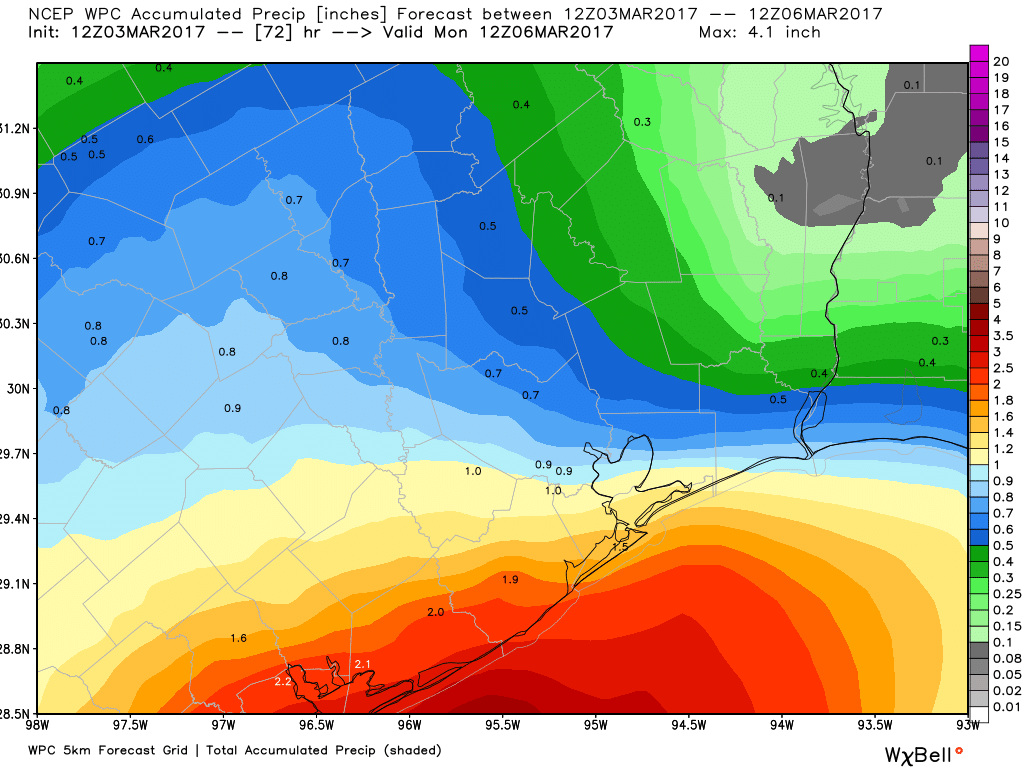
How much rain to expect this weekend? Totals will vary, but by Monday morning, expect anywhere from a quarter to half inch north of Houston to 1-2″ on average south of Houston, with higher amounts possible toward Matagorda Bay.
Next Week
After a mostly quiet day on Monday, with just a slight shower chance, our attention will turn to a cold front Tuesday. The forecast models have been in disagreement with each other over the evolution of this system for the last few days. It appears we are gaining some consensus now, and that points to a front that lacks much punch behind it on Tuesday. Expect scattered showers and thunderstorms during the afternoon Tuesday. We should see a break Wednesday, followed by a return to scattered afternoon showers or storms perhaps Thursday into next weekend.
Temperatures should be warm, and it will be humid to start the week. High temperatures should be in the upper 70s to low 80s Monday and Tuesday. We’ll cool off a little Wednesday and Thursday, with perhaps another morning in the 50s possible if we’re lucky. Then we warm up and turn on the Gulf humidity pump again later next week and probably the weekend. We’ll have more on this next week.
Posted at 6:50 AM by Matt
I’m a little vague about the strength of Sunday’s storm system, Eric. Is it still weak, or has it been beefed up a little bit by the models?
So much for Sunday being the nicer of the two weekend days and not having much rain accumulation in Harris County. Westbury is at 2.52 inches already and it’s only 6:30 pm Sunday!
Yes…this event definitely overperformed in and around Houston today. This forecast will not end up on my refrigerator.