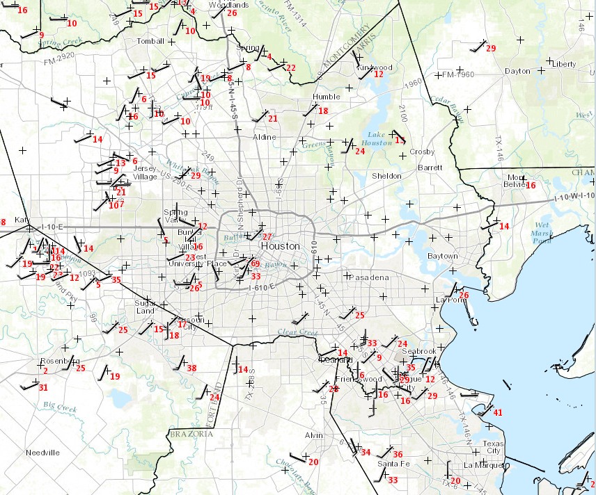
A fairly tight pressure gradient in front of an advancing front has caused more gusty winds than previously expected today. A site at Johnson Space Center recently measured a wind gust of 44 mph. These strong winds are expected for persist along the coast and the first tier of inland counties for a few more hours.

As a result, the National Weather Service has issued a wind advisory for these counties through 3pm CT. The biggest threat is to high-profile vehicles traveling across exposed areas, such as bridges and other elevated roadways.
The winds should die down later today as the storm system and a weak front move off to the east of the Houston region. Expect some scattered storms as the front comes through, but the severe weather should remain to the north and east of Houston for the most part.
Posted on Monday at 12:35pm CT by Eric
Neighbors’ basketball goal blown over – fortunately missing their car.
No sense in raking leaves today. Everything was airborne towards the neighbor’s yard.
Oh wait….!! ?
Perfect!