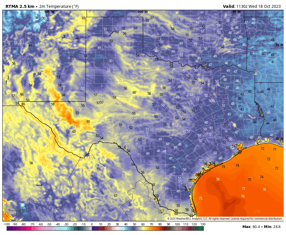
Good morning. Temperatures are generally in the 50s across the Houston region this morning, and this will be the last time we’re this chilly for about 10 days as our weather turns warmer and, eventually, a bit wetter. If you’ve enjoyed the cooler weather, take heart. It does look like we’ll return to much more fall-like pattern before the end of October.
As a reminder, despite the brief return to warmer weather, we’re excited to be celebrating Fall Day on Sunday. We’re gathering at McGovern Centennial Gardens, at the northern end of Hermann Park, any time from 4 and 6 pm for a festive meet-and-greet and fall activities for all ages—face painting, photo opportunities, seasonal treats and more! Admission is free. It’s not mandatory, but if you’d like to tell us you’re coming, please do so here. It will help with planning.
Wednesday
Winds have turned to come from the south, and this will allow us to warm to about 80 degrees today. Skies will be sunny, and those winds should remain light, in the vicinity of 5 to 10 mph. As dewpoints recover some, we’ll start to feel a little bit more humidity this afternoon and evening. Overnight lows probably will be about 10 degrees warmer than Tuesday night, dropping into the 60s.
Thursday and Friday
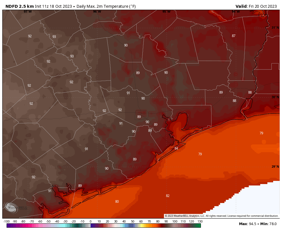
Our pattern turns decidedly warmer to end the work week, with an atmospheric flow generally from the southwest, which will help nudge temperatures into the upper 80s for much of the region on Thursday. A weak front will slowly slog through the area overnight Thursday, and this infusion of slightly drier air will help push temperatures a bit higher on Friday. Some inland areas will likely hit 90 degrees, although humidity will be lower.
Saturday and Sunday
Lows will drop into the low- to mid-60s on Saturday morning, with drier air. However, the front’s influence will fade pretty quickly and we’ll see a more southerly flow. Look for a few clouds on Saturday, with highs in the upper 80s for the most part, with a few areas possibly touching 90 degrees. Some clouds will be possible on Sunday, with highs likely in the mid- to upper-80s for most of the area.
Next week
Our pattern will generally be warm and wet next week, although as usual we have some questions as to how wet conditions will get. Generally, days should be partly cloudy, with highs in the mid-80s. Rain chances will start to increase on Tuesday, and much of the area could see 0.5 to 2 inches of precipitation next week, give or take, as atmospheric moisture levels rise. The air will be fairly muggy. If you’re wondering where fall is, there is a fairly strong signal for a robust front by around next Friday or Saturday. That’s far enough in the future for it to be uncertain, but at this point I definitely think it’s likely.


90 Degrees?…. BOOO!
Agreed
👻