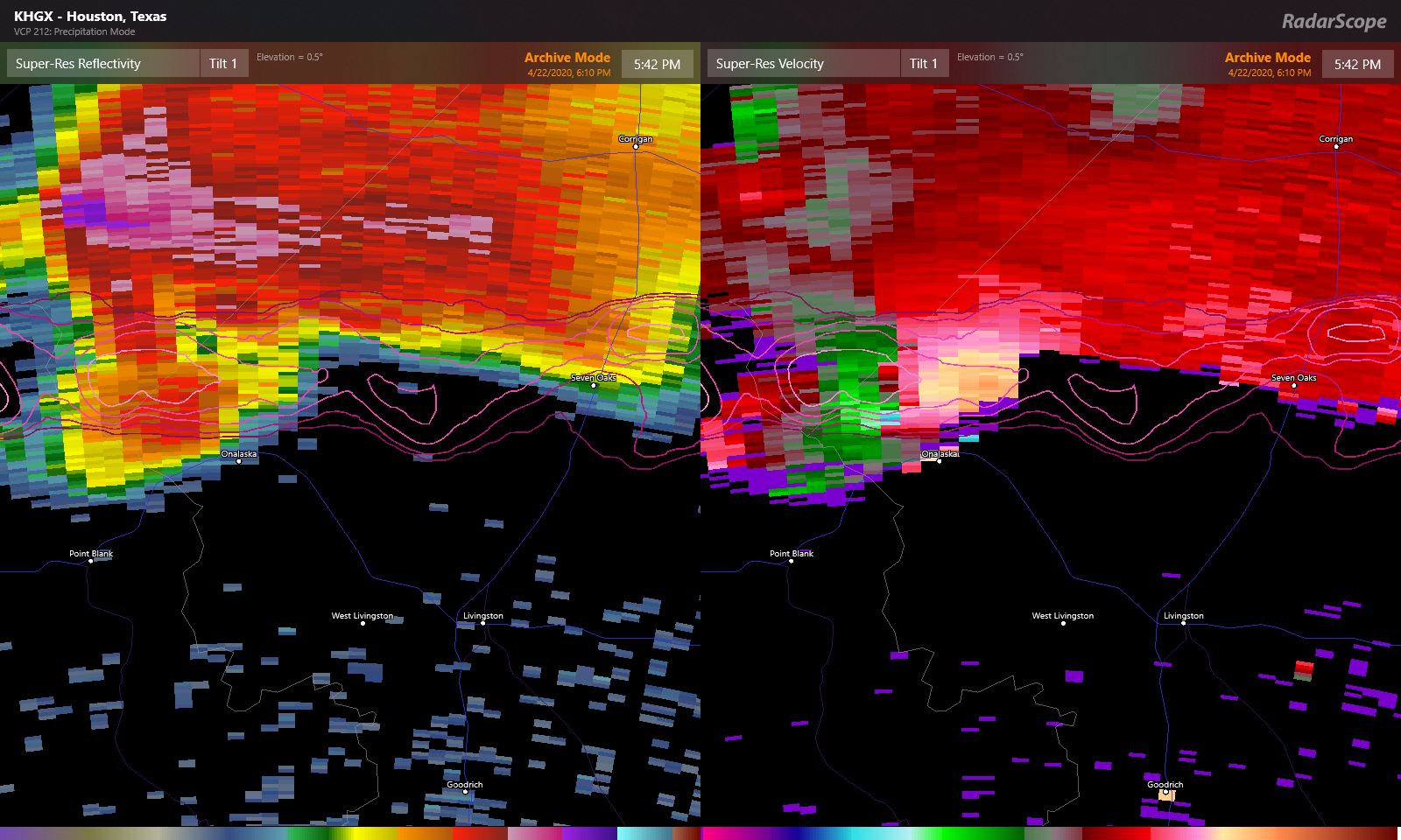
Since the weather is not terribly busy, let’s start with a couple housekeeping items today. First, the National Weather Service surveyed the damage from Wednesday’s tornado in Onalaska yesterday. They found that a tornado traveled from at least near Waterwood, on the west side of Lake Livingston through at least Barnes, in northeast Polk County.
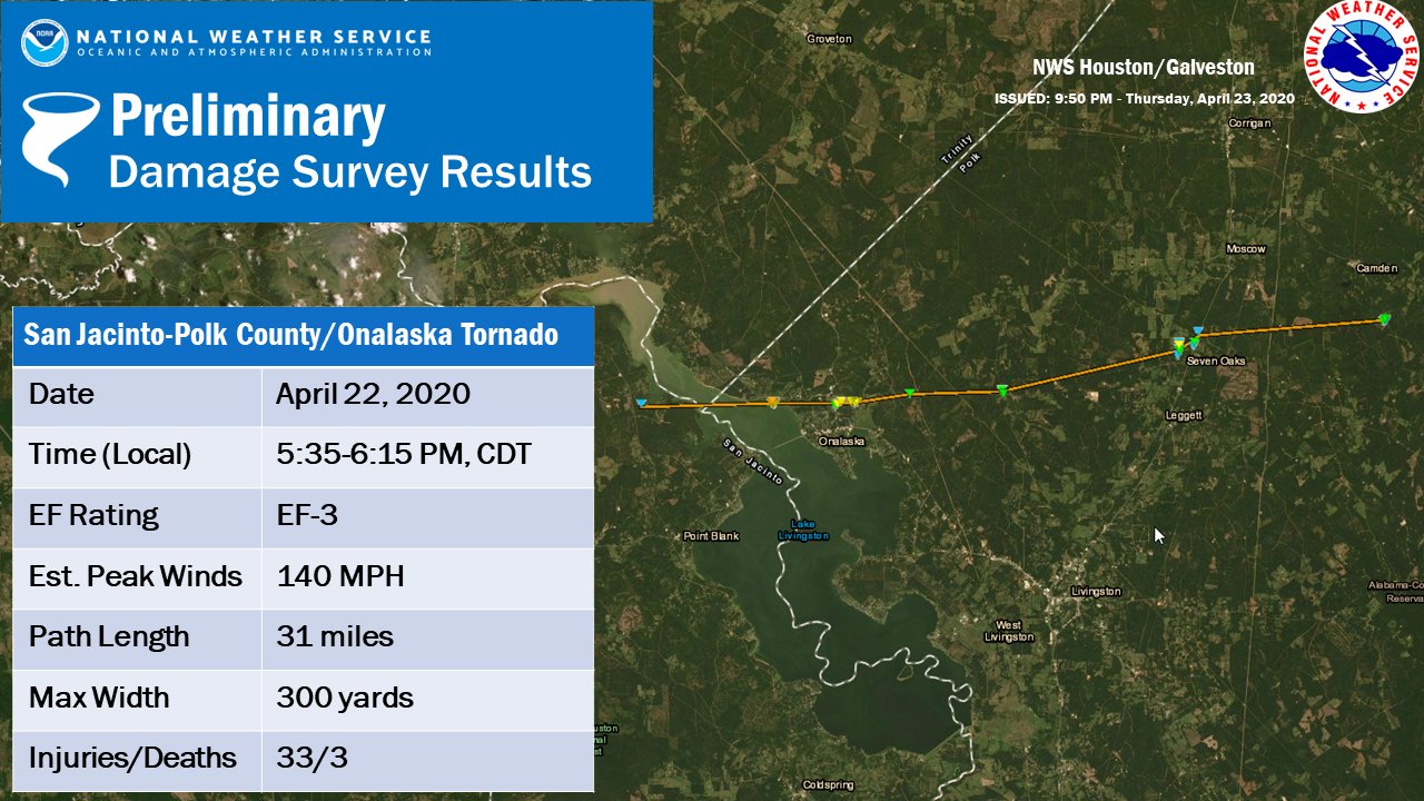
That’s a little over 30 miles, though it could change as more reports are examined. The survey team found mostly EF-1 and EF-2 damage in Onalaska, but they did find low-end EF-3 damage in Paradise Acres, just north of Highway 190 on the northeast shore of Lake Livingston. Maximum winds were estimated to be 140 mph.
We’ll update if any new significant findings emerge.
One of the other issues we have had that we’ve touched on from time to time, is dry weather. The latest drought monitor from yesterday shows the northern side of the Houston area mostly drought free, but steadily increasing drought conditions as you go south of the city.
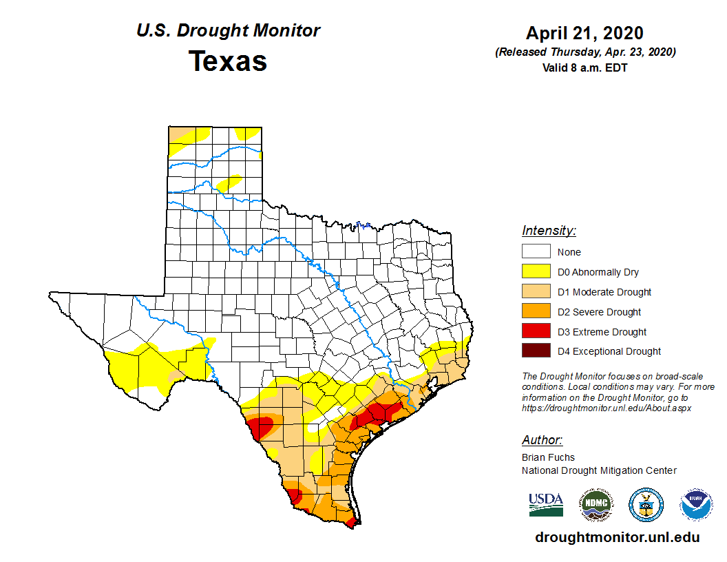
The entire Gulf Coast from Texas to Florida, which has been dominated by a ridge of high pressure for most of the winter and spring, is under some kind of abnormally dry or drought condition. Until that stagnant pattern can break or the daily afternoon thunderstorms of summer fire up, we will probably continue to see most organized storms pass us by to the north. We will keep tabs on things and let you know if that does change of course.
Alright, onto the forecast.
Friday
Most areas are crystal clear this morning, but some patchy fog has shown up in a couple spots. Either way, that will clear and we should expect mostly sunshine today with highs making a run for 90° this afternoon.
As a cold front begins to approach the area this evening, it could be carrying some thunderstorms. Areas north of Houston, unfortunately, stand the best chance of seeing these. Those storms could be locally strong to severe north of Houston, but they should be quick moving and the main threats would be isolated damaging wind or hail. Storms should begin to weaken as they approach Houston, and the most likely areas to see rain this evening would be along or east of I-45.
Bottom line: With a cold front approaching this evening, don’t be shocked to see a little rain or hear some thunder for an hour or two.

Weekend
Once the front clears overnight, the weekend should be delightful. Look for wall to wall sunshine with nothing worse than a few passing high clouds. Highs will top off in the low- to mid-80s Saturday and mid-80s Sunday. Overnight lows should be in the mid-60s on average tonight and upper-50s to low-60s tomorrow night into Sunday morning. All of this will complemented by north winds of 5 to 10 mph as well.
Monday
Look for a transition out of this pattern to begin Monday, thought it will still be very nice. There could be a little morning fog, but the rest of the day will see a few more high clouds and slightly higher humidity. High temperatures will warm into the mid-80s, with morning lows mostly in the low-60s.
Rest of next week
A basic blueprint for next week would be for clouds to increase more on Tuesday, with higher humidity and a slight chance of a shower. A cold front will probably arrive Wednesday and push through the area, bringing at least a chance of showers or storms. As in other recent events, I would not pin my hopes on this being the storm to bring us a widespread, soaking rain.
Behind Wednesday’s front, it appears we’ll see lower humidity and cooler nighttime lows. We are beginning to reach the time of year where it will be difficult to see substantially cooler daytimes with clear skies. So expect middle or upper-80s most days with lows ranging from near 70° ahead of the front Wednesday morning to low-60s or a little cooler behind the front. More on Monday!
Thanks Matt. Just an FYI, but this update doesn’t show up right on the homepage. Yesterday’s report is the first thing that shows up. It could be just my browser, but I’d thought I’d let you know.
Works fine here on a couple browsers. Might be the dreaded “clear cache” situation for you. Let us know if it continues!
Zip 77035 (Willowbend and S. Post Oak) is really dry these days.
Any idea when this horrible high pressure cap will break up or move away?