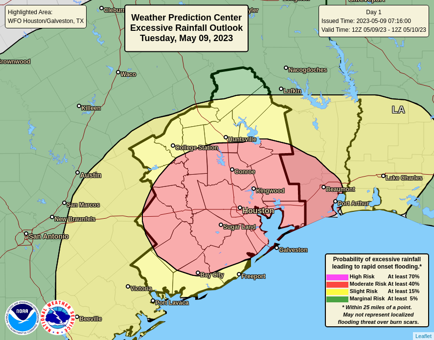
If you live south of Interstate 10, you may be wondering what all the fuss is about in terms of the potential for heavy rainfall this week. Much of the southern half of Houston did not see any rainfall Monday, whereas some locations near Tomball received as much as 4 inches of rainfall in a short period of time. This is a pattern we expect to continue today. Not everyone is going to see heavy rainfall, but the areas that do likely will see high rainfall rates that can quickly back up streets.
For today and tonight I expect that most of the area will receive 1 to 2 inches of rainfall, which is more than manageable. What concerns me is that the atmosphere is primed for heavy rainfall, and some locations within the Houston metro area may quickly pick up 4 to 6 inches through this evening, and this may cause more than nuisance street flooding. For this reason we are upgrading to a Stage 2 flood event for today. Please understand that most of the Houston region likely will not see serious flooding, but the potential exists and you need to be weather aware today and tomorrow.

Tuesday
This storm activity will be driven by a combination of a very moist atmosphere as well as upper-level disturbance over southern Texas that will produce the kind of lift needed for heavy rainfall. Storms have already developed near Victoria and Port Lavaca this morning, and they should steadily build toward the Houston metro area from the southwest. By mid-morning these storms should move into the central Houston area. The greatest threat appears to be from mid-morning to mid-afternoon for Houston.
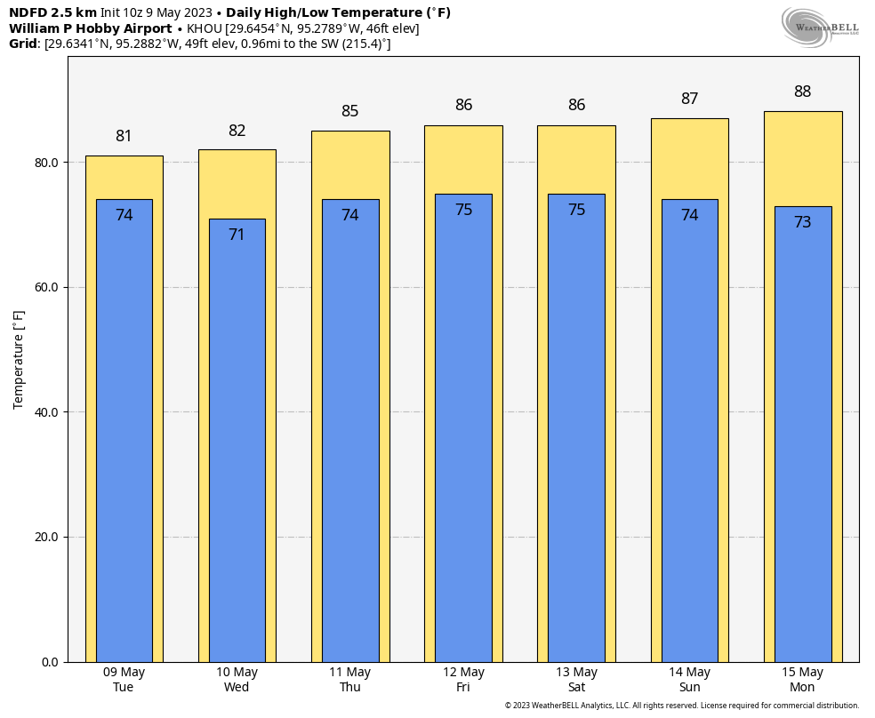
Highs, otherwise, will reach about 80 degrees in the metro area with cloudy skies. Winds will be out of the south at 5 to 10 mph. Rain chances will probably slacken this evening and into the overnight hours. Lows will drop to around 70 degrees in the city tonight, with slightly cooler conditions inland.
Wednesday
This will be another day with the potential for heavy rainfall and widespread showers, with perhaps an earlier start during the morning hours than on Tuesday. This may be a repeat of Tuesday in terms of a flooding threat, or not quite as bad. In any case, we’ll be watching things closely and publish an update this evening if warranted. Highs should again reach about 80 degrees, with light southeasterly winds. Lows should drop into the low 70s.
Thursday and Friday
As the aforementioned upper-level low pressure system starts to lift away from the Houston area, the threat of heavy rainfall should start to ease somewhat. That’s not to say rain chances will be zero, as they’ll still be in the 30 to 50 percent range each day. Both afternoons may see a bit of sunshine, allowing highs to reach the mid-80s. Lows remain warm and sticky.
Saturday and Sunday
So the weekend does not look ideal for outdoor activities. Saturday, in particular, should be cloudy with a healthy chance of light to moderate rainfall. I’m not concerned about flooding, but we may see some thunderstorms. Highs likely will be in the mid-80s. Sunday has a chance to be more favorable for outdoor activities, with lower rain chances and the possibility for partly sunny skies. Rain chances are still going to be at least decent, however, for some sprinkles or showers.
Next week
Modest rain chances likely will continue into next week as some sort of front—not a very strong one, alas—works its way toward the region. This may give us a few days with somewhat sunny skies and slightly drier air by Tuesday or Wednesday of next week. But that forecast, for now, is a mix of data and hope on my part. We’ll see.


Looks like you need to update the flood stage image in the right hand column.
This drought is bringing a lot of rain, and I am tired of everything being so wet, and slipping and falling on all of the mud slicks that are on the sidewalks. Houston should be called the mud pie. There is a trough to the west which is causing the flow of cool air and the moisture. It seems like the promised “early summer” is not arriving this week as the weather has been cool.
The longer summer holds off sounds great to me.
Will the weekend potential rain be a similar pattern where its worse the farther south you are? Wondering if a planned camping trip up to huntsville is still going to be feasible.
Will an outdoor tent rental work for Saturday’s weather?
Just a note about your stage 2 alert graphic: The text in parens (i.e. Katy) should use “e.g.” instead (i.e. means “it is” while e.g. means “for example”.)
I think thats more of a inside joke re SCW community
i.e is quite correct in that example. It is saying that ‘in effect’ it is just those areas that will be affected.
5/8″ rain by 1:00pm Westchase area, Rain stopped now.
It seems like it should have been obvious this was going to be just a quick line of storms today, given that it was an outflow driven line of storms in the southwest this morning moving northeastward. There’s no real chance of backbuilding with a storm like that. It doesn’t seem like today merits a moderate risk of excessive rainfall; perhaps that was meant for tonight? Isn’t the serious flood threat supposed to be tomorrow morning?
Agree TL. Rather meager rainfall. The posted flood risk kept some drivers home today and certainly influenced plans. I10 near downtown has less traffic right now. I guess better safe than sorry. NWS is having a tough go predicting this stuff. But we are so far behind normal rainfall, it has to come back. Not sure what all the quibbles about the flood chart…looked spot on to me from my inside the loop perspective.
We had similar rain as Ken reported here in Sienna. 0.65″ between 10:00 am and 1:45 pm, with the majority falling between 10:00 and 11:00. Really rapid drop in the air temp too at about 11:00.
this >>>> 92 degrees
Really though the almost turquoise skies were scary