We’ve talked about the late start to autumn this year in Houston, and we’re going to come very close to the latest start of fall on record. As a quick reminder, we’re defining “fall” as the first temperature of 65 degrees, or below, on or after Sept. 1. If we look at the data for the city, which goes all the way back to 1889, we can see how late we are this year in reaching this temperature, which denotes the arrival of the first decently strong “fall” front.
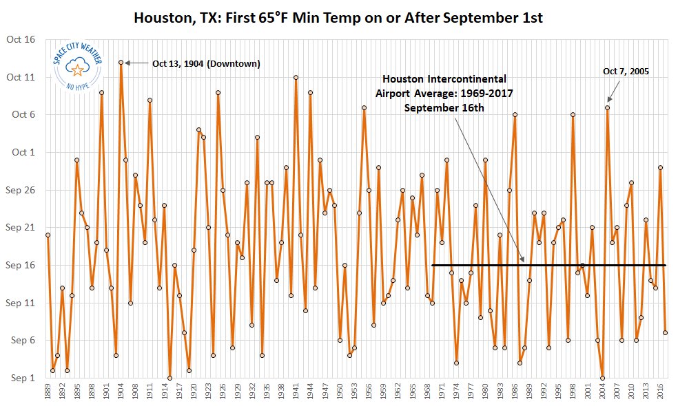
Today is October 9. Note that since the official weather monitoring station was moved to Bush Intercontinental Airport in 1969, the average date of “fall” was September 16th, and this trend line has been flat. The latest beginning of “fall” for this site came in 2005, on Oct. 7. We passed that a couple of days ago. The latest ever start to fall dates all the way back to 1904, when the downtown weather station didn’t measure a 65-degree night, or cooler, until Oct. 13. We’ll come close to that this year. But will be break it? Probably not.
Tuesday
We’re going to have one more sloppy humid day before some drier air arrives. Mostly cloudy skies should keep temperatures in the upper 80s, with some scattered showers and thunderstorms like the region saw Monday. While some of these storms could produce briefly heavy rain, we don’t expect them to persist for too long.
We’ve also seen might higher water levels along the coast during the last day or so; this is due to stronger lunar tides, persistent southerly winds, and waves from the distant Hurricane Michael. The effects of this should ease by Wednesday morning, with the passage of a cool front and wind shift. A coastal flood advisory remains in effect until that time.

Wednesday
A moderate cool front—meaning it originates from the northwest instead of diving due south from Canada or the Arctic—arrives on Wednesday. Clearing skies will allow for highs to push up into the mid- to upper-80s, but we’ll definitely notice the drier air as the Sun goes down. Lows Wednesday night will be in the upper 60s to 70s closer to the coast, and lower- to mid-60s inland.
Thursday and Friday
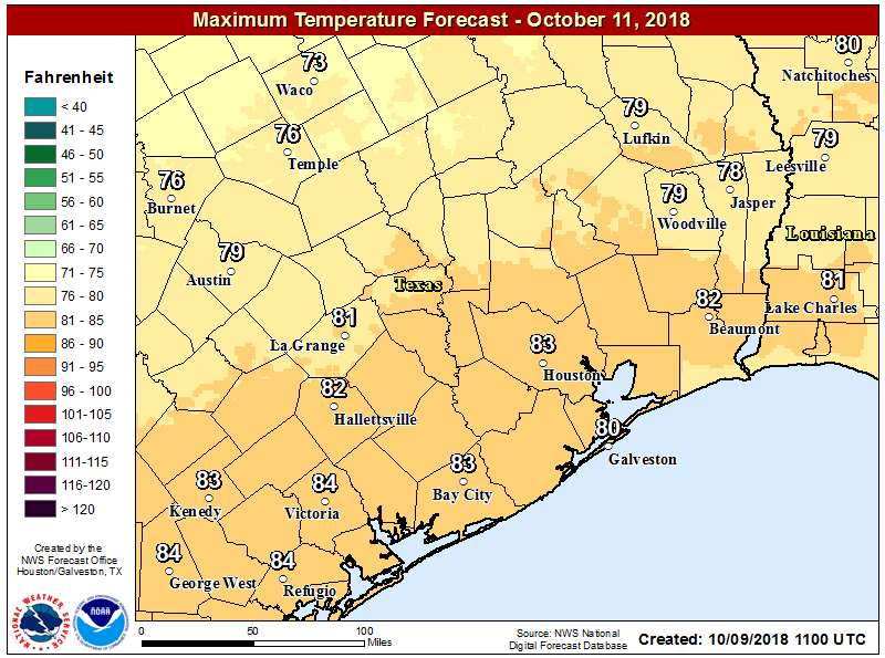
Thursday morning (Oct. 11) is Houston’s first chance to record a 65-degree temperature at Bush Intercontinental, but it’s not guaranteed. If we miss out on Thursday or Friday, we’ll definitely hit it by next Monday. Either way, the end of the work week should be pleasant, with sunny days, highs in the lower 80s, and overnight lows in the 60s. Our first real taste of fall is going to be darn nice.
Saturday, Sunday, and beyond
Saturday should be a lot like Thursday and Friday, although we’ll see a slight bump in rain chances on Saturday as some moisture begins returning from the Gulf of Mexico. Highs both Saturday and Sunday should be in the low 80s.
A second, considerably strong cold front pushes through later on Sunday, or Monday, and this will bring a decent chance of rain to the area. Forecast models suggest we could see 0.5 to 1.5 inches of rain later Sunday and Monday with the front’s passage, and in its wake.
The front will also usher in demonstrably cooler weather. High temperatures next week will probably be only in the 60s for a few days, before they recover to the 70s for the second half of the week. We may also see a sustained stretch of nighttime temperatures in the 50s for inland areas. This is fall, for real.
Do you think an outside party at 2-5 pm on Sunday will get rained out?
Aaaaaaaahhhhhhhh! Fall is almost here! [Pause] I can be calm about this. [Pause] Aaaaaaaaaahhhhhhhh!
Still more rain…
We’ll actually get the cold front? It won’t be blocked by Sergio?
It would be interesting to see if there is any correlation between the late fall and the length of summer. Did we have a late start to summer or earlier? It seems that there is a cyclical pattern, I wounder what the driving forces are.
Jason, I would look at the jet streams.
Any Early info on TS Nadine?
Based on what I think I’ve gathered from reading this blog, the arrival of this cool front essentially ends the hurricane season for us.
You mentioned coastal water, Michael seems to be taking a similar track to Alberto did back in May, which if I’m not mistaken was part of the reason for the beautiful blue water in Galveston. Is there any chance this could happen again?
Your thoughts on the area of interest in the Caribbean ( drifting westward ) that the NHC is watching?
I am seriously tired of all this rain, day after day after day. I’ll take 95 degrees and sun any day.
Seriously! It’s downright depressing that it rains every single day.
Eric, could, you please, address Disturbance #1 in the Caribbean. It is now given 30% chance of development by the NHC. What are the odds of it developing and tracking to our area? Does the arrival of cold fronts now mean that we have broken the odd October weather pattern and the storms should not be kept away from us? Thank you very much!