Scattered thunderstorms—some of them pretty intense—have begun dying out this evening with the loss of daytime heating. After what I expect to be a fairly quiet night tonight, what comes on Wednesday?
Probably some more rain. We’ll see a spike in atmospheric moisture levels on Wednesday, and several forecast models show a fairly healthy line of showers moving down through Texas, likely reaching the College Station area an hour or two after sunrise, and perhaps moving into the Houston area by around noon. Note: these times are estimates, and the timing may vary. But I think it’s reasonable to expect the possibility of some heavy rain in Houston between the late morning hours on Wednesday until around 5 p.m.
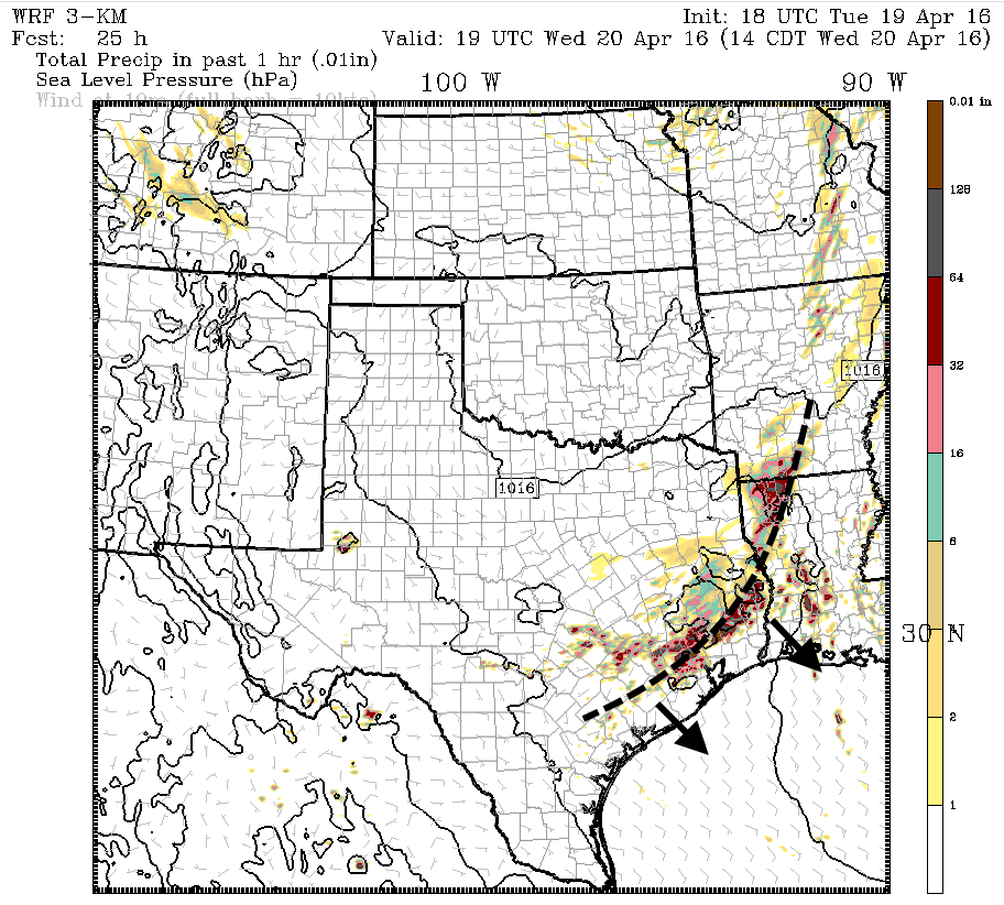
How much? We may see perhaps 1 to 3 inches across fairly widespread areas, but could easily get more in isolated areas (can’t pinpoint where, sorry). I don’t expect this system to prove the rainmaker that we saw Sunday night and Monday morning, but after all the rains we’ve received, and the swollen rivers and bayous (especially on the western side of Harris County) we’ll have to watch this system closely. There shouldn’t be much in the way of severe weather beyond heavy rain, but that will be enough to contend with. It’s also possible we see less activity than is forecast, but I would certainly not bank on that.
Yet another round of rain will be possible on Thursday, but we can worry about that after seeing what Wednesday brings. I’m still expecting better weather—drier, sunnier—on Friday and Saturday.
Posted at 8:45pm CT Wednesday
Eric,
What the heck is going on with the creeks in Spring specifically Cypress Creek? I believe it was supposed to crest at 1 PM today but just heard a report that the 45 North Feeder road is closed past 1960. Can we expect this to go higher?
Thank you for your daily updates!
It peaked again this evening but is forecast to fall during the overnight hours.
http://water.weather.gov/ahps2/hydrograph.php?wfo=hgx&gage=wfdt2
Is Katy going to be affected by these new storms?
It’s quite possible, yes.
Is Kingwood going to be affected by the storms?
Sally, hard to pinpoint any one area right now. But Kingwood has as good a chance as any.