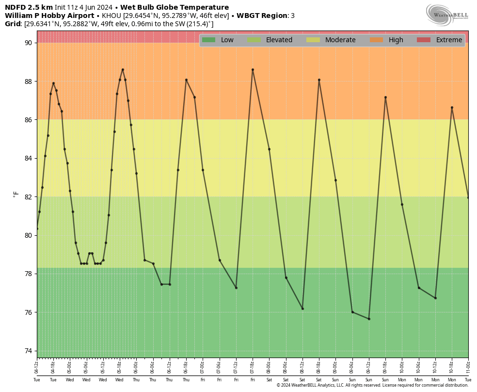
In brief: We may see a broken line of showers and thunderstorms move into the Houston region today, although I think rainfall accumulations will be hit or miss. Still, it’s something to be aware of if you’re going to be out and about today. After that we’re looking at several days of hot and sunny weather, although there’s a non-zero chance of a weak front early next week.
Hurricane season outlook
As you probably know, a majority of predictions have forecast the 2024 hurricane season to be especially active. On Thursday I’ll be discussing the seasonal outlook with Reliant’s Lyris Leos, and what Houstonians should consider heading into the season. The broadcast will occur at 2 pm CT on Facebook Live, and will also be available as a recording afterward. You can ask questions in the comments below, or on Facebook.
Wednesday
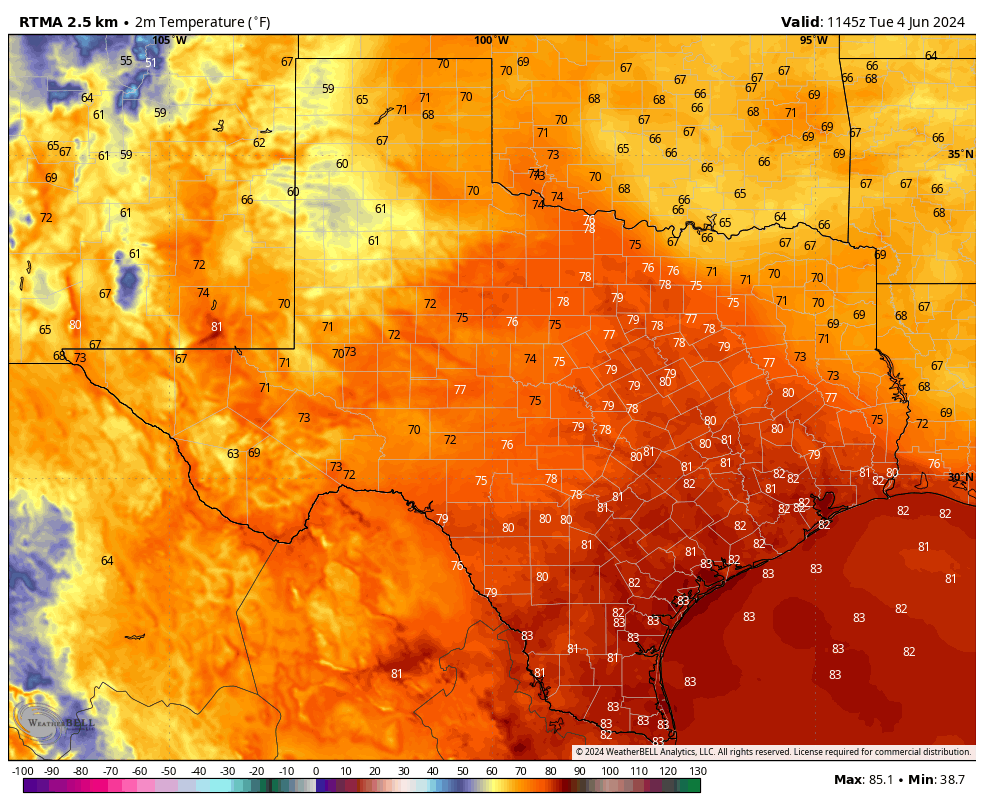
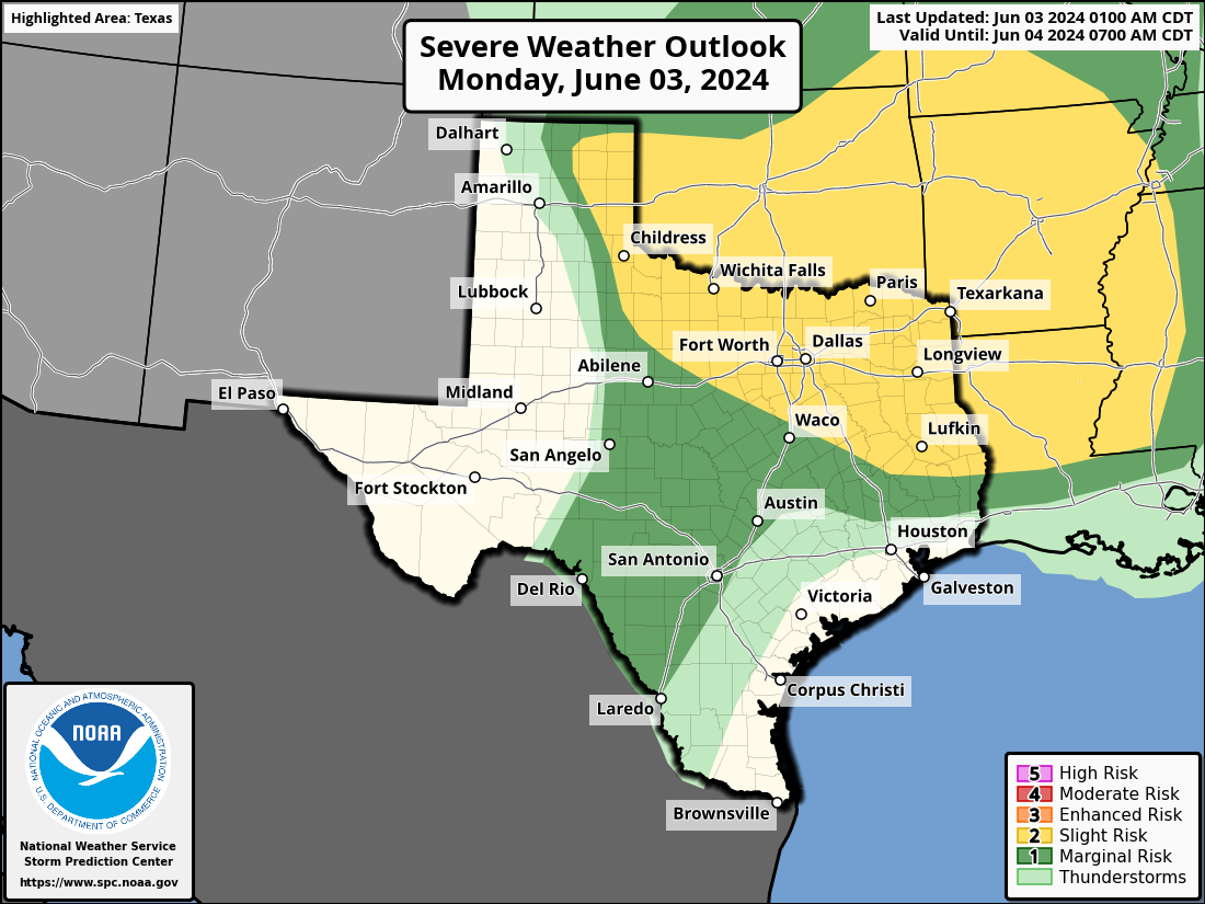
There is a complex of thunderstorms near Waco and Lufkin this morning that will move steadily southward. Although I’m not convinced this line of organized storms will hold together, some showers and thunderstorms may move into Houston later this morning, likely reaching areas such as The Woodlands and Kingwood 10 am to noon, central Houston an hour or two later, and pushing into coastal counties around noon or shortly after. Anything that develops will likely have cleared the area by this evening’s commute.
Rainfall amounts will be widely variable, with a few isolated locations perhaps seeing 1 to 2 inches of rain, and many other parts of the metro area no accumulations at all. I can’t rule out some severe thunderstorms with this line, but overall the chances for strong winds and hail are fairly low. Highs will depend on the extent of clearing this afternoon, but most locations should reach the low 90s with partly sunny skies after the system passes through.
Thursday
A sunny and hot day, with highs in the mid-90s across much of Houston. Rain chances look to be close to zero. Winds will be light, from the south.
Friday
Another hot and sunny day, likely the warmest of the week. Expect parts of Houston to reach the upper-90s.
Saturday and Sunday
The weekend should see continued hot and sunny weather, with highs in the mid-90s and plenty of humidity. Rain chances are low to non-existent. Lows will be in the upper 70s.
Next week
The forecast turns more interesting early next week. I’m not ready to make any guarantees, but there is an increasing likelihood that some sort of weak front may work its way into Houston. Since we’ll be well into June at that point, we still should be somewhat skeptical, but there’s a decent chance we’ll see some showers on Monday or early Tuesday, followed by an influx of some somewhat drier air. We should have more confidence in this forecast by tomorrow or Friday.