Good morning. Temperatures have dropped into the upper 30s to lower 40s across most of the Houston metro area this morning, and this is the coldest we’re going to get until the middle of next week. We’re still looking at the likelihood of widespread showers on Friday before a mostly sunny and cool winter weekend.
Thursday
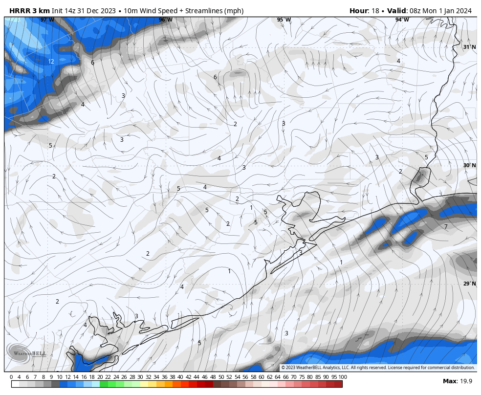
After the cool start, temperatures today should reach about 60 degrees under mostly sunny skies. Winds will continue from the east, and we may start to see some gusts this afternoon of 20 or even 25 mph. Clouds will start to build in this evening, but I think rain chances will hold off at least until midnight, and probably more likely until the hours just before sunset on Friday. Look for lows tonight to drop down to around 50 degrees in Houston.
Friday
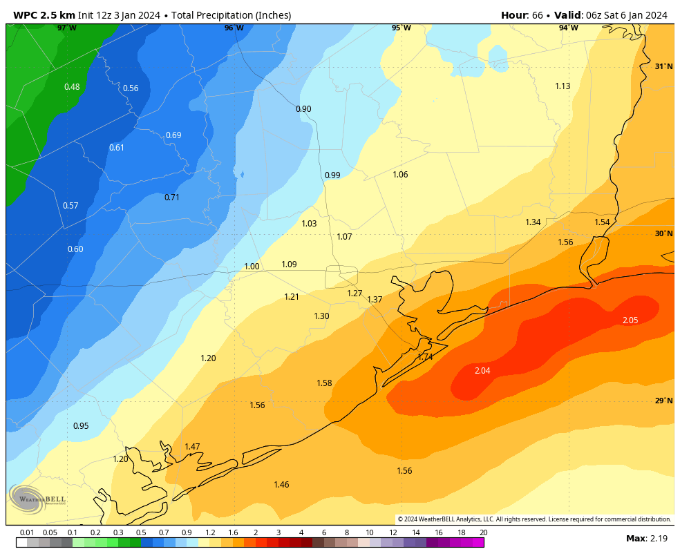
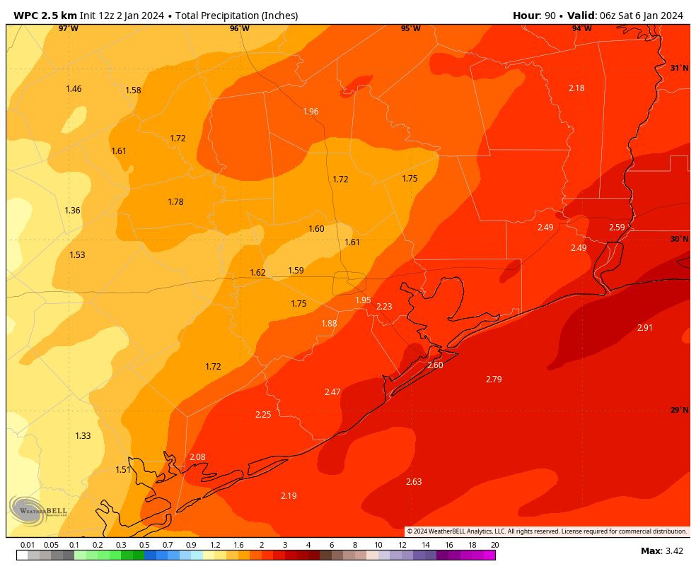
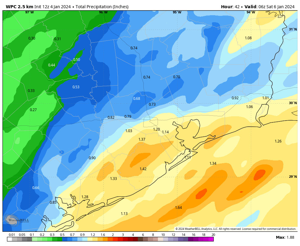
A low pressure system will bring widespread rain chances on Friday, particularly during the morning hours. There’s no indication in the atmosphere or forecast models for anything extreme, both in terms of rain accumulations or severe thunderstorms. Most of the area probably will pick up between 0.5 and 1.5 inches, with the greater totals more likely south of Interstate 10, closer to the coast. In terms of timing, the showers should generally move in from the west and exit to the east of Houston by around noon, give or take a couple of hours. We should see some partially clearing skies by later Friday afternoon, with highs in the low- to mid-60s.
Saturday and Sunday
The weekend should see partly to mostly sunny skies, with dry air, and daytime highs generally in the low 60s. Friday and Saturday nights should be cool, but by Sunday evening we’ll see a resurgent onshore flow that will start to pump up atmospheric moisture levels and humidity. This will set the stage for another round of showers on Monday.
Monday and Tuesday
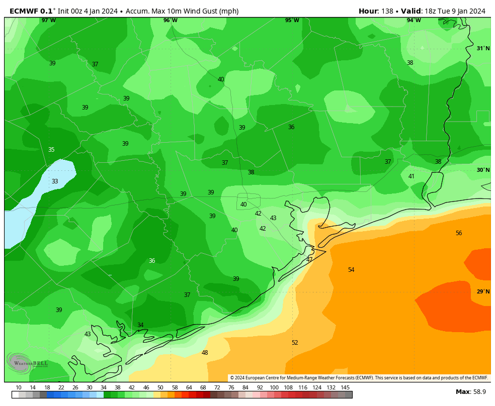
Monday could be a bit dynamic as a strong cold front approaches the area. This will bring showers, and potentially some strong thunderstorms during the daytime. We’ll try to have some better details on this for you in tomorrow’s update. The front will then bring some very strong northerly winds with it, with gusts up to 35 or 40 mph in Houston, and the potential for even stronger winds closer to the coast. These winds are likely to peak on Monday night and Tuesday morning, so that’s something to be aware of if you’re going to be out and about. This may be an issue for any tailgating associated with Monday evening’s College Football Playoff National Championship at NRG Stadium, depending on the timing of the front.
Tuesday should be sharply colder, with highs only in the 50s to go along with the strong winds. Lows on Tuesday night will probably drop at least into the upper 30s for Houston, with a light freeze possible for areas further inland—we’ll see.
Rest of next week
We’ll likely warm back up by Wednesday or Thursday before another front brings things back down for the weekend. My sense is that startline temperatures for the Houston Marathon on Sunday morning will be in the vicinity of 40 degrees, but there’s still a lot of time to go before that forecast is set in stone.