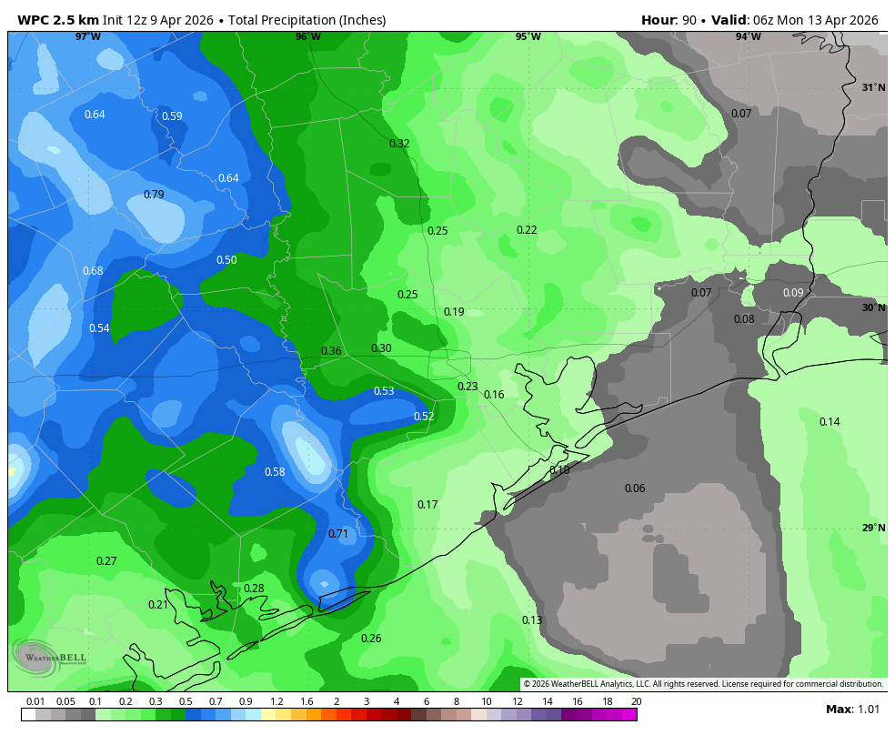
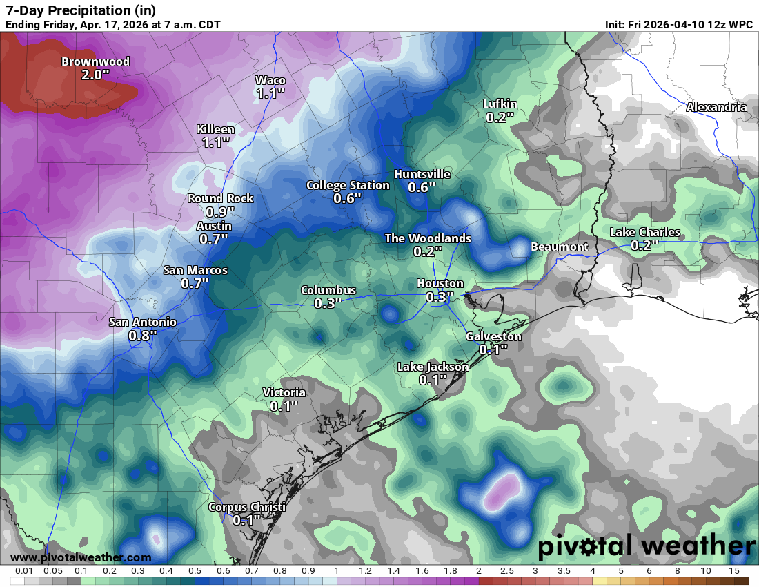
In brief: Daily rain chances will remain for Houston over the next several days, but admittedly on most of those days it seems unlikely we’ll cash in. While there will be a couple opportunities for legitimate rain chances over the next 6 to 7 days, Central and West Texas may end up in a much better spot than Houston for now.
Side note: We wish the Artemis II crew a safe return, as they splash down this evening (just after 7 PM CT) off the coast of Southern California. The weather looks good.
We hear you, reader. We talk about rain chances more often than we actually seem to get them. It seems true. It feels true. And I don’t disagree. We’ve been in a shaky pattern for several months now where rain chances, especially out around days 3 to 7 look promising, only to disappoint when the bill comes due. Is it drought or a model bias? Both? I’m not totally sure. But I do know that fading the rain chances has worked more often than not lately.
Now, we did see just shy of an inch of rain yesterday near Eagle Lake at a CenterPoint gauge. But that’s way out there in Colorado County. Still, that helps (especially for farmers that are struggling with this constant battle of stress that’s been with us for a few growing seasons now). But for most of us in Houston seeking rain, it’s just been a frustrating go of it. Let’s walk through things based on what we know this morning.
Today
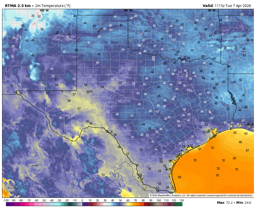
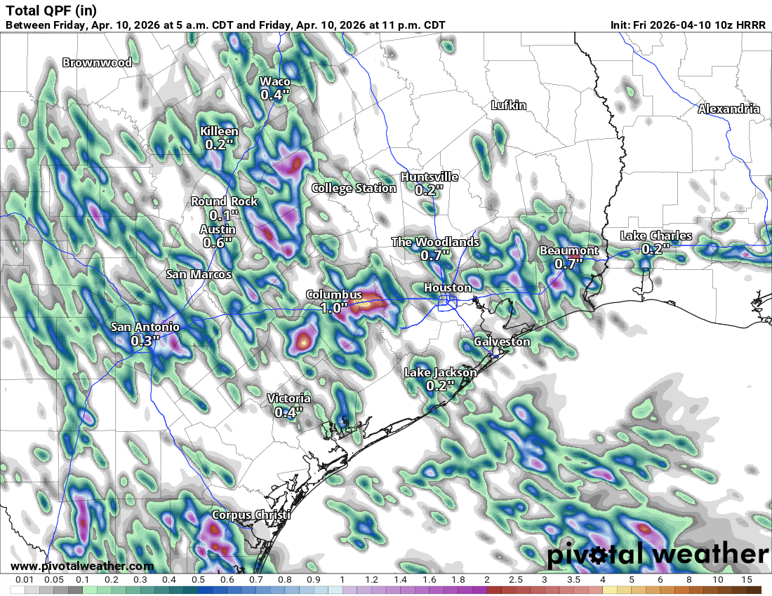
We will see at least isolated to scattered downpours across the area today. Many of you probably won’t see much rain, but some neighborhoods could pick up a quick inch or two. The HRRR model forecast below shows isolated pockets of heavier rain in between a lot of nothing. Don’t focus on the specific locations here, but that’s the general gist of what to expect.
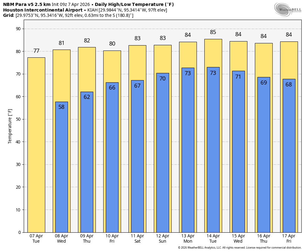
Other than that, expect clouds, some sun, and highs in the lower 80s.
Saturday
Rain chances will probably favor Central Texas over East Texas on Saturday. Still, a few showers are possible west of Houston tomorrow. Highs will be a touch warmer, into the low or mid-80s.
Sunday
More substantial rain chances will creep closer on Sunday, but they may still remain primarily west of Houston. I would expect to see some sort of thunderstorm cluster or line of storms enter the Brazos Valley during the afternoon hours. However, the trajectory of a disturbance in the upper atmosphere and the general southwest to northeast movement of things across Texas this weekend may lead to most of the storm activity passing northwest and north of Houston. I would set my expectations low for Sunday in terms of rainfall, unless you live in College Station or perhaps Huntsville or Lake Livingston.
Those that do see rain could see hefty rain, however, as the atmosphere will be pretty juiced up this weekend. So if you hit a persistent area of rain, just be wary of some street flooding.
Monday
The pattern shifts a bit more eastward on Sunday night and Monday. We should again at least see a smattering of activity around the area, but I would once again set my expectations fairly low. Highs on Monday will be in the mid-80s with lows in the 70s.
Tuesday through Thursday
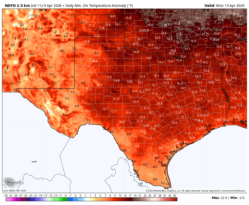
Houston will be caught between a building upper-level ridge in the Southeast that’s going to lead to some impressive, record warmth next week in the Eastern U.S. and a deepening trough in the West. These situations don’t typically lead to us seeing the rain we otherwise could, and it could be a situation where there are daily thunderstorms impacting West and Central Texas, while the Houston area gets the shaft. Obviously, this could change, but again, the theme today is to keep the expectations low. And maybe go wash your car. Yeah. That should do the trick.
Temperatures will remain well into the 80s next week.