In brief: Houston can expect to see fairly widespread showers and thunderstorms this afternoon, some of them becoming severe. It will be an afternoon to be weather aware across the region. Tonight very breezy conditions arrive as a cold front blows in to cool us down for the remainder of the week.
Wednesday’s storms
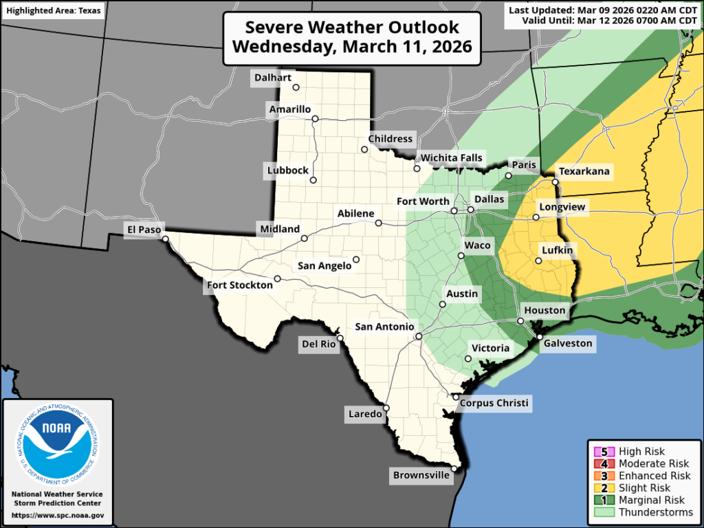
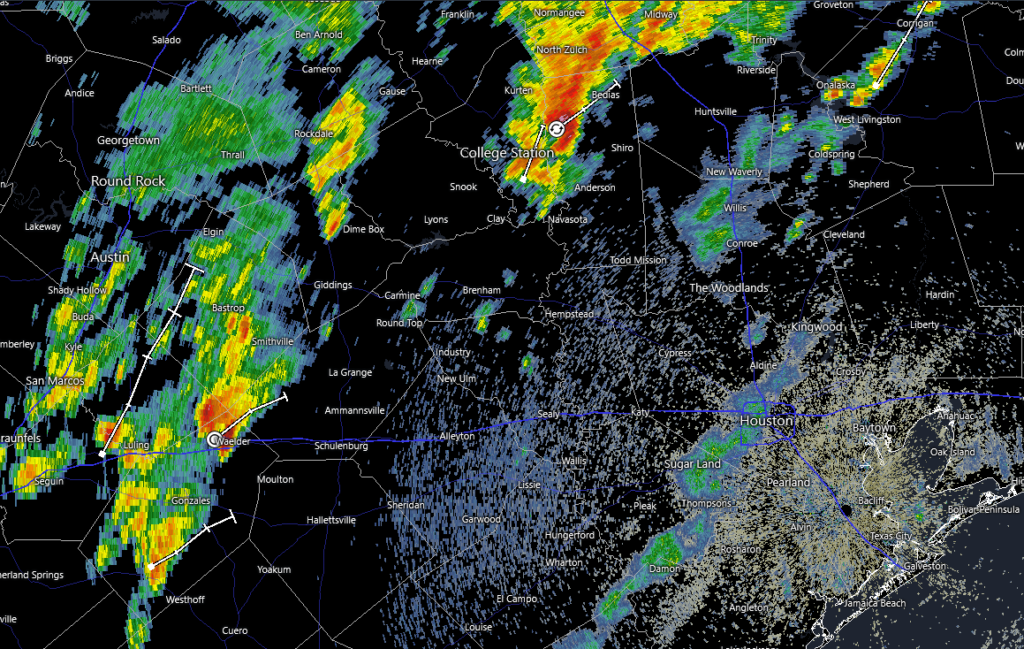
If you largely missed out on rain this past weekend an approaching cold front will offer another chance today as showers and thunderstorms fire up ahead of the front. Houston already is seeing some sporadic activity during the pre-dawn hours, and a cluster of storms is presently affecting the College Station area.
Metro-area activity should increase in coverage later this morning as the system moves in from the west, and Houston should see fairly widespread showers and thunderstorms from around noon to 6 pm. There is the potential for heavy rainfall, however the storms will be moving at a decent clip. So for most locations I expect accumulations of 1 inch of rain, or less (with some locations only seeing a smattering of rain). A few places, of course, may very well see higher bullseyes of rainfall.
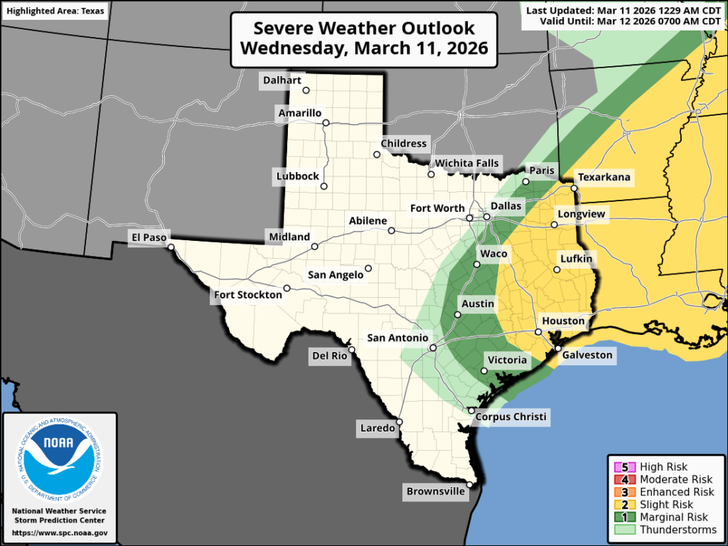
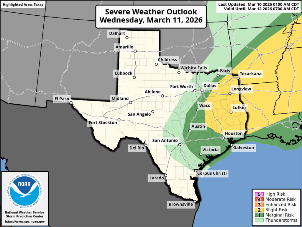
Notably, there is also the threat of severe weather with some of these storms. Although conditions will be most favorable along and north of Interstate 10, we cannot rule out damaging winds, hail, and possibly even a tornado throughout the Houston area today. Please be weather aware this afternoon if you are out and about, and check the radar before hitting the road. Not everyone will see inclement weather, but where severe thunderstorms do develop conditions could deteriorate quickly. The majority of storms should have exited the area by or before sunset.
Wednesday

Aside from the potential for storms, the other notable feature about today’s weather is the temperatures. Lows this morning have only fallen into the mid-70s for much of the region, which is very warm. Highs today, with mostly cloudy skies, will reach around 80 degrees with plenty of humidity. As noted above, storm activity will increase in coverage this afternoon.
Houston rodeo forecast
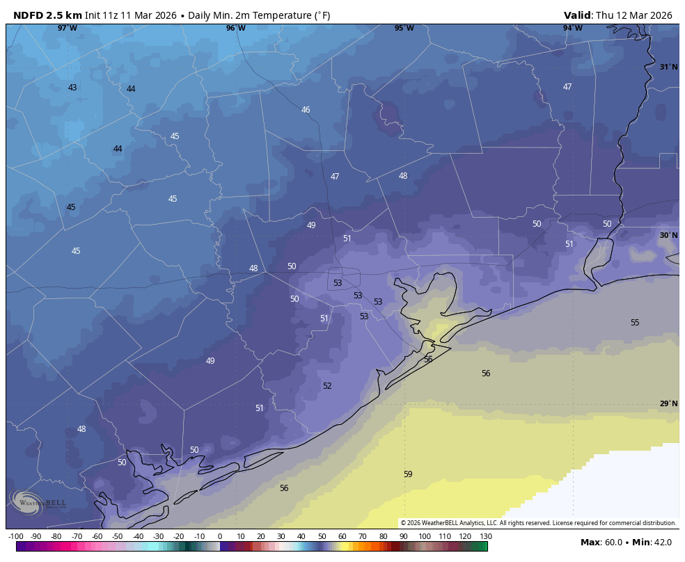
There is the potential for storms in the Houston metro area, including near NRG Stadium, this afternoon. But by around 6 pm I do expect them to be clearing out. That’s not the end of things, however, as we will see gusty winds from the north later this evening. By around 9 or 10 pm winds should increase further in intensity, perhaps up to 35 mph. You probably will feel this after the show as colder and much drier air moves in. These winds will blow all night, bringing temperatures down into the low 50s by Thursday morning.
Thursday
This will be a spring-like day with highs in the upper 60s and brisk, northerly winds gusting up to 25 mph. Skies will be sunny. Winds should start to slacken some by the evening, with a majority of the area falling into the upper 40s on Thursday night.
Friday
This will be a sunny, pleasant day with calm winds. Look for high temperatures in the mid-70s. No complaints, really. It will be spectacular. Lows on Friday night will fall into the mid-50s.
Saturday and Sunday
Temperatures this weekend will be warmer, with highs in the low 80s on Saturday and mid-80s on Sunday, and mostly sunny skies. Still, humidity does not look to get too high. The region’s next front arrives late this weekend, perhaps on Sunday evening or Monday morning. At this point I don’t foresee much in the way of storms with this one.
Next week
I’ll have more on this tomorrow, but Sunday’s front could usher in some significantly cooler air, with a few nights in the lower 40s in Houston, and possibly even upper 30s for more rural locations. We’ll have to wait for details, however, as I want to see a little more consistency in the models before hazarding a firm forecast.