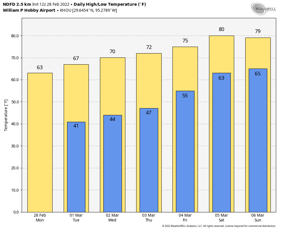
Good morning. We’re continuing to warm up, with temperatures this morning generally 40 degrees or above for the metro area. We’re going all the way to the low 80s by this weekend before the next front arrives. If you’re looking for more signs that spring is coming, you can check the Houston Health Department’s daily pollen and mold count report. We’re starting to see heavy levels of tree pollen. For some of us, this means the beginning of a sneezy spring.

Wednesday

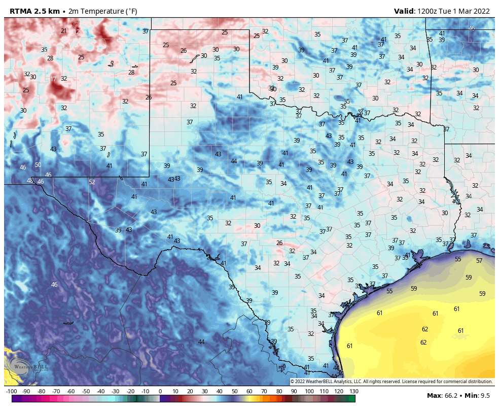
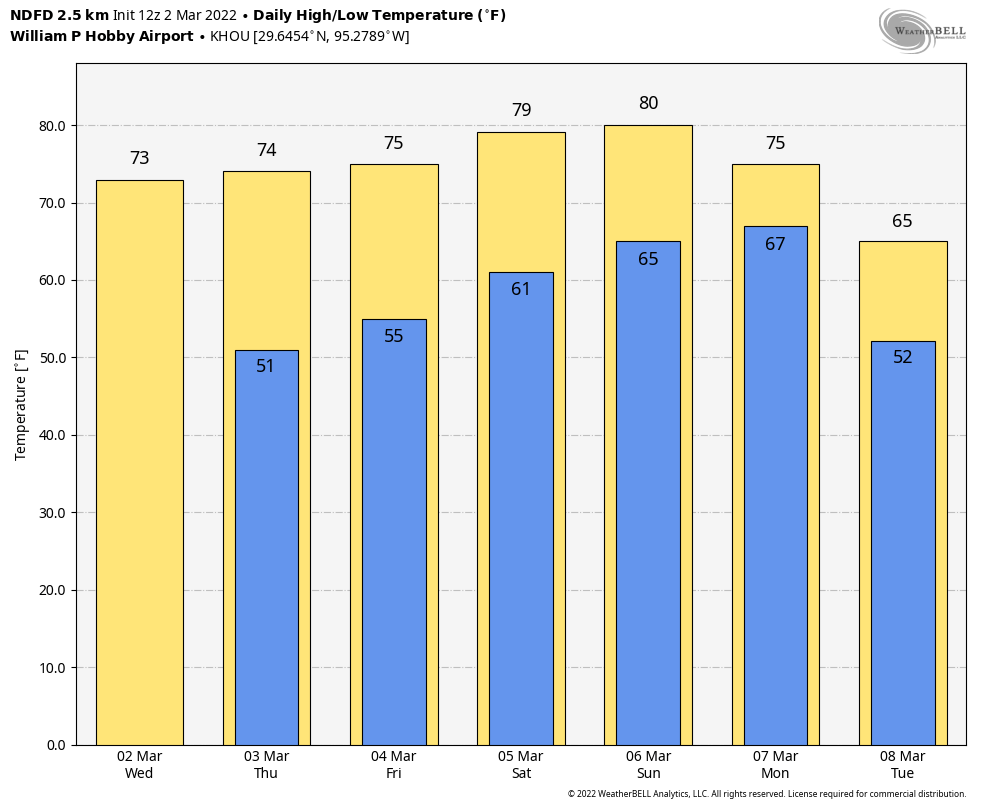
High pressure remains in place, and that will bring us one more day of really dry air. Highs today will warm to about 70 degrees, or a little bit warmer, with light southeasterly winds. Skies will be mostly sunny, but a few clouds are possible tonight as low temperatures drop into the 50s across the region.
If you’re heading out to the Houston Livestock Show and Rodeo to see Tim McGraw later today, temperatures this evening should be in the low 60s, with light winds, and partly cloudy skies. After the show, temperatures will have dropped into the upper 50s, with perhaps a few more clouds. So there are no weather concerns at all!
Thursday
High temperatures will likely rise to the mid-70s on Thursday, with a little more humidity. Skies should still remain partly to mostly sunny, however. Lows Thursday night won’t fall much below the mid- to upper-50s.
Friday
This should be another partly to mostly sunny day, with highs in the mid-70s. As winds from the south become a little more pronounced at 10 to 15 mph, it will also start to feel more humid outside. Lows Friday night may not drop below 60 degrees.
Saturday and Sunday
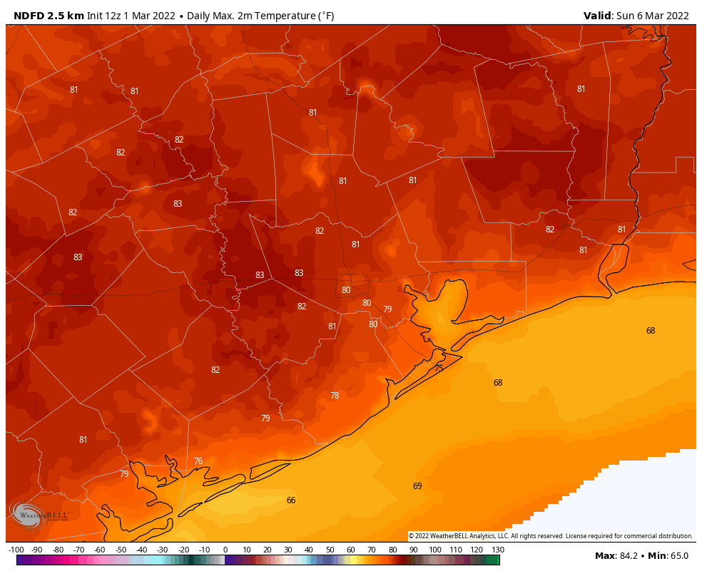
The forecast for the weekend is coming into better focus, and it looks to bring warm and partly sunny weather to the region. Look for highs both days to reach about 80 degrees, and perhaps a few degrees warmer for western parts of the Houston area. While some light, very scattered showers are possible each day, overall there doesn’t seem to be much atmospheric support for rain to develop. Overnight lows will be warm, in the mid-60s.
The next cold front should arrive some time on Monday, likely cooling our weather down into the 60s, with lows in the 50s. We probably won’t see as much sunshine after this front as the atmosphere remains disturbed and with showers are possible into mid-week.