In brief: In today’s post we discuss the likelihood of Saturday being fine to get out and about in Houston, and whether that is likely to change on Sunday. We also have some thoughts for people driving north on I-45 and west on I-10 this weekend.
Big picture on the winter storm
Not much has changed overnight with the forecast for this weekend. A strong Arctic front will arrive in the region on Friday or Friday night, but it still appears that coldest air behind this front will only gradually spill into the Houston region. Therefore, if you’re planning to remain in the Houston metro area (i.e. from The Woodlands to Galveston, and Katy to Baytown) you should be able to go about your activities as normal throughout the daytime Saturday. I think roadway conditions will also be fine on Saturday evening, prior to 9 pm at least, but we’ll have to see.
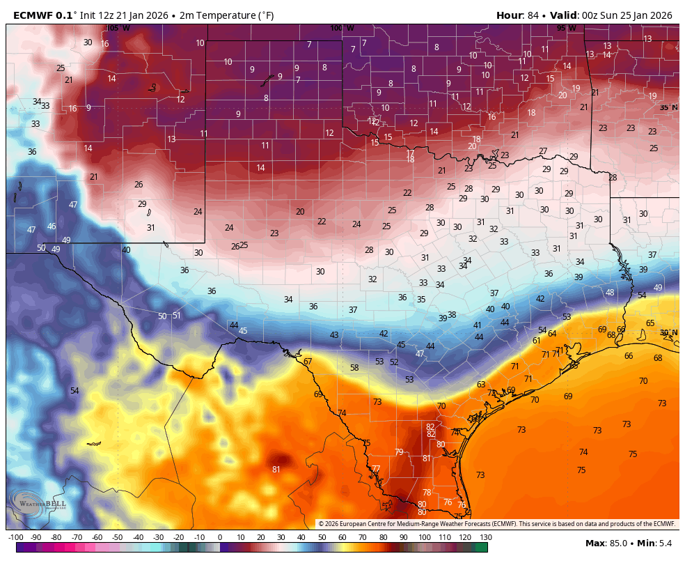
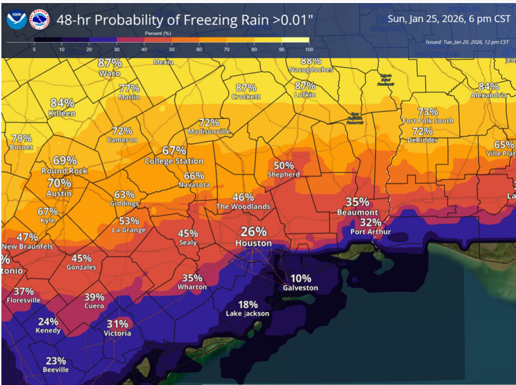
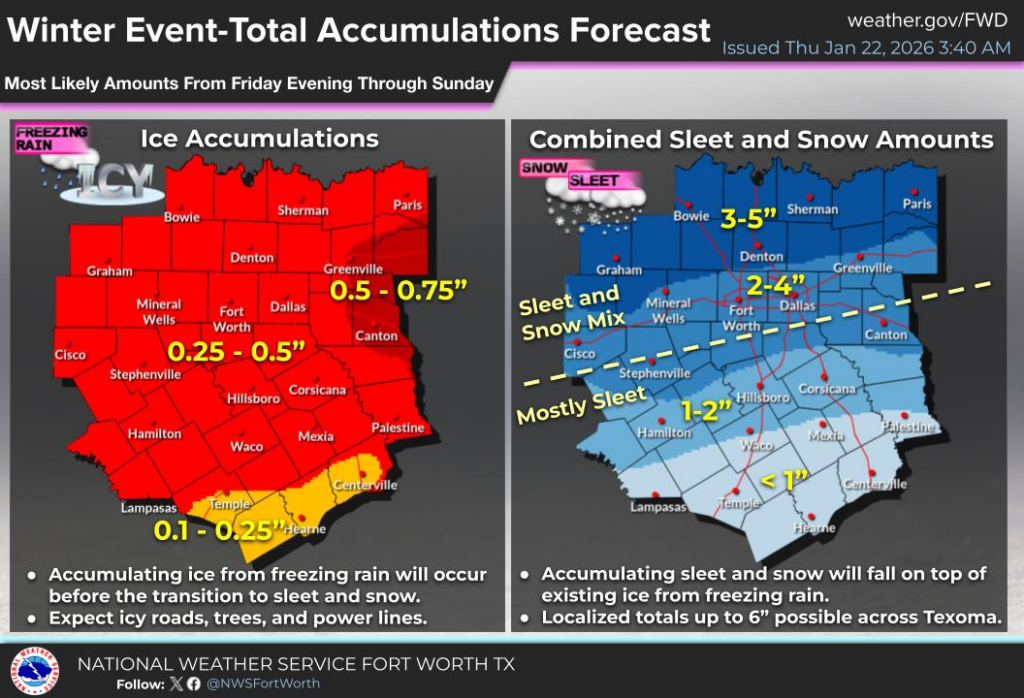
Sunday is now the greater concern as this is when the colder air will arrive in Houston. The question, as we’ve been talking about for a few days now, is the timing of the colder air’s arrival and the end of widespread, light showers. I think there’s a decent chance that showers and freezing temperatures overlap on Sunday morning, in which case roads become icy and dangerous to drive on. Whether this occurs on bridges and overpasses only, or a majority of roads remains to be seen. But you should be prepared for disruptions, especially along and north of Interstate 10.
Our coldest temperatures will descend into the region on Sunday night into Monday morning, when there will be a hard freeze across the region. Whether roads remain icy during this period will depend on the amount of precipitation, afternoon temperatures on Sunday, sunshine later on Sunday, and a host of other factors I just cannot predict. But there is the distinct possibility of ice on roads through Monday morning. We’ll see.
What if I need to drive north on I-45?
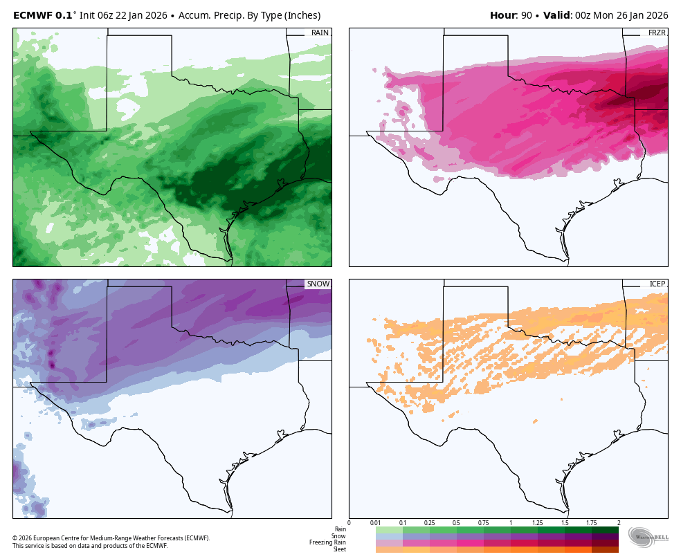
There must be a lot of cheer competitions in the Dallas area this weekend because I have received an extraordinary number of questions about participants. I wish you all well, if the competitions proceed. My sense is that travel north all the way to Dallas should be fine on Friday and Friday afternoon. At some point on Friday night, maybe sunset, maybe 9 pm, maybe midnight, rain will start to transition to sleet or freezing rain in the Dallas-Fort Worth metro area. After that temperatures will remain below freezing through at least Monday morning, and perhaps all the way to Tuesday. Roads in the region up there will likely range from hazardous to borderline impassable for the weekend.
What if I need to drive west on I-10?
You have a little more time if you’re headed west. Driving along I-10 should be fine on Saturday, and likely into Saturday evening. But again, at some point Saturday evening or Saturday night there will likely be a transition to freezing rain that will last into Sunday morning. I would imagine that driving back from Austin or San Antonio will be fine on Monday afternoon.
What if I live north of Houston, in the Piney Woods or College Station?
For locations on the northern fringes of the Houston metro area, basically along and north of Highway 105, you can expect freezing temperatures to remain in place from Saturday afternoon through at least Monday, and possibly into Tuesday morning. This means any freezing rain or ice that accumulates on Saturday and Sunday will likely remain in place for awhile. I expect travel around these areas to be very difficult starting on Saturday and you should prepare to hunker down for a couple of days.
Thursday
It won’t feel like winter today. Thanks in part to warm, humid air and yesterday’s rains we are seeing fairly widespread fog this morning. After this clears we will see partly sunny skies this afternoon, and a warm day with temperatures in the lower 70s. Winds will be light, generally from the east. There is a very slight chance of showers near the coast. Lows tonight will only drop to about 60 degrees. It’s a good day for winter storm preparations.
Friday
This will be another fairly warm and humid day, to start. Expect highs to reach the upper 60s. We may see some very light showers during the daytime, ahead of the front, which should arrive on Friday afternoon or evening. As noted above the initial push of cooler and drier air into Houston will not be the main event. Lows on Friday night will likely drop into the upper 40s or lower 50s, with additional light showers.
Saturday
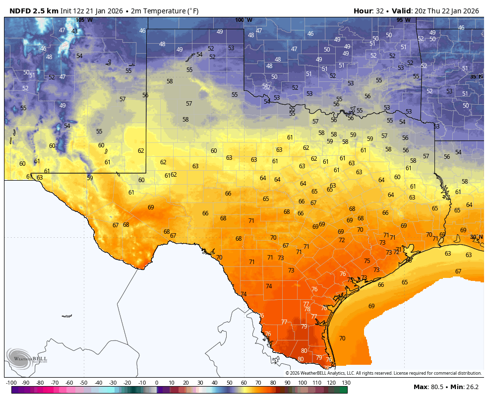
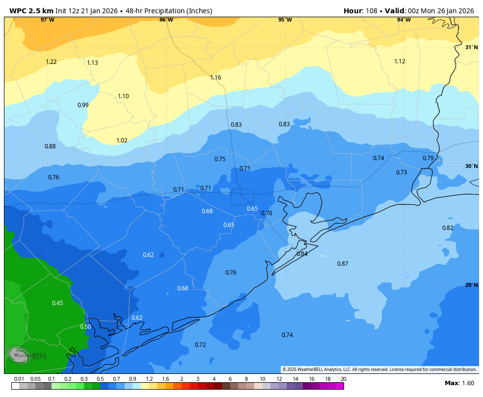
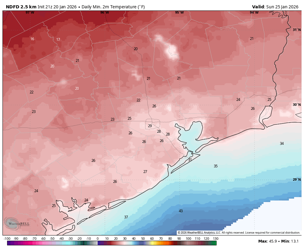
This will be a rainy and cold day. Expect widespread showers. Overall, I expect most areas to pick up about one inch of rain, give or take. The majority of this will fall as cold rain in Houston, rather than freezing precipitation. Highs on Saturday will likely top out in the 50s before a surge of colder air arrives later on Saturday and into Saturday night. We continue to think it should be OK to move around the Houston area on Saturday, with temperatures remaining above freezing. That could begin to change Saturday night, but perhaps not until after midnight for most locations.
Sunday and Monday
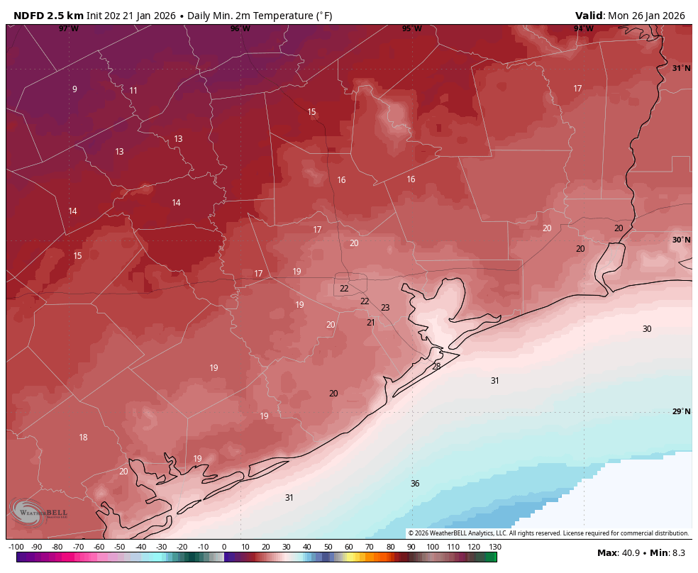
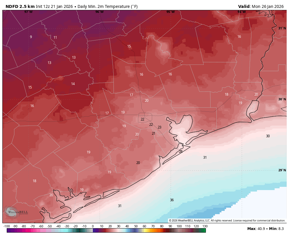
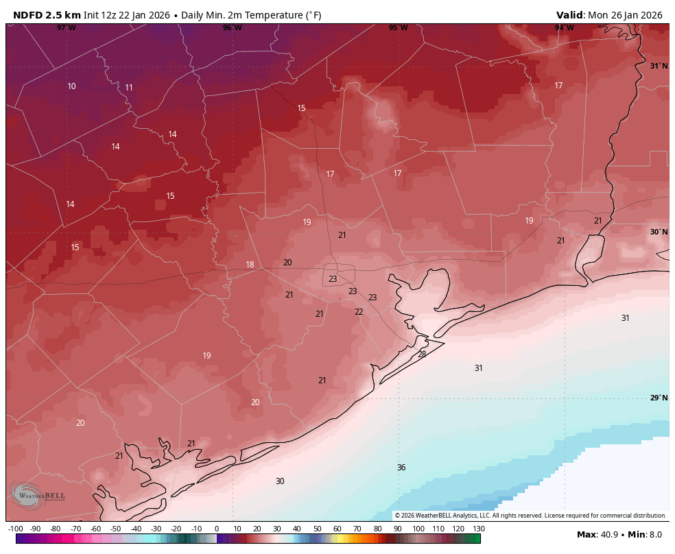
This will be the coldest period. I don’t feel particularly comfortable predicting highs on Sunday because they will be influenced by a number of factors, including clearing skies on Sunday afternoon, the influence of ice on the ground north of the Houston metro area (northerly winds chilled by this ice are not well modeled), and other factors. Generally, I think there is a decent chance that Houston’s highs reach above freezing for a couple of hours on Sunday, and if this happens in conjunction with clearing skies we could see most roads dry out. That’s the glass half full scenario. It is also possible that light rains linger into Sunday afternoon, temperatures remain at about the freezing level, and ice persists on roads through Monday morning. It’s going to be a close call in Houston. Anyway, we are highly confident in a cold night on Sunday into Monday (see image above), with lows in the hard freeze range necessitating the protection of pipes, plants, and pets. Temperatures on Monday should push at least into the upper 30s, and in conjunction with clearing skies this should end the threat of ice on roads. Lows on Monday night will be very cold again, although perhaps a couple of degrees warmer than Sunday night.
Next week
We should get into the 50s or perhaps lower 60s for a few days next week, but there is the potential for another front by Friday or so that could return freeze chances into Houston. We’ll see.
Our next update will be posted by around 3 pm CT today.