In brief: A cool front today will bring a smattering of showers or a few thunderstorms to Houston, followed by continued warm but slightly less warm weather this weekend. A much stronger front aims at us for late Monday or early Tuesday, ushering in what we hope will be a spectacular Thanksgiving Day.
Good morning! Hang on one second, I think Josh Allen just got sacked again. Yep. Can confirm.
Annual Fundraiser
Black Friday is a week away, and our annual fundraiser is in the final stretch! We’ve been fortunate to have a fairly quiet weather year in Houston for a change. Still, we’ve got some fun holiday gift options that are uniquely Houston. Or you can just throw in a couple bucks if you’re able. Eric and I deliberately keep our fundraising for the site limited and confined to November so we can focus the rest of the year on information, content, and improvements to our operation for you. We know everyone has a personal budget for what news and information outlets they support, and we are so grateful and thankful to have your support.
Dang, has it been warm!
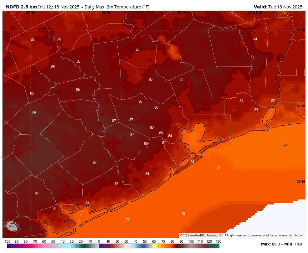
Yesterday was our 9th consecutive day of 80 degrees or more. We hit 86 degrees officially at Bush Airport, a new record for the date, breaking the previous record of 84 degrees set in 2011 and 1977. That’s now the third record high we’ve matched or beaten in this stretch.
I went back and looked at November and wintertime streaks of 80 degrees or more, and this now ranks as the sixth longest streak of 80 degrees or hotter in the November through February timeframe.
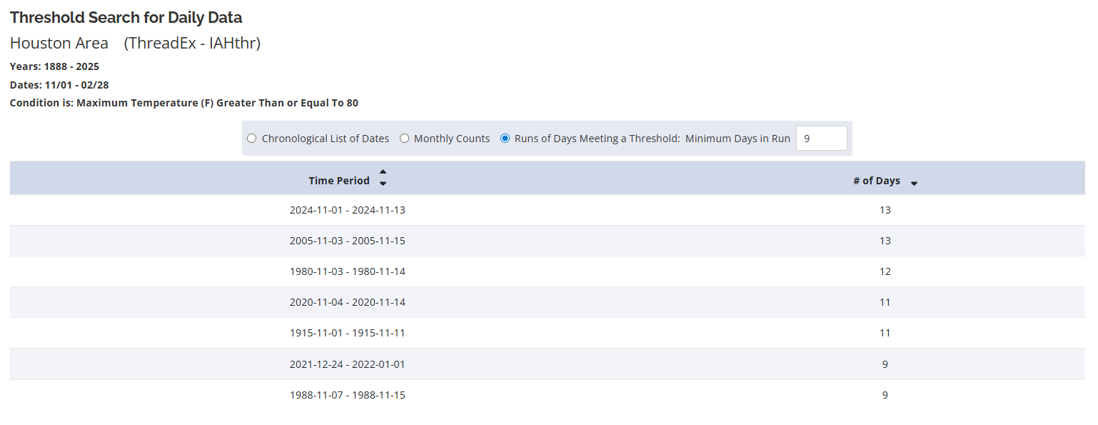
The last comparable streak of this length occurred last November when we did 13 days in a row to start the month of November. But a streak of this length this late in the year has only occurred one other time: December 2021-January 2022 when we hit 85 degrees on New Year’s Day during a 9 day streak.
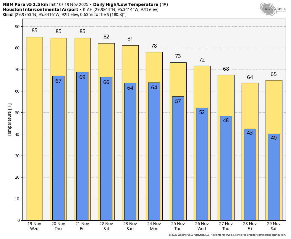
So will we threaten the 13 day record? We probably won’t break it, but we may tie it. It should be at least 11 straight after today and tomorrow. But Sunday is the wild card day with a forecast high right on the fence of 80 degrees. Monday should warm back into the low 80s ahead of the front before we wipe it out completely Tuesday or Wednesday. Hopefully the Texans can string together more wins like we’re doing with 80s.
Today
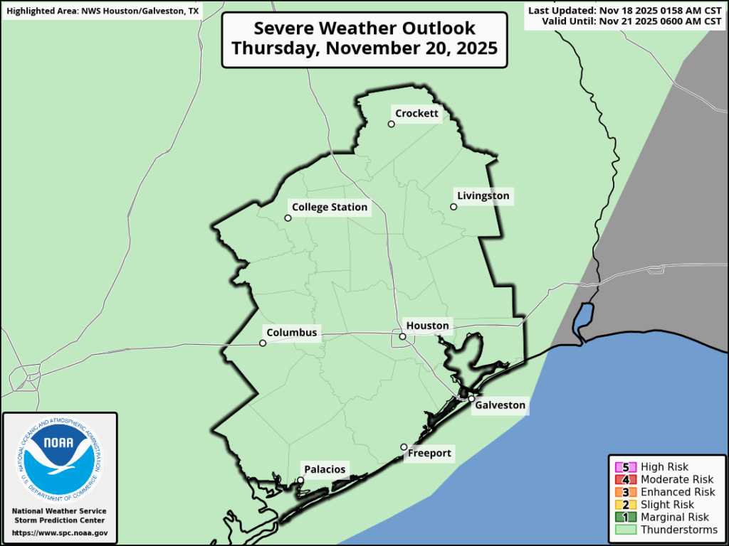
As a meteorologist, you’d think we’d like good forecasting challenges. And most of us do. However, the story of the disturbance today has been rather maddening. Maybe it’s because we went from 2 to 4 inches of rain forecast earlier this week to NyQuil dose accumulations. Capital N, little y…. There is an expression in meteorology “When in drought, keep it out,” meaning rainfall chances. A lot of times modeling can get overzealous with rain risks in drought-y patterns. There’s a persistence to that kind of pattern. That said, we’re already also seeing some forecast “nudges” next week now too. But clearly models are struggling to handle this pattern in the lower latitudes over North America right now.
Anyway, here’s how today should unfold. Radar is mainly quiet for now with a couple showers up near Navasota and Huntsville. Scattered showers and a couple embedded thunderstorms will develop late this afternoon or early this evening across the area, probably near a Cleveland-Cypress-Wharton line. They will slowly crawl south and east overnight, perhaps lingering near coastal areas or down toward Freeport and Lake Jackson on Saturday morning.
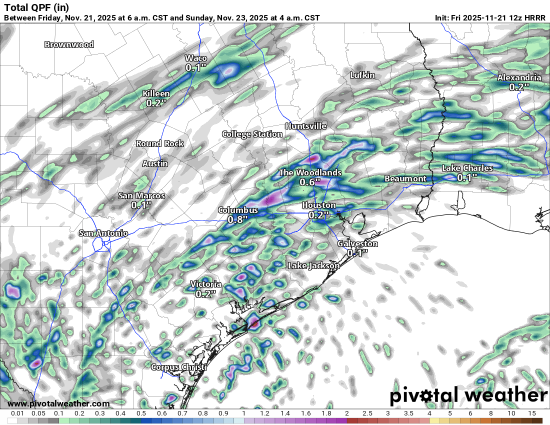
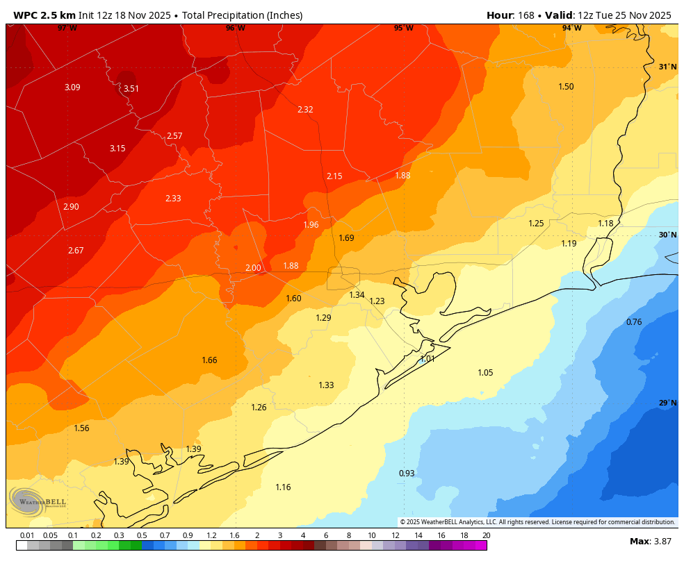
The rain totals will be quite erratic with some places seeing perhaps 1 to 2 inches of rain, while most languish at a quarter inch or less.
Weekend
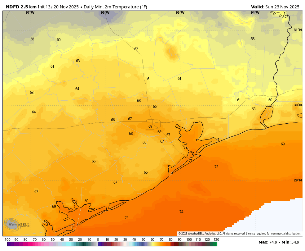
This weekend looks fairly benign. I don’t want to say we won’t see any rain at all; we could see lingering showers near the coast on Saturday and an isolated rogue shower, especially north and west of Houston on Sunday. But overall, any disruption to your plans should be minimal. As noted above, look for 80s on Saturday and around 80 or so on Sunday. Slightly cooler air filters in, so morning lows may be in the low 60s or even some upper-50s in outlying areas Sunday morning.
Monday & Tuesday
Things change more substantially early next week. A legitimate cold front is still on track to push through the area on late Monday or early Tuesday. We do expect more numerous or widespread showers and thunderstorms with this front compared to what we see today. That said, the forecast is by no means set in stone. We’ll reassess and update Sunday or, of course, Monday. Either way, look for a drop off in temperatures behind the front.
Wednesday
Good weather for travel it would appear! We kick off the holiday weekend with cooler temperatures, as highs will only be in the upper 60s to low 70s after morning lows in the 50s. Wednesday does look breezy as well, so just note that, particularly if your early holiday weekend plans include a boat.
Thanksgiving Day
Houston isn’t exactly known for nice weather on holidays. We lean on gallows humor to get through them. However, it looks spectacular on Thanksgiving as it stands right now. Morning lows should be in the 40s and 50s, so dress appropriately for one of the many turkey trots around the area. I will say, overnight modeling is trying to back off on this — again. So the map below may be optimistic on the cool side.
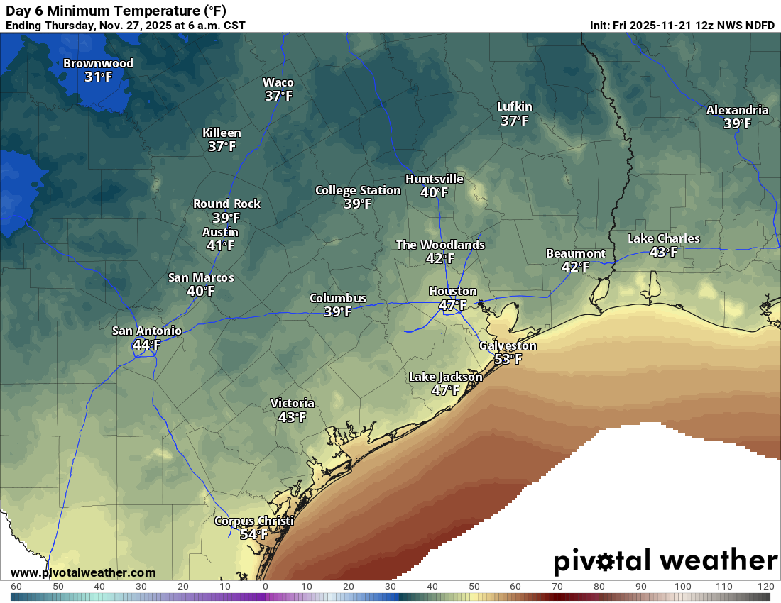
Highs will be in the 60s. Friday and the rest of the weekend looked good as of yesterday, but this morning the European model is trying up rainfall chances a bit. I’ll remain skeptical for now. Enjoy the weekend!