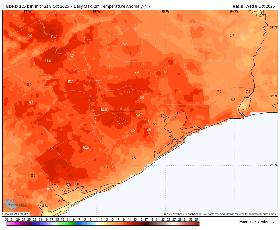
In brief: Dry weather will continue in the Houston area for the foreseeable future with warm to hot afternoons and somewhat pleasant mornings. Drought is expanding in Houston now, and with that comes some elevated wildfire risk, particularly today north and east of Houston. Thankfully, winds look generally light on land.
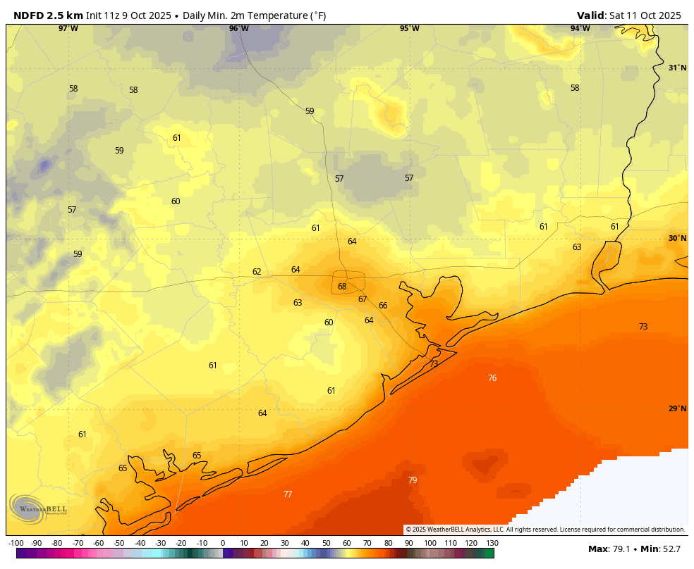
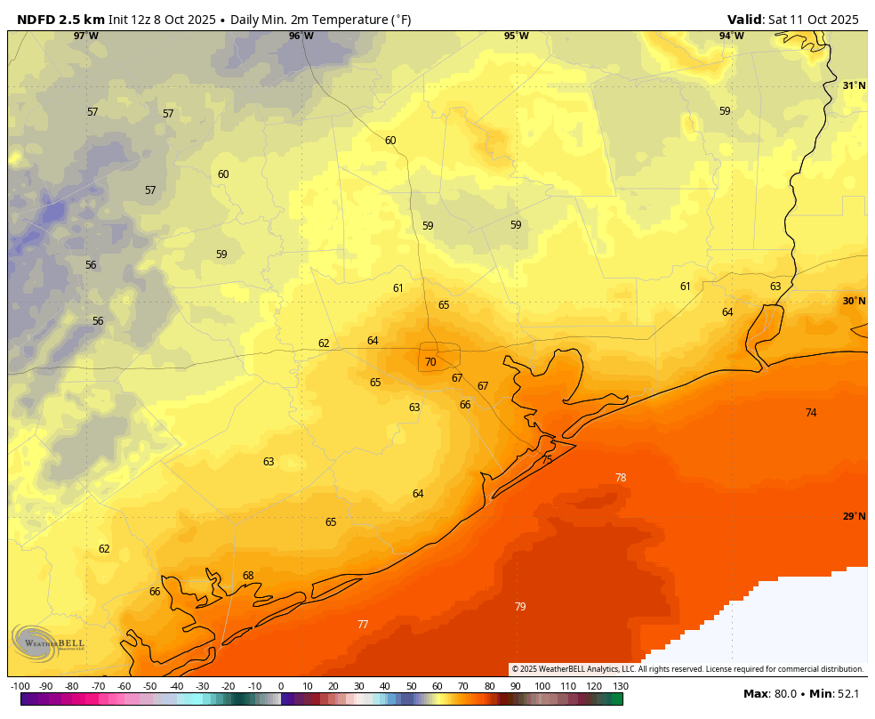
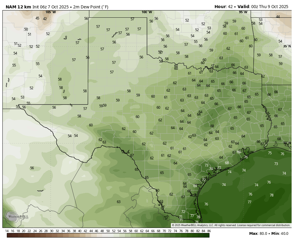
Good morning, and if you’ve stepped outside this morning, it really does feel kind of good! Much of the area is seeing temperatures in the 60s this morning.
Tonight should be even a bit cooler. Low humidity will allow for cooler nights and continued warm to hot days heading into next week.
Drought update
A couple notes on that drier air: First off, drought has finally begun to creep into the Houston area.
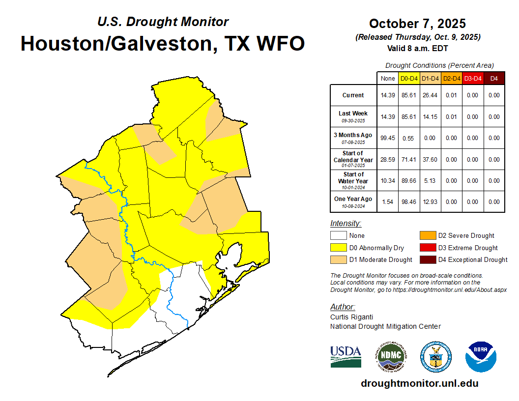
We’ve seen some drought on the fringes, but that has now begun creeping into the immediate metro. With no rain expected over the next week, this should continue to slowly expand. Thankfully, we were able to bank some rain this summer due to the frequent cadence of daily storms. But that only gets you so far once you get to autumn.
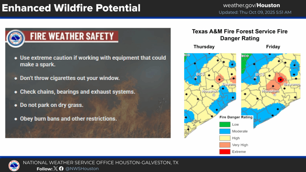
Wildfire risk
Because of this dry, less humid weather and expanding drought, human-caused wildfire risk is somewhat elevated, particularly today and possibly tomorrow. Please continue to use extreme caution outdoors when it comes to anything that could lead to a fire. Thankfully the winds are well below Red Flag Warning criteria, but even still, this is a reminder that wildfires can and have happened here before.
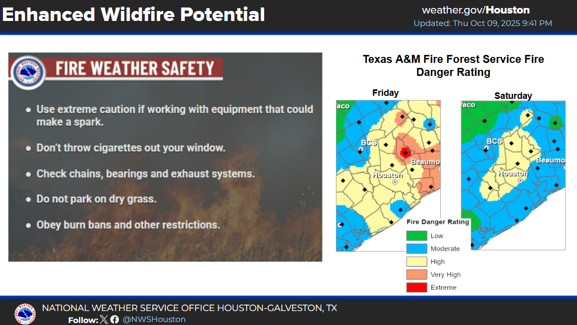
Humidity levels increase enough to suppress wildfire risk after tomorrow. We may get a brief reinforcing “cool” front next week, but aside from that, today should be the most elevated day for fire risk for a bit.
Forecast notes
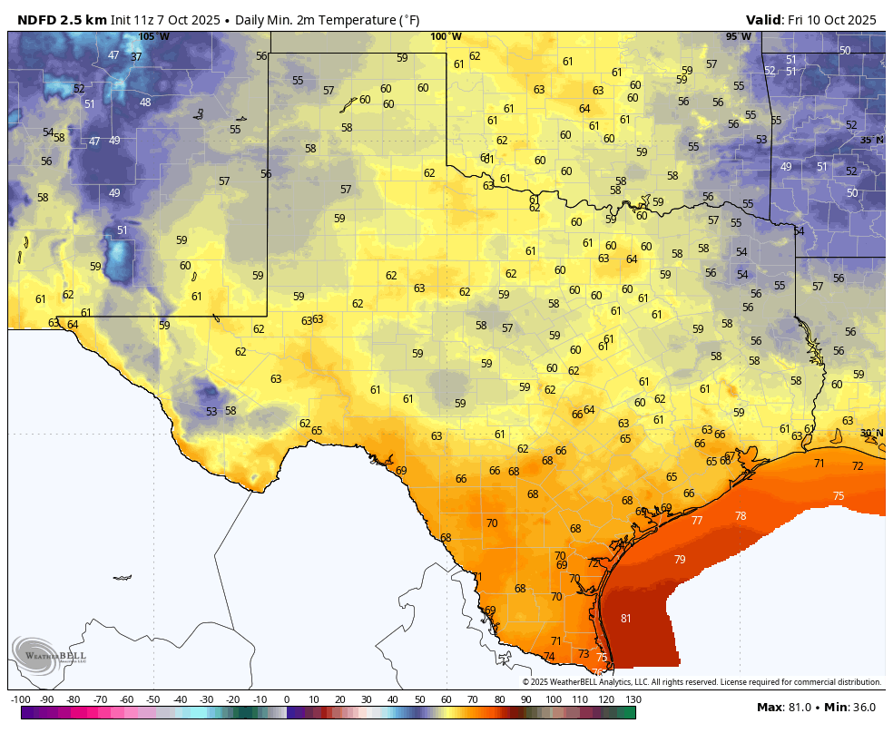
The forecast is pretty straightforward other than what we’ve discussed above! We expect little to no rain over the next 7 to 10 days. Daytime highs will be in the upper 80s to low 90s. Morning lows will be in the lower 60s tomorrow, then mid to upper 60s heading into next week. Not a whole lot of risk or wrinkles to this forecast right now. So, expect sunshine, occasional ozone alerts, and continued bad allergy weather. Both the good and the bad in early October in Houston.