In brief: The cold weather we’ve been experiencing for the last 36 hours is here to stay, as we are going to remain quite cold through Friday night. On Thursday and Thursday night we’re going to add a fair amount of rain to the mix, but fortunately this is unlikely to fall as freezing rain in Houston. The weekend looks sunny and pleasant, at least.
Cold update
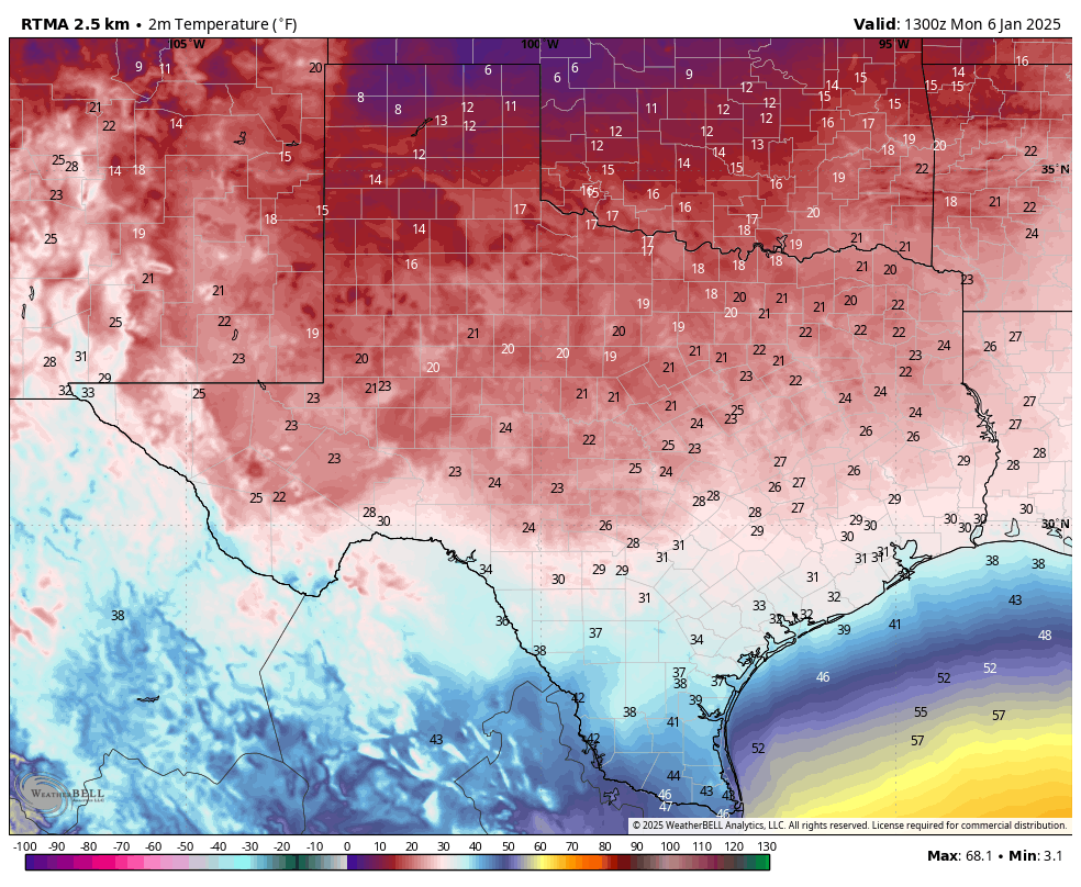
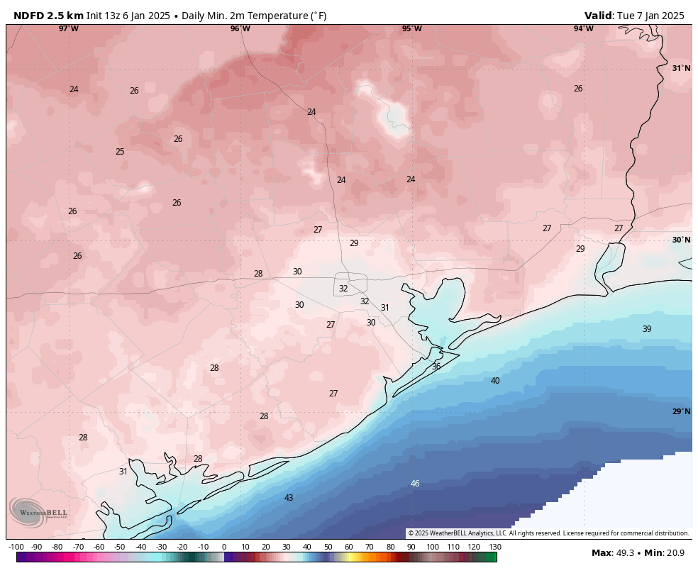
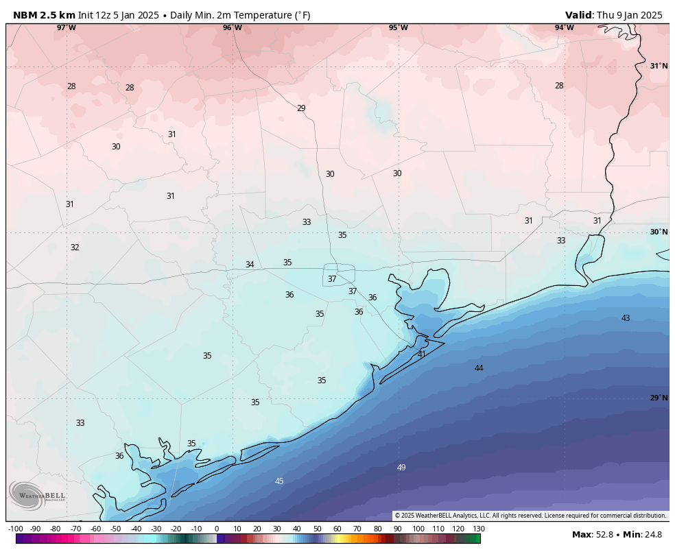
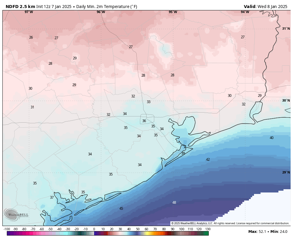
Temperatures this morning have, again, fallen to just below freezing for much of the Houston area. The city’s official low temperature this morning is likely to be about 30 degrees at Bush Intercontinental Airport. This is not near record territory, as the record low temperature for January 7 in Houston is 19 degrees, set in 1970.
However, both our daily high and low temperatures are running 10 to 15 degrees below normal, and what is unusual about this week’s weather is its sticking power. We’re going to remain quite cold, weather-wise, through Saturday. So if you received an ugly sweater for Christmas, at least you’re going to be able to put it to good use.
Tuesday
After the cold start this morning we will see sunny skies today, and this should help push high temperatures up to around 50 degrees. Believe it or not, this could be the warmest we get until at least Saturday, which will be the region’s next truly sunny day. Anyway, winds will be lighter today than on Monday, so it will feel less chilly outside. Low temperatures tonight will probably be 1 to 3 degrees warmer than Monday night, so a light freeze is still possible in the Houston metro area, but it’s not guaranteed.
Wednesday
This will be a colder day, as winds from the north increase a bit, with gusts up to 20 mph, and we see the development of some clouds. These clouds should limit highs in the mid-40s during the daytime, but also moderate nighttime highs just a bit. Most of Houston probably will only fall into the mid- to upper-30s. That’s a good thing because beginning early Thursday we’ll start to see some rain chances.
Now I know some people will be disappointed that temperatures are not a few degrees colder, giving us the chance of snow. But I have to say, if temperatures were freezing—given the atmospheric profile—we probably would be getting freezing rain rather than snow in Houston. And let me tell you, that’s miserable, and it’s a mess on roads, and it can stick to powerlines and snap them and … well, freezing rain sucks. So let’s be glad it’s unlikely to fall here. There is a slight chance of freezing rain for counties well north of the city of Houston, including Houston (which is north of Huntsville, Texas) and Trinity counties.
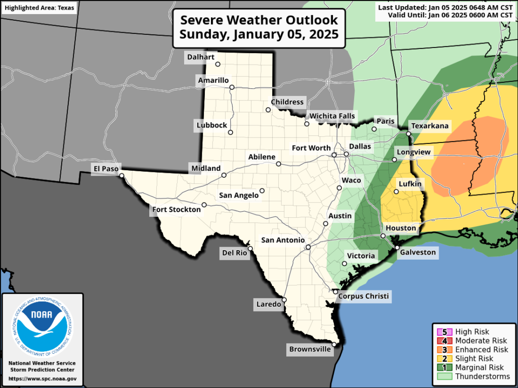
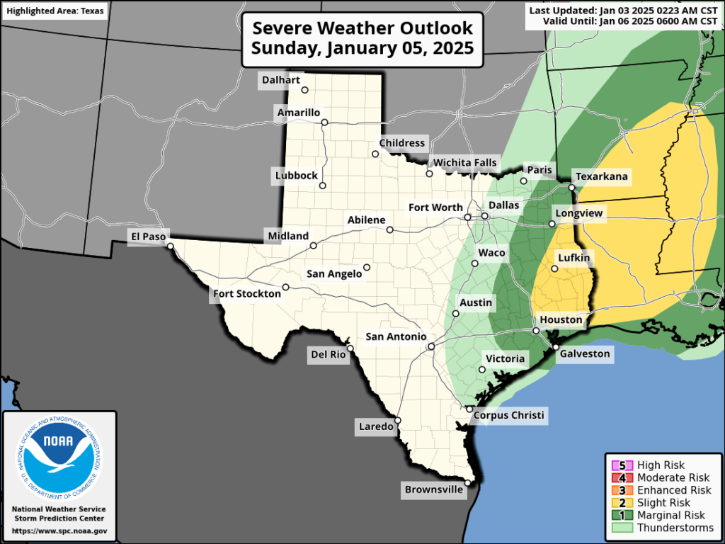
Thursday
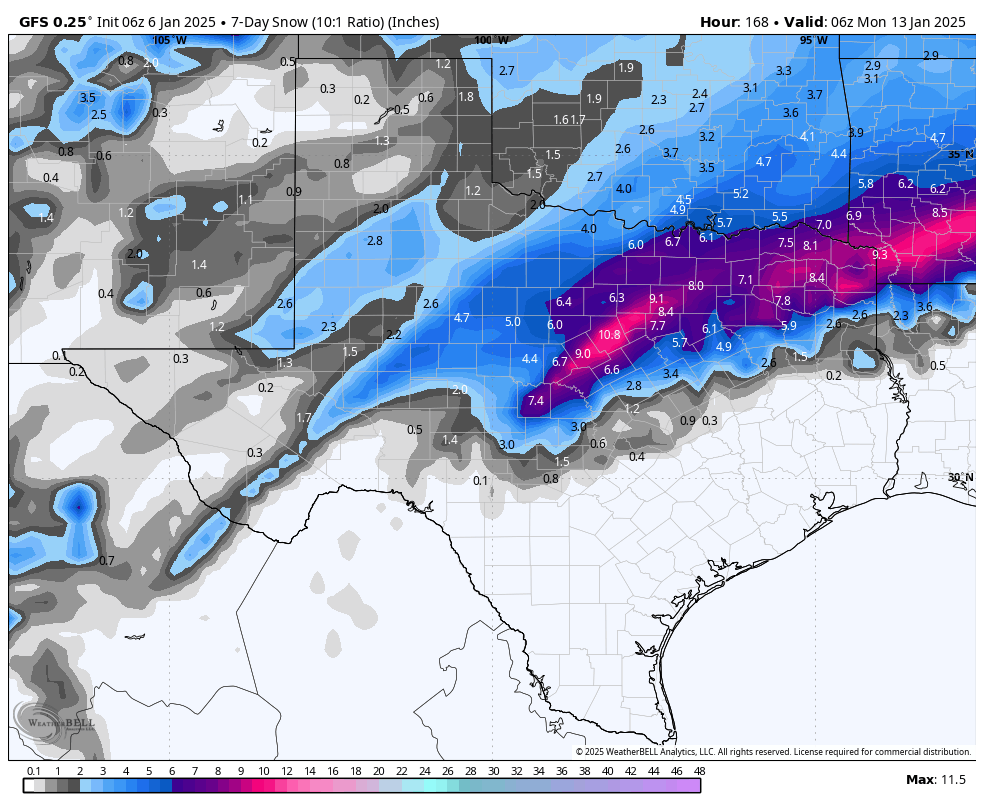
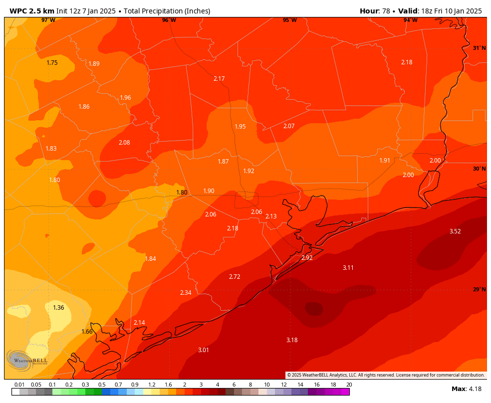
This will be a cold and gray day, with an increasing chance of showers the later we go. Like, please don’t plan any outdoor activities for Thursday or especially Thursday evening. Temperatures will be in the 40s, and winds from the northeast at 15 mph with higher gusts. And then there’s the rain. I expect much of the area to pick up 1 to 3 inches of rainfall through Thursday night, with some higher totals possible. So yeah, it’s going to be cold and wet and icky. The rains will continue into Friday morning. As noted yesterday, a winter storm is likely in North Texas, including the Dallas-Fort Worth metroplex. Avoid traveling there if possible.
Friday
Some rain chances linger on Friday morning before the coastal low pressure system finally clears out. Afterward expect highs in the 40s with mostly cloudy skies. We probably will see an influx of colder air as the low moves to the east on Friday, so lows on Friday night may drop back into the lower 30s on Friday night, with some parts of Houston again seeing a light freeze.
Saturday and Sunday
Sunshine should finally return for the weekend, allowing high temperatures to reach maybe the lower 50s on Saturday, and even the 60s on Sunday. We have no real weather concerns for the weekend, so it’s something to look forward to as we’re freezing this week.
Houston Marathon
Hello, fellow runners. We’re now just 12 days away from the Houston Marathon, and we can begin to take a peek at the weather for the event. I know opinions vary, but I love cold and dry conditions. Some of you like it much warmer and even muggier. So what can we expect?
Most of next week looks to remain fairly cold. Not as cold as this week, but with lows consistently in the 40s, and possibly even 30s on some nights. However things may start to warm up some about 10 days from now. At that point there is a pretty broad divergence in the models about whether another system comes through to keep the chill going, or whether we continue to see warmer and milder weather.
So I think we cannot say much sensible about the weather yet for the marathon. It might be 40 degrees on the start line, or it might even be 60 degrees. Rain is definitely a possibility, but it’s way, way too early to make any kind of a prediction there. I’ll update the marathon forecast when there’s something I’m a little more confident in.