Good morning. Houston’s forecast remains on track, with a succession of mostly sunny days and weak fronts to keep a lid on temperatures and our air reasonably dry. Because there really is nothing else to talk about this morning, we’ll spare a few words on two tropical systems in the Caribbean. The tropics forecast is complicated, but likely inconsequential for the Houston area.
Friday
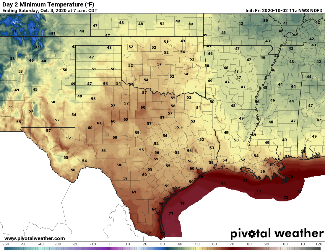
Drier air is moving into the region in the wake of a front on Thursday, and it feels splendid outside with lows generally in the 60s across the region, and dewpoints in the 50s. High temperatures today will reach into the low-80s under mostly sunny skies, with a light northeasterly breeze. It looks like low temperatures tonight will be the region’s coolest for the next several days, with lows on Saturday morning dropping into the mid-to-upper 50s for inland areas.

Saturday and Sunday
Houston should have a pleasant fall weekend, with highs in the low 80s on Saturday. As winds shift to come from the southeast later in the day, we’ll see a slightly warmer night and then highs somewhere in the mid- or possibly upper-80s on Sunday. The passage of another weak front on Sunday may bring a few clouds, but generally we anticipate a sunny weekend.
Monday and Tuesday
The start of the coming work week should bring more of the same, with highs in the 80s, lows in the 60s, lots of sunshine, and a fair amount of dry air in the wake of Sunday’s front.
After that?
We may see another weak front by around Thursday, and this may bring some clouds into the sky and our first real chance of rain in awhile. But honestly, I don’t have much confidence in the forecast after the middle of next week, so we’ll have to get back to you on Monday.

The tropics
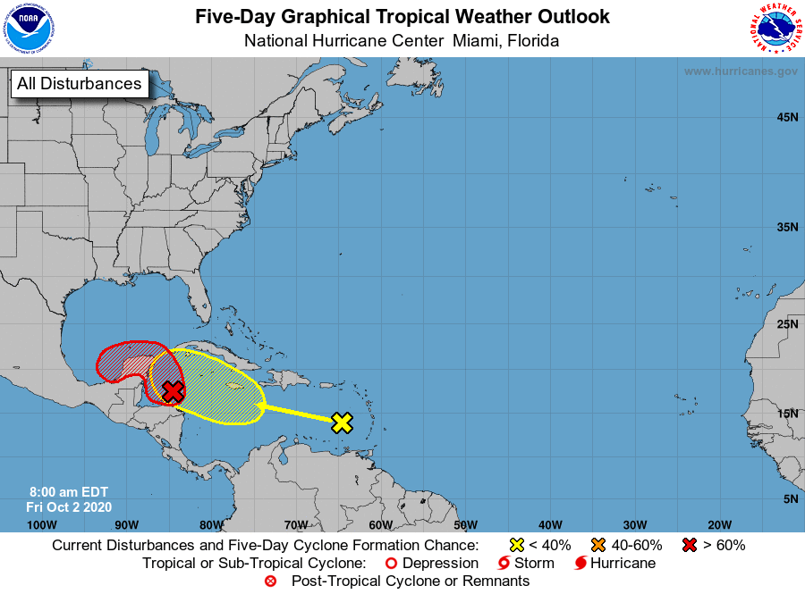
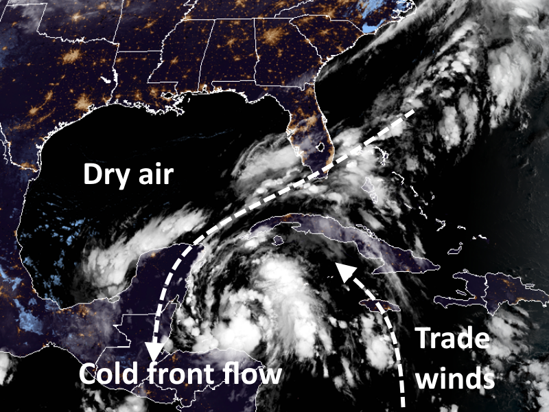
So there are still two systems in or near the Caribbean Sea that the National Hurricane Center is tracking. The low-pressure area near the Yucatan Peninsula now has an 90 percent chance of becoming a tropical depression or Tropical Storm Gamma over the next two days. It is being aided by the front that pushed through Houston several days ago, and deep into the Gulf of Mexico. This front is providing a northerly flow to help the storm complete a circulation, which has trade winds on the other side.

This system is likely to move toward the Yucatan Peninsula over the next day or two. There it may get swallowed up by interaction with land, dry air over the Gulf, and an not-great shear environment. However, it is possible that something emerges into the Bay of Campeche in a few days, and wanders around there—bottled up by the additional fronts coming into Texas and high pressure.
After this, who knows? It could get pushed into Mexico, eventually, or maybe pulled north or northeast. It remains very difficult to see this system (or the one behind it) affecting the upper Texas coast, but we’ll continue to watch it for you and update if anything changes. Have a great weekend!

Had trouble understanding the NHC color-coding around the Yucatan…so your last statement, “Have a great weekend!”, was good enough for me.
Sorry for anyone who encountered a weird Wordpress error trying to load the site this morning—Cloudflare pushed a broken version of their plugin with some missing files, which caused the site’s Wordpress installation to lose its damn mind. Everything’s fixed now, though!