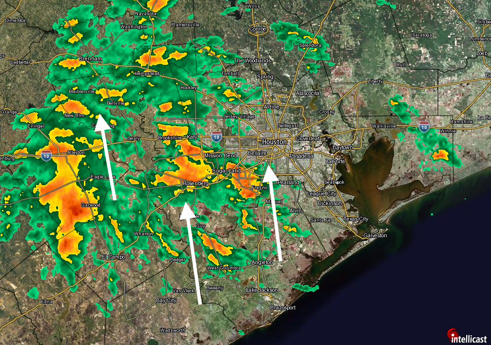
Hey everyone. Just popping in with a quick update because we’re seeing some heavy rain moving into Houston tonight that was, frankly, somewhat unexpected. These showers are developing ahead of the main storm system, which is still well to the west-northwest of the Houston metro area.

In any case, with the very moist atmosphere in place, showers and thunderstorms are moving from south to north across the western part of the Houston metro area. Some of NOAA’s high resolution forecast models are now picking up on this trend, and they’re showing continued development during the late evening and overnight hours. The HRRR model indicates it is possible that some areas in Fort Bend, Harris and Brazoria county could pick up 1 to 3 inches of rain (or more) between now and early Monday morning.
There’s no guarantee, of course, but since the models are now picking up on this radar trend we definitely could see more rainfall tonight than seemed likely earlier.
Posted at 8:15pm CT Sunday
In Rosenberg it’s been raining for about an hour. It is a steady rain, with moments of heavy down pour.
I’m just inside BW8 on the west side and we’ve got some good thunder going. I wondered if the storms had moved much faster than anticipated. Thanks for the update!
KISD schools closed here in NW Houston..Crazy thunder and heavy downpour