Areas along the I-35 corridor are getting hammered by storms today, some of which are producing rainfall rates in excess of 3 inches per hour. The system is not moving much either. It all is likely a preview for what’s to come later this week for parts of Houston. However it should be stressed that predicting how much rain, and where the heaviest storms will occur remains highly uncertain.
TONIGHT
So far today only scattered, light to moderate showers have developed over the Houston metro area, particularly the east side. That’s likely to remain the case throughout the evening. I don’t anticipate any severe weather for the rest of today because most of the action will be off to the west of Houston.
However as that system over central Texas continues to move eastward, the Brazos Valley including College Station should begin to see its effects later, perhaps before midnight or shortly after. Expect 3 to 6 inches of rain (if not more) during the overnight hours for parts of Texas between Houston and Austin.
MONDAY and TUESDAY
Sometime on Monday, perhaps before noon, Houston will see the main area of showers and thunderstorms approach from the northwest. With ample moisture (being recharged by the Gulf of Mexico) and a slow-moving low pressure system parts of the Houston metro area will very likely see the same kinds of intense rainfall rates as are occurring in central Texas today.
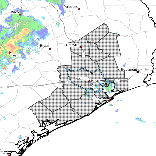
Some of the forecast models slowly drag the heaviest convection across the region to the north of Houston and even Montgomery County, whereas others dig deeper south into the Houston metro area. It is not clear which solution is most likely at this time.
However it appears that in Houston the heaviest rains may ultimately fall to the north of the Interstate 10 corridor, and seems most probable that areas closer to the coast may see less rain. It is not possible predict the small-scale features that will case storms to stall and release the most rainfall. In any case as this system approaches Houston, and passes through, we will have the potential for very heavy rain beginning Monday morning through Tuesday. Most areas should see 3 to 8 inches of rain, with isolated areas seeing 10 inches or more.
We’ll have more details about timing and effects of these storms as they get closer to Houston.
Posted at 4:30pm CT Sunday
Thanks for the update! I appreciate all you do!